Showing posts with label Mercer County. Show all posts

Tuesday, May 14, 2024

Endangered NJ Historic Places

It is another kind of endangered...

Preservation New Jersey is a nonprofit group focused on preserving historic sites. They make an annual list of the top 10 most endangered historic places in the state


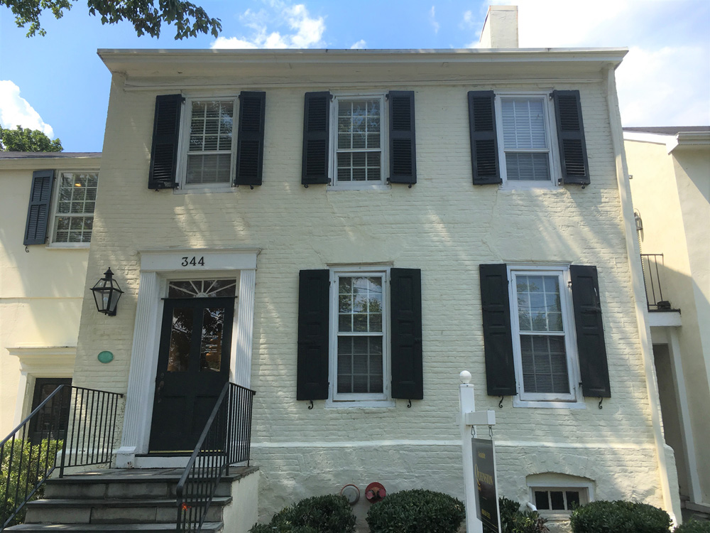
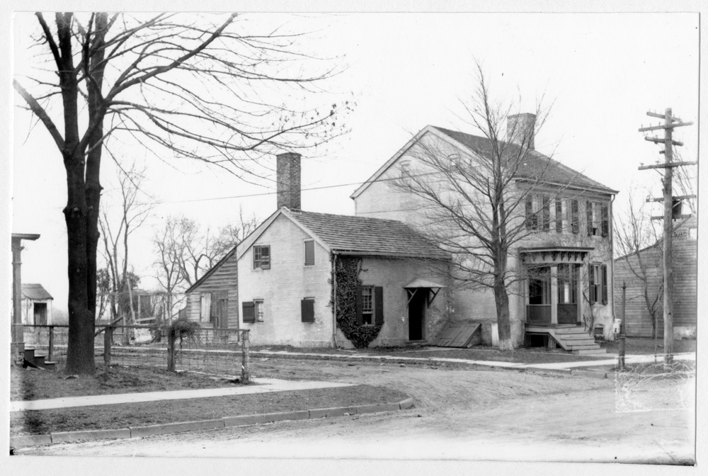
One example is the Joseph Hornor House located at 344 Nassau St. was built in the 1760s by the grandson of one of Princeton's Quaker founders. The two-story, brick, side-hall house originally had a one-story kitchen wing. In the early 20th century, a second story was sensitively added on top of the wing. The house is an anchor to the Local, State, and National Register Jugtown Historic District, and occupies the northeast corner of the historic crossroads of Nassau and Harrison Streets in the Jugtown section of Princeton. Nassau Street is also part of the Lincoln Highway National Register District. The corners of this historic crossroads retain two other Pre-Revolutionary buildings and an early-19th-century building. The proposed threat facing the Joseph Hornor House is its incentive design for redevelopment for the purpose of affordable housing units. The current project will include adding a four-story structure to the rear that would amass and surround the historic structure. Redevelopments in historic districts are on the rise with new Affordable Housing and tax credit initiatives. While the revitalization of neighborhoods contributes to reactivating historic places, there is a growing trend in demolition and insensitive changes to integral features of structures and streetscapes. More care and sensitivity to the impacts of historic districts are necessary through compliance with existing preservation standards and guidelines both at a local, state and federal level. Preservation New Jersey supports and encourages the development to comply with preservation standards and guidelines as it will set the precedent for other new development in the Jugtown Historic District and in other historic Princeton neighborhoods. 


Sunday, February 13, 2022

Princeton's Largest Remaining Undeveloped Property Now Protected

The largest remaining undeveloped property in Princeton is more than 150 acres of mature oak, beech and hickory forest, and contains wetlands. It is now permanently protected, thanks to a partnership among several government agencies and nonprofits It is located on Province Line Road, in the town’s northwest corner.  

The purchase price was $8.8 million from the Lanwin Development Corp. and the family of the late Bryce Thompson. The purchase is part of an initiative called “Princeton’s Emerald Necklace” that seeks to connect preserved green spaces in the town and beyond. A partnership of organizations – led by the town of Princeton and including the Friends of Princeton Open Space, Ridgeview Conservancy, The Watershed Institute, Mercer County, the state Green Acres Program and New Jersey Conservation Foundation – worked cooperatively on the acquisition. Nearly $3 million in private donations were received. The land is now jointly owned by Princeton, the Friends of Princeton Open Space, The Watershed Institute and the Ridgeview Conservancy.

It is now open to the public for passive recreation, including hiking, birding and nature observation. It is also an important habitat for endangered and threatened species, including the red-shouldered hawk and barred owl, as well as songbirds, salamanders and other species whose numbers are in steep decline.

The purchase is important since a development of large homes was previously approved on the land, despite local opposition. Approximately 4,000 trees would have been cut down on the site had the land not been preserved.

planetprinceton.com

fopos.org 

Sunday, December 16, 2018

Holiday Activities at New Jersey State Parks

Historic Christmases in New Jersey ranging from the American Revolution to the Victorian era and modern day are among the highlights of annual holiday activities planned this month at state parks, according to a NJDEP press release.

“Christmas is a special time in New Jersey, with many activities for the public to recall our important place in history and to celebrate the beauty and magic of the season,” Parks and Forestry Director Olivia Glenn said. “There is something for everyone at many of our parks, from seeing the stately Ringwood Manor decorated as it would have been during its heyday, to watching busy elves in Santa’s workshop, to the always popular Delaware River crossing on Christmas. These activities are a great way to enjoy the holiday spirit.”


Ringwood Manor
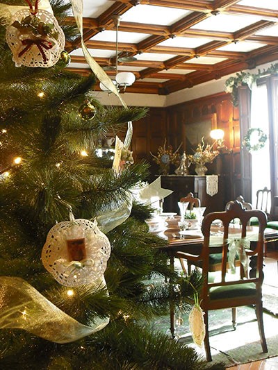
Ringwood Manor at Ringwood State Park in Passaic County is hosting the 43rd Annual Victorian Christmas, showcasing holiday décor from the 19th century, while Washington Crossing State Park will host the annual Christmas Day re-enactment of Gen. George Washington and his troops crossing the Delaware River. Other activities include a reading of the Charles Dickens classic A Christmas Carol at Waterloo Village in Sussex County and history-themed fun at The Historic Village at Allaire in Allaire State Park in Monmouth County.

The 19th century Ringwood Manor is listed on the National Register of Historic Places. The stunning house that was home to well-known ironmasters in the 19th and 20th centuries sits on a low hill that overlooks a rustic landscape, making it a beautiful location to visit during the holidays and winter.

From 1 p.m. to 3 p.m. on Dec. 16, Santa Claus and his elves will be busy in their workshop at Ringwood State Park’s Hermitage Museum Visitor Center to greet children and their families.

Children can spend time at holiday craft tables, surrounded by vintage toys, trains, Christmas trees, holiday decorations and music. Refreshments will be provided. Admission is $6 for adults, $4 for children ages 6-12, and free for children age 5 and younger. Santa’s Workshop is sponsored by Friends of the Hermitage.

Remaining dates to visit Ringwood Manor for the Victorian Christmas are Dec. 9, 15 and 16, from 10 a.m. to 4 p.m. Admission is $10 for adults, $8 for seniors and students, and $5 for children ages 5-12. Group tours for 10 or more people are offered from 10 a.m. to 3 p.m. Dec. 12, with admission set at $7 per person.

The Women’s Club of West Milford, the North Jersey Highlands Historical Society, and the Ringwood Manor Association of the Arts sponsors the Victorian Christmas. For more information, call (973) 962-2240.

Santa at Ringwood State Park

To learn more about the 2018 Victorian Christmas at Ringwood Manor, visit www.ringwoodmanor.org/victorian-christmas.html 


A reading of Charles Dickens A Christmas Carol is scheduled at 7 p.m. on Dec. 13 at Waterloo Village in Stanhope, Sussex County. Admission is $10 per person. Food and beverages will be available for purchase. Call (973) 347-1835 to register.


The Historic Village at Allaire within Allaire State Park in Farmingdale, Monmouth County, is offering guided lantern tours and interactive Christmas activities for all ages.

Visitors can tour the Historic Village at Allaire by lantern light and learn about Christmas in the 1800s. Tours leave every 15 minutes from 5 to 8 p.m. p.m. on Dec. 7, 8, 15 and 21. The 90-minute, outdoor guided tours are $20 per person. Tickets must be purchased in advance. Strollers are not permitted in the historic buildings.

Christmas at The Historic Village at Allaire will offer interactive programs from 11 a.m. to 4 p.m. Dec. 9 and 16. Activities include music, storytelling, hearth cooking, dancing, wagon rides, crafts and a visit from Santa Claus. Admission is $7 for adults and $5 for children younger than 12 years of age.


Washington Crossing the Delaware River on Christmas Day

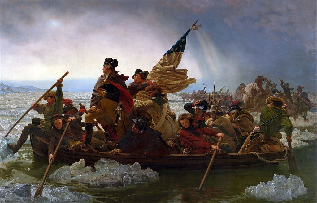
At 1 p.m. on Christmas, visitors to Washington Crossing State Park in Titusville, Mercer County, can commemorate the 242nd anniversary of the pivotal crossing of the Delaware River on Dec. 25, 1776, during the War for Independence.


The crossing led to strategic victories the next day in Trenton, followed by victories at Assunpink Creek on Jan. 2, 1777 and at Princeton the next day. These victories helped establish Washington’s Continental Army as a viable fighting force that could challenge the British Army and its Hessian mercenaries.


Prior to the crossing and the ensuing battles of Trenton and Princeton, the American Revolution was thought to be lost. But those victories turned the war around and led to the eventual defeat of the British in 1783.

Visitors are encouraged to arrive by noon to have time to park and find a good viewing location. A history narration of the event will begin at 12:30 p.m. along the riverbank. Cider and doughnuts will be provided at the Nelson House.


Approximately 100 re-enactors will start the crossing at 1 p.m. from the Pennsylvania side of the Delaware River, in reproductions of the Durham boats used by Washington and his troops.

The re-enactment is free and will be held weather-permitting. For more information, call (609) 737-0623.

Those interested in learning more about the history and significance of the crossing, as well as the Battle of Trenton may attend a free lecture with Washington Crossing State Park Historian Clay Craighead at 2 p.m. Dec. 15, at the park’s Visitor Center Museum.


Tuesday, December 20, 2016

Saving Maxwell's Field in Princeton


This month it was announced that an agreement to save a portion of a Revolutionary War battlefield in Princeton, New Jersey from development was completed. 

The Civil War Trust has an agreement to buy nearly 15 acres of land across from Princeton Battlefield State Park for $4 million. The group has raised $1.4 million to buy the land from the Institute for Advanced Study and will now begin fundraising for the rest, with the intention to turn over the property to the state.

The Civil War Trust is the largest and most effective nonprofit organization devoted to the preservation of America’s hallowed battlegrounds. Although primarily focused on the protection of Civil War battlefields, the Trust also seeks to save the battlefields connected to the Revolutionary War and War of 1812.

The battlefield in Princeton is where American and British troops fought each other on January 3, 1777. The Battle of Princeton during the American Revolutionary War ended when the British soldiers in Nassau Hall (now part of the Princeton University campus) surrendered.

This victory came just after Washington's crossing of the Delaware River and capturing the troops at the Old Barracks in Trenton, and the two victories did a lot to improve American troop morale. This was just Washington’s first victory over British regulars in the field.

The 22 acres adjacent to Princeton Battlefield make up Maxwell’s Field where George Washington's charge first hit the British lines. Also adjacent to the site is the Institute for Advanced Studies which has been attempting to build faculty housing on Maxwell's Field. The institute is best known as the place where Albert Einstein worked. Under the new plan, they will build faculty housing on the part of the land it is keeping.

Approval from the Princeton planning board and Delaware and Raritan Canal Commission is still needed..

Sunday, April 12, 2015

Bringing the Assunpink Creek Back Into the Daylight in Trenton

Assunpink Creek flowing through Trenton near Mill Hill Park
Work is expected to begin on a $4 million restoration this spring that is being financed 75 percent by the U.S. Army Corps of Engineers and 25 percent by the DEP through a federal Clean Water Act grant.

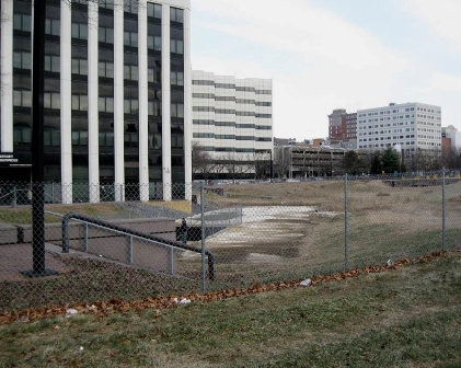
What the project hopes to accomplish is to restore the Assunpink Creek in downtown Trenton. You say you've never seen it? That's because decades ago this tributary of the Delaware River was channeled into an underground culvert. It disappears from view between South Broad and South Warren streets.

The idea years ago was certainly to allow for greater development where the creek flowed, but the culvert prevented fish from migrating into the Delaware. The downtown also lost the natural beauty of the stream.

Maybe it was a sign from nature when the nine years ago part of the culvert roof collapsed. The immediate effect was not good - a safety hazard that was fenced off and became an overgrown lot.


But this project to restore the creek looks like it will now happen.

On the New Jersey Future website at www.njfuture.org, you can see maps and historic photos.

The term for this restoration is "daylighting," as in bringing back the water to the light of day from its capture underground.

The Assunpink Creek is 25 miles long, and drains approximately 91 square miles in central New Jersey. The main tributaries that feed Assunpink Creek are Shabakunk Creek and Miry Run. The headwaters begin in Millstone Township, in Monmouth County, and flow into the Delaware River in Trenton.

The creek gathers intensity as it meanders west from Millstone Township in Monmouth County, through the Assunpink Wildlife Management Area and Mercer County Park, across the old, flat clays and silts of the Raritan and Magothy formations into Trenton.

The Lower Assunpink Creek Ecosystem Restoration Project study area is located on a 3- mile section of the Assunpink Creek between the Delaware River and the Trenton city limits. Several former industrial sites, abandoned bridges, and a 500-foot section of the creek between Broad and Warren Streets, contained within a buried box culvert were identified as candidates for ecological restoration.

The buried box culvert, known locally as the Broad Street culvert, was evaluated during the feasibility study and approved for removal and restoration of a natural creek channel. The Broad Street culvert removal project is located in the heart of the downtown Trenton business and historic district on a recovering urban stream that also serves to connect several greenway and urban park facilities.

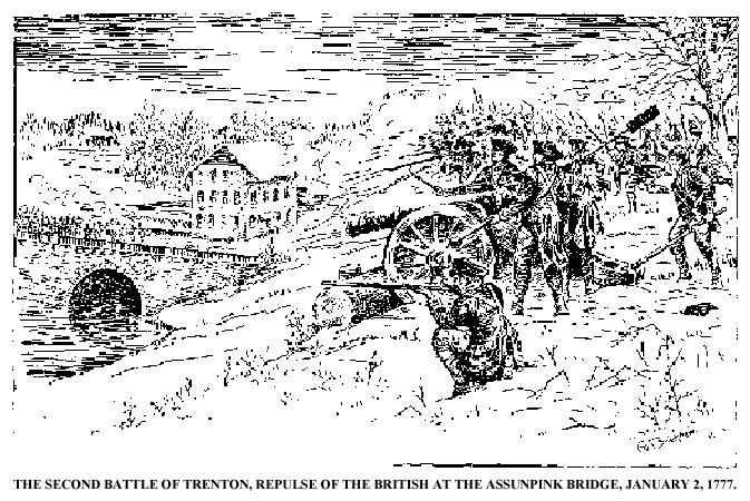
illustration via www.trentonhistory.org


The project site is also the location of the the Battle of Assunpink Creek (AKA the Second Battle of Trenton) during the American Revolution. On Jan. 2, 1777, the Continental Army and supporting militias held a defensive line along the creek's south shore. Under George Washington's command, the Americans repelled charges by British and Hessian soldiers across a stone bridge spanning the creek, as well as an attempt to ford the creek near its mouth.

By morning, Washington had reached Princeton and after a brief battle, the British there were decisively defeated and most of the garrison was captured. With their third defeat in ten days, Cornwallis' superior, General William Howe ordered the army to withdraw from southern New Jersey and most of the way back to New York. The British left forward positions at New Brunswick and Washington moved his army to Morristown for winter quarters.

The daylighting of the stream this year will mean the removal of the culvert structure, allowing the stream to be exposed to natural sunlight, and the resulting open channel design will improve anadromous fish migration. Low-light conditions can disorient migrating fish, hindering their ability to spawn upstream.

The project will also benefit businesses adjacent to the site, provide recreational options for visitors and local residents, and provide historical and educational opportunities for the community.

The name Assunpink comes from the Lenape word for "stony, watery place," describing the gravelly springs of New Jersey's 65 million-year-old ancient coastline. This ironstone "cuesta," or ridgeline divides the inner and outer coastal plains.

Tuesday, February 24, 2015

Bald Eagle Rescue

Two bald eagles interlocked, injured and hanging from a tree in Tuckerton, NJ.
Photo by Ben Wurst.

The Endangered and Nongame Species Program received a report on February 18th that two adult eagles were injured and hanging from a tree in Tuckerton. With some help from an AC Electric company truck with a cherry picker on it, Ben Wurst, Habitat Program Manager went up to try to free the birds.

One eagle was alive but the other had unfortunately died. The survivor was banded and recorded as a female that was came from a nest near Merrill Creek reservoir in 2008.

Probably, the two had fought over territory and fell from the air into tree branches. The dead eagle had a "death grip" on the surviving eagle. Without help, they both were likely to have died in the tree.

The bird was taken to Mercer County Wildlife Center to be checked. Sadly, its leg that was in the grip of the other eagle was badly injured and the bird showed signs of frostbite damage due to not being able to move and fly. After 5 days, the bird was euthanized at Tri-State Bird Rescue because the fracture and frostbite made her unlikely to survive in the wild and eagles in general do not like being in captivity.


 Helmet-Cam video of Ben working to save the eagle.

http://www.conservewildlifenj.org/blog/2015/02/18/battling-bald-eagles-land-in-tree/

Thursday, May 22, 2014

Youth Fishing Derby May 31 in Trenton

The City of Trenton is partnering with DEP to host a Youth Fishing Derby on Saturday, May 31 (rain or shine) at Stacy Park in Trenton. The program will take place from 9:30 a.m. – 1:30 p.m. and is open to Trenton youth between ages 6 – 12. Each child must be accompanied by a parent or other adult guardian.

DEP entities that are assisting with the Youth Fishing Derby include the Black Environmental Solidarity Team (BEST), Fish and Wildlife’s Hackettstown Hatchery and Hooked on Fishing not on Drugs Program, Water Resource Management’s Urban Fishing Program, and the Office of Communications.

Details about the Youth Fishing Derby, including a flyer, program and registration information, can be found at www.nj.gov/dep/seeds/fishingderby.htm

Wednesday, January 11, 2012

Busy New Jersey Beavers

USFWS.gov photo
The beaver is the second largest rodent in the world. Even children are familiar for its wide, flat tail, trre-gnawing and for building dams.

Those tails are useful for slapping the surface of the water to warn other beavers of approaching danger. Although these critters are rather awkward on land, they can navigate quickly under water and can stay submerged if necessary for up to 20 minutes.

Trees (bark and leaves) are their favorite winter food, but in summer other vegetation, especially aquatic plants like water lilies, make up their diet.

Beavers are known for their engineering of dams on rivers and streams. Their intent is to build their lodges (homes) in their preferred pond setting. They ingeniously place vertical poles, and then fill in the spaces between the poles with horizontally placed branches. Then, they further fill in the gaps with a combination of weeds and mud to hold back the water around their lodge. They have even been known to create "canals" in order to float larger tree materials they need rather than dragging them over land.

Their powerful front teeth are cartoonish but they are effective for cutting trees and plants for building and for food.

Though beavers are found throughout New Jersey, it is likely that many residents have never actually encountered one in the wild. Children and adults might mistake a groundhog for a beaver.

NJ's beaver population is strong because they generally coexist well with humans and they have few natural predators. 

Not all cases of beaver building have been met with amazement by humans. There have been reports over the years of busy beavers encroaching on human activities.  In Camden County, beavers on Kirkwood Lake created dams that made the water rise so that homes that normally had about 100 feet of land between them and the lake wound up with only a few feet of land.

In Middlesex County, a beaver blocked a culvert on a road in the Jamesburg Park Conservation Area and built a dam between two cranberry bogs. The town wanted to avoid flooding that had occurred in previous years. In that case, the town got a permit to trap the beaver out of season. They snared a 31.5-pound, 40-inch-long female beaver in an underwater trap.

This past year, in Princeton Township, human intervention with beavers also made the news.
A pair of busy beavers killed by a local animal control officer activated animal lovers who wondered why the beavers were not relocated rather than killed.

The beaver pair were contributing to flooding at the Pettoranello Gardens section of Community Park North, which has a pond and several streams. Workers tried to dismantle the dams, but the beavers got busy and rebuilt.

It didn't help that the state Division of Fish and Wildlife said the Princeton animal control department had not gotten the proper permit prior to killing the beavers. It seems odd but, according to a spokesman for the department, beavers trapped either in conibear traps, which kill them, or in live traps, still must be euthanized and may not be relocated.

As said earlier, our state beaver population is healthy. The state regularly surveys the 30 hunting and trapping zones in the state. Permits obtained from the Division of Fish and Wildlife are required to trap beaver and/or otter.

During the 2009-2010 season, more than 600 beavers were trapped and killed. The beaver season runs from the end of December to early February. (The duration of the trapping season for beaver on 23 Wildlife Management Areas is January 1 through February 9, 2012, but if the anticipated harvest of beaver and/or otter has not been accomplished during this season, up to 14 additional days may be authorized by the Director.)


More on "Beavers as Master Builders of Wildlife Habitats"

North American beaver (Castor canadensis)


Friday, March 4, 2011

Princeton Battlefield Park

General Washington rallying his troops at the Battle of Princeton.
The first inhabitants of the Princeton area were the Lenni Lenape Indians. Europeans founded the settlement in the latter part of the 17th century. The first European to find his home in the boundaries of the future town was Henry Greenland who built his house in 1683 along with a tavern. It was in that tavern that representatives of West and East Jersey met to set boundaries for the location of the township.

Princeton was to be divided into two parts: a borough and township. It was founded from pieces of Middlesex, Burlington, Somerset and Hunterton counties which were divided by the central “King’s Highway.” The King's Highway is today's Nassau Street which eventually turns into Princeton-Kingston Road to the north and Stockton Street to the south.

Even though New Jersey's capital is the city of Trenton, the governor's official residence has been in Princeton since 1945. That is when Morven became the first Governor's mansion. It was later replaced by the larger Drumthwacket, a colonial mansion also located in the township. Morven is now a museum property of the New Jersey Historical Society.

Princeton Battlefield State Park is a 200-acre (81 ha) state park located in Princeton Township. The park preserves the site of the Battle of Princeton on January 3, 1777.

On the night before the battle, George Washington, Commander-in-Chief of the Continental Army, repulsed a British attack at the Battle of the Assunpink Creek in Trenton. That night, he evacuated his position, circled around General Lord Cornwallis' army, and went to attack the British garrison at Princeton. Brigadier General Hugh Mercer, of the Continental Army, clashed with two regiments under the command of Lieutenant Colonel Charles Mawhood of the British Army.

Mercer and his troops were overrun and Washington sent some militia under General John Cadwalader to help him. The militia, on seeing the flight of Mercer's men, also began to flee. Washington rode up with reinforcements and rallied the fleeing militia. He then led the attack on Mawhood's troops, driving them back. Mawhood gave the order to retreat and most of the troops tried to flee to Cornwallis in Trenton.

In Princeton itself, General John Sullivan forced some British troops who had taken refuge in Nassau Hall to surrender, ending the battle. After the battle, Washington moved his army to Morristown, and with their third defeat in 10 days, the British evacuated southern New Jersey. With the victory at Princeton, morale rose in the ranks and more men began to enlist in the army. The battle was the last major action of Washington's winter New Jersey campaign.

Princeton hosted the first Legislature under the State Constitution of New Jersey to decide the State’s seal, Governor and the organization of its government. In addition, two of the original signers of the Declaration of Independence—Richard Stockton and John Witherspoon lived in Princeton.

In 1783, Congress fled from Philadelphia to Princeton, fearing a mutiny by some of the soldiers. General Washington took up residency at Rockingham in Rocky Hill, where he wrote his Farewell Orders to the Army.

On September third, he rode to Nassau Hall to receive news that the Treaty of Paris had been signed, which officially recognized America's independence. Princeton, thereby, became the first Capital of the new nation.

The Battlefield Park is maintained by the New Jersey Division of Parks and Forestry, and is located on Mercer Road (Princeton Pike), about 1.5 miles south of Princeton University and 3.8 miles north of Interstate 295/95.

Besides the battlefield itself, another stop is the Mercer Oak named after Hugh Mercer, a brigadier general in the Continental Army during the American Revolution. During the Battle of Princeton, Mercer was stabbed by an English soldier's bayonet. According to legend, he was unwilling to abandon his troops, and rested on the tree's trunk while they stood their ground. After the battle, Mercer was taken to the Clarke House where he died from his injuries nine days later.

The tree was about 300 years old when it was torn by strong winds in March 2000. It is the emblem of Princeton Township and appears on the seal of the township and is an element of the seal of Mercer County, New Jersey. For public safety reasons, arborists cut off the remnants of the trunk the day after the tree fell and several scions from the tree were planted around the battlefield. In May 2000, an 8-foot sapling grown from a Mercer Oak acorn was planted inside the stump of the former tree.

The Thomas Clarke House Museum, built in 1772, was built by the third generation of Quakers at Stony Brook. The house is furnished in the Revolutionary period and contains military artifacts and battle exhibits, as well as a research library. During the battle General Mercer was brought to the Clarke House and treated unsuccessfully by Dr. Benjamin Rush.

There is also an Ionic Colonnade designed by Thomas U. Walter (architect of the US Capitol Building)and a stone patio marking the grave of 21 British and 15 American soldiers killed in the battle. A poem was written for the site by Alfred Noyes, Poet Laureate of England.

The park's hiking trails lead to the Delaware and Raritan Canal and to the adjacent property of the Institute for Advanced Study.

The Princeton Battle Monument is located near Princeton University on park property at Stockton Street and Bayard Lane.

The Historical Society of Princeton uses the Bainbridge House which had previously been used once for a meeting of Continental Congress in 1783, a general office and as the Princeton Public Library. The House is actually property of Princeton University and is leased to the Princeton Historical Society for one dollar per year. The house has kept its original staircase, flooring and paneled walls and is 70% unaltered.


Take a virtual tour of the Princeton Battlefield Park

Princeton Battlefield State Park official site
Friday, February 25, 2011

Delaware and Raritan Canal


Historic map of the D&R Canal
click image for large size via http://mapmaker.rutgers.edu
The Delaware and Raritan Canal (D&R Canal) is a canal in central New Jersey, that was built in the 1830s and served to connect the Delaware River to the Raritan River.

Delaware and Raritan Canal Company 24x36 Giclee
D&R Canal Company
It was intended as an efficient and reliable means of transportation of freight between Philadelphia, Pennsylvania and New York City, especially coal from the anthracite coal fields in eastern Pennsylvania. Before the advent of the railroads, the canal allowed shippers to cut many miles off the traditional route from the Pennsylvania coal fields. That route took the coal down the Delaware, into the Atlantic Ocean, around Cape May, and up along the coast to New York City.

Delaware and Raritan Canal at Work, The (NJ) (Images of America)The canal system was dug mostly by hand tools, mostly by Irish immigrants. Work began in 1830 and was completed in 1834, at an estimated cost of $2,830,000. When the canal first opened, teams of mules were used to tow canal boats through it (the steam engine was not yet applied to such uses).
The canal's greatest usage occurred during the 1860s and 1870s during the area's Industrial Revolution. On May 18, 1872, the D&R Canal Company was merged with several parallel railroads into the United New Jersey Railroad and Canal Company, and leased by the Pennsylvania Railroad. Over time, the importance of the D&R Canal waned as railroads were used to perform, more rapidly, the same function as canals, but it remained in operation until 1932.

Over the years, sections were filled for various road and rail projects and other sections of the canal were piped underground.

Today, the D&R Canal offers us a number of natural and historical resources, including 160 species of birds, wooden bridges, canal locks, historic bridge & canal houses, and former mill sites. The park can be enjoyed individually or at one of the many nature and history related programs that are offered throughout the year by the park's naturalist and historian.

The total length of the entire canal system was approximately 66 miles (106 km).

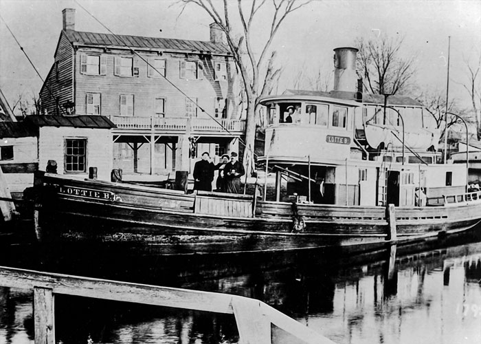
A steam tug docked on the canal in front of a Princeton hotel.

Unfortunately, some sections of the canal are forever lost. A section of the main D&R Canal in Trenton, along Mulberry Street, has been covered over (the water still flows below) and redeveloped, and is inaccessible to public use. The portion of the canal that provided access to the Delaware River in Bordentown is also abandoned. In Trenton it has been covered by NJ Route 129, which opened in 1996. Another section south of Trenton is located in Hamilton Township, Mercer County, New Jersey between the southern boundary of Trenton and the Crosswicks Creek.

Locks were used to overcome elevation differences along the D&R canal. Many of the locks are still present along the canal route; however, the lock gates have been replaced on the upstream side with small dams and water outfalls. The downstream gates have been removed, so the water in the locks is level with the water on the downstream side. Some of the locks have been buried or removed due to construction projects in the vicinity of the canal.

A number of spillways, which drained excess water from the canal into nearby waterways during periods of heavy flow, are located along the canal route. Spillways are evident as a dip in the tow path along the canal.


Image: bikinghikingwithkids.com

In 1974, most of the canal system was declared a New Jersey state park. It remains one today, and is used for canoeing, kayaking, and fishing.

A graded natural-surface trail along the side of the canal, which was the tow path that mules used to tow barges on the canal before steam powered barges, is now used for hiking, jogging, bicycling, and horseback riding. Some 36 miles (58 km) of the main canal, and all 22 miles (35 km) of the feeder canal, still exist. The feeder canal along the Delaware, being a former railroad rather than a towpath, is especially suited to bicycling. The park is operated and maintained by the New Jersey Division of Parks and Forestry.

The D&R Canal trail is a recreational trail of 77 miles (124 km) trail is made up of three segments that transverse three counties: a canal towpath from New Brunswick to Trenton; a canal towpath / rail trail from Trenton to Bull's Island; and a rail trail from Bull's Island to Frenchtown. The three combined trails together form the largest completed trail entirely in New Jersey. Much of the trail runs inside the state park. [Note: There is no direct connection between the main canal and the feeder canal paths along the Delaware River. Signed on-street connections are required to traverse the entire trail system.]

The proposed Capital to Coast Trail is planned to connect to the D&R Canal Trail.

The canal is accessible from many points along its route, with small parking areas providing access at most road crossings. One of the most scenic and popular sections of the D&R Canal state park is the segment along Lake Carnegie in Princeton, New Jersey, which features the canal on one side of the path and the lake on the other side. Another attractive section borders the Colonial Park Arboretum and Gardens in East Millstone.

The Delaware and Raritan Canal was added to the National Register of Historic Places in 1973 and the many historic canal houses where the bridgetenders lived (such as the Blackwells Mills Canal House and the Port Mercer Canal House) were listed as contributing properties.

Tuesday, July 13, 2010

130 Acres of Open Space For Hopewell Township


More than 130 acres of fields, woods and stream nestled between Washington Crossing State Park and Baldpate Mountain have been permanently preserved as open space.


The historic Hollystone Property, as it's called, was acquired with the help of D&R Greenway Land Trust May 25, a $2.8 million purchase open space advocates and state and local officials are planning to celebrate next week.


Located off Route 29 in the area of Fiddlers Creek Road, the property links Washington Crossing State Park with Baldpate Mountain, effectively creating an 8-square mile swath of preserved land stretching from Mercer to Hunterdon County.

The property was called a "conservation bonanza," with woodlands that make up a 9,500-acre forest that is home to rare and endangered plants and animals.


read more at http://www.nj.com/mercer/index.ssf/2010/07/hopewell_hails_greenways_unite.html

Friday, March 26, 2010

D&R Greenway


D&R Greenway Land Trust is central New Jersey's non-profit land preservation organization, founded in 1989 through the collaboration and vision of four organizations: the Stony Brook - Millstone Watershed Association, Friends of Princeton Open Space, Regional Planning Partnership, and the Delaware & Raritan Canal Commission.

They were originally named the Delaware & Raritan Greenway, but they changed their name in 2004 to better reflect their preservation work as a Land Trust, and because their work expanded beyond the focus on the Delaware & Raritan Canal.

I actually heard about them because of a poetry event they offered recently called "Living Among Giants, Seeing the Forest for the Trees." It's one of a number of public programs they offer at at the Johnson Education Center.

They cover a lot of ground. Their operating region consists of over 1,500 square miles, encompassing portions of the Delaware, Raritan and Millstone River watersheds and the Delaware & Raritan Canal. This includes Mercer, Hunterdon, Somerset, Middlesex, Burlington and Monmouth counties.

Recently, they have also worked at preserving preservation of farmlands in Salem County in the area of Mannington Meadows.

Since 1989, D&R Greenway Land Trust has preserved 223 properties. The total acreage preserved as of February 1, 2010 is 14,320.69 acres valued at $316,177,653.

Monday, May 11, 2009

Rivers Can Be Endangered Too


Here's a list we don't want New Jersey to make it onto - the ten most endangered rivers in the U.S. as selected by AmericanRivers.org

A much better list is that of green infrastructure projects involving our waterways. There are a number of ready-to-go projects in New Jersey. These projects would be worth over $53 million in jobs and materials, but, more importantly to this blog, they would also improve clean water and boost natural flood protection.
“Clean water is our nation’s most vital resource, but our water infrastructure is outdated and crumbling, unable to cope with our drinking water, wastewater, and flood protection needs,” said Betsy Otto, vice president of strategic partnerships for American Rivers. “The good news is, investments in green solutions to these water infrastructure problems will create jobs, save money, and protect public health and safety.”
A wetland restoration project in Oxford, NJ could restore 225 acres of failing agricultural lands and a failing private levee along Furnace Brook to forested and floodplain wetlands. Nearly one mile of levees would be removed, ditching would be backfilled, and the land would be planted again to forested and marsh wetland vegetation. This project would restore natural flood protection and reduce downstream flood damage, improve wildlife habitat and expand an adjacent state wildlife area.

In Trenton, the Assunpink Creek restoration project would remove a culvert and improve the health of this Delaware River tributary. The effort would also include the construction of a multiple-use trail for public recreation. 

The Lower Millstone River Fish Passage Project is another project. The Millstone River, a tributary to the Raritan River, is near the townships of Franklin and Hillsborough, NJ. The Stony Brook-Millstone Watershed Association will conduct a study to examine the feasibility of restoring American shad and other fish in the lower Millstone River in central New Jersey. Among other potential restoration strategies, the project will explore the possibility of removing two dams on the lower Millstone River which would open an additional 14.1 miles of the river to fish. The study will assess the potential positive and negative effects of dam removal as well as other potential methods for providing fish passage on the river.