Showing posts with label South Mountain Reservation. Show all posts

Monday, August 25, 2025

3 Family Friendly Hikes

Here are three easy and family-friendly hike options to do with kids (or kids-at-heart) to close out the summer or into the fall.

The Batsto Lake Trail in Wharton State Forest is a peaceful loop through the Pine Barrens, offering lakeside views and historic buildings in the Village of Batsto. It is 4.1miles and would take a little more than a hour to complete the loop along sandy paths, bog bridges, and pine needle-covered trails along Batso Lake. Wharton State Forest is the largest piece of land managed by New Jersey State Parks. The area was a regional hub for glass and iron manufacturing during the mid-1700s to mid-1800s.


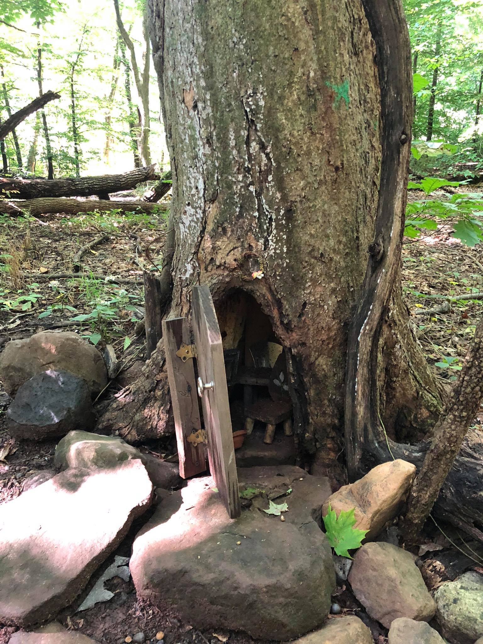
The Fairy Trail at South Mountain Reservation in Essex County is a short and magical walk perfect for kids and curious adults. This is an easy half-mile path inhabited by fairies who have built homes along the trail. The rules help to introduce kids to the principles of Leave No Trace.


Watchung Reservation's White Trail (Union County) goes over gentle terrain with scenic views and historical landmarks. At 2.7 miles, it will take you about an hour, depending on how many stops you make. Of course, like most of these hikes, you can extend the hike by continuing on the white or purple and yellow trails or turn back. Information and directions at Watchung Reservation White Trail. The Reservation also has the Trailside Museum and other trails to explore.


Tuesday, May 3, 2022

South Mountain Reservation - and Cougars?

Mountain lion (not photographed in New Jersey!)

Though none of these animals inhabit our state, I regularly get comments and emails here about sightings of a moose, elk, reindeer, or wolf. I chalk them up to misidentification but the most persistent rumored animal is the mountain lion (also known as cougar or puma). State biologists will tell you our biggest cat is the bobcat, but that hasn't stopped people from reporting a cougar. 

You can find an occasional news article about "sightings of a large cat." One of those sightings was on the Winslow Hammonton border by Route 73 (Camden County) which was reported to be a mountain lion. A panther was once reported in Vineland. The NJDEP's Division of Fish and Wildlife receives these reports and often investigates but there is usually no video, photos, or physical evidence (like tracks or fur samples). There are no officially confirmed cats bigger than a bobcat in the state.

Look at the photo above. That cat is very different from abob cat or domestic cat. The tail alone should be distinctive enough for identification. Cougars are 5 to 6 feet in length including their long tails and average about 135 pounds and can weigh up to 180 pounds. Bobcats are mid-sized cats measuring 2 to 3.5 feet long and weighing up to 40 pounds. They are about twice the size of a domestic cat.

The state's denial of the existence of any cats larger than a bobcat hasn't stopped readers of this blog from making almost 60 comments (as of today) on my post about the idea of a mountain lion in New Jersey

Blackrock Falls

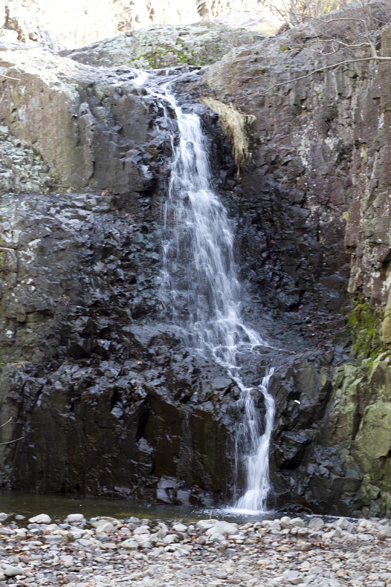
Hemlock Falls

I will add to this idea by saying that there were mountain lions here historically.

South Mountain Reservation, which is now a very suburban area near South Orange and Millburn, was a childhood playground for me and my friends. WE wander to Washington Rock, fed the deer in the fenced-in paddock, climbed Hemlock and Blackrock Falls, walked and biked trails, and fished at Campbell's Pond and Diamond Mill.

The Reservation covers 2,110 acres between the first and second ridges of the Watchung Mountains. Going back to 1896, John Durand, who grew up in Maplewood, described the mountain that includes South Mountain Reservation as:

“a wilderness, as it probably existed at the time of Hendrick Hudson, a primitive forest abounding with deer and other wild animals, and traversed by streams alive with trout. Game was plentiful – partridges, quail, woodcock, rabbits, squirrels of every species, raccoons and foxes; while occasionally a hungry bear that had trespassed on the farmyards in the vicinity would be tracked to its den and shot.”

In 1680, wolves, bears, and cougars were observed in the area, and there was a bounty on them. 

The Lenape Indians gave us the name for the Watchung ridges of New Jersey, the first and second of which form the Reservation’s eastern and western boundaries. “Watchung” meant “high hills.” 

In colonial times, sawmills existed on the Rahway River and there was a logging industry. During 1779-80, the eastern ridge protected the Continental Army’s encampment at Morristown and gave the Army a clear observation to tNew York to the east. The place is known now as Washington Rock Lookout but it was  Beacon Signal Station 9 of the 23 beacons built by General Washington to observe the movement of British troops quartered on Staten Island and Manhattan.

On June 23, 1780, the Essex County and Newark Militia were warned by those beacons that the British were moving west had launched an attack westward. In a pincer movement designed to gain access to Hobart Gap, Hessian troops fought bitterly along Vaux Hall Road while the British advanced along Galloping Hill Road before being repelled, the Hessians at the base of the mountain and the British in Millburn (then Millville). 

Washington Rock served again as a lookout for the Army when reactivated during the War of 1812.

After the war, Samuel Campbell dammed the Rahway River to establish a paper mill. Campbell’s Pond at the southern end of the Reservation bears his name. By the 1820’s, the Diamond Paper Mill Company had dammed the river to sluice water to their mill site. Today that site is the Paper Mill Playhouse.

The reservation was built from land purchases starting at the close of the 19th century. Famous landscape architect Frederick Law Olmsted visited the newly acquired reservation and regarded it as some of the most beautiful and promising terrain he had ever seen anywhere. He turned the design commission over to his stepson and the Olmsted Brothers firm. Later construction work, including trails, footbridges, and shelters, came with the Federal government's Depression-era Civilian Conservation Corps in the 1930s.

It is still a wonderful parcel of preserved land in a densely populated area of the state. Much of the wildlife that Durand reported still exists there - but no evidence of any mountain lions.

More info on the area at South Mountain Conservancy

Wednesday, March 8, 2017

Hike All of New Jersey's 21 Counties

Lake Aeroflex in Kittatinny Valley State Park is considered the deepest natural lake in NJ

Some early spring days and temperatures may have gotten you thinking about more outdoor activities. Walks and hikes are my own favorite way to get outdoors these days. Back in the days when my knees were in better shape, I really wanted to through hike the Appalachian Trail, but I knew that was a reach. I joined a hiking club that did the Appalachian Trail in sections which seemed more doable. Though I never did the entire east coast AT, I did cover all of its sections in NJ, NY, PA and sections in other states.

NJ.com ran an artilce recently with suggestions of where you might hike in each of NJ's 21 counties.  Setting a goal of doing a hike this year in each county would be a good way to get into hiking and see more of the state.

Starting up north, you could try a Sussex County hike in Kittatinny Valley State Park. In its 5,600-acres, there are trails of varying difficulty. Actually, for almost all of the 21 suggested locations, you can take a hike and also a gentle walk. These are not backpacking expeditions requiring training and special equipment (though there are a few tougher hikes in our state).

Kittatinny features some glacial lakes and limestone outcroppings that will be seen from two rails-to-trails paths and those Stokes State Forest, a popular destination featuring a portion of the Appalachian Trail, cliffs, Tillman Ravine and miles of good hiking trails.


And down south, you can try Cape May Point State Park. With 244-acres along the Jersey Shore, this spot offers some flatland walks and hikes through wetland marsh, coastal dunes and beaches. The area is known for its wildlife and birding - along with a World War II-era bunker offshore. There are no mountaintops to scale, but you can climb the Cape May Lighthouse. 

Alternately, you can explore Belleplain State Forest, which is in Cape May County but extends north into Cumberland County. The Forest offers several trails including a flat but longer (7.2 miles) East Creek Trail.

In between and in my own backyard of urban Essex County, there is one of childhood stomping grounds: South Mountain Reservation. At 2,112-acres, this urban nature reserve is located between the first and second ridges of the Watchung Mountains.

It is a great escape with woodlands, streams, creeks, ponds, a reservoir and Hemlock Falls. There are trails from less than a mile (a short walk!) up to 6 miles. As with any of these locations, you can bundle several trails together to create a longer hike.

An alternative spot is the smaller 400-acre Eagle Rock Reservation which is also an easily-accessed spot for a short day hike or ramble.

Thursday, August 27, 2015

South Mountain Reservation and Hemlock Falls

South Mountain Reservation was one of my youthful playgrounds. I rode my bike there and walked the trails without the aid of trail maps or blazes 50 years ago.

Back then, there was a deer paddock that held the deer in check and where families came to feed the deer. Back in the day, deer were an oddity for most urban and suburban kids. The paddock is gone and the progeny of those deer have spread far and wide around that area.

I didn't know the details back then but South Mountain Reservation covers 2,110 acres (8 km2). It is part of the Essex County Park System and portions of it are in Maplewood, Millburn and West Orange. It borders South Orange, between the first and second ridges of the Watchung Mountains.

I liked thinking as I walked along the Washington Rock area that once there were Revolutionary soldiers there guarding a signal fire that would warn General Washington's Army at Morristown that the British were approaching from the east. It was the site of Beacon Signal Station 9 (of 23) built by General Washington to observe British troop movements quartered on Staten Island and New York City.

From this outlook, on June 23, 1780, the Essex County and Newark Militia were first warned that the British had launched an attack westward toward "the Gap," (Hobart Gap), a natural pathway to Washington's troops encamped at Morris Town. 

In what was termed a "pincer movement," Hessian troops fought along Vaux Hall Road, while the British advanced along Galloping Hill Road. The Hessians were stopped at the base of the First Watchung Mountain. The British were defeated in Springfield.

Campbell Pond

There are a number of trails rated easy to moderate. Some are quite rocky and there are a few easy stream crossings that in the heat of summer may be dry creek beds. There is one more significant crossing over the Rahway River. The Lenape and Oakdale trails are probably the most popular.

The Reservation is both north and south of South Orange Avenue with the northern half stretching to Northfield Avenue in West Orange near the Turtle Back Zoo and Orange Reservoir. The southern half extends to Glen Ave. in Millburn and includes Campbell's Pond - where we fished as kids. We referred to it as Diamond Mill and it is near the Papermill Playhouse.

There are several trail maps available and even a Google map that shows the Lenape Trail. This suburban wilderness has several parking areas, formal trails, and some woods roads that can be used.

You can find more information and maps in the New Jersey Walk Book and Hiking New Jersey: A Guide To 50 Of The Garden State's Greatest Hiking Adventures


Monday, May 5, 2014

Waterfalls of New Jersey

New Jersey probably is not the first place one thinks of to find waterfalls. The Garden State has about 30 waterfalls. Most of them are found in the Kittatinny Ridge (northwest), the north-central Highlands, and the Piedmont of the central part of the state. Almost all of them are on public lands and so are accessible to visitors, and many of them offer surrounding lands suitable for a walk or hike.

NJhiking.com has many hikes that feature waterfalls.

Buttermilk Falls in Sussex County tops out at 80-90 feet and cascades spectacularly down the red shale face of the Kittatinny Ridge. It is the only waterfall in New Jersey, apart from Paterson's Great Falls, with a developed viewing area created by the National Park Service. There is an interpretive display and a wooden walkway to the top.

Buttermilk Falls is in the Delaware Water Gap National Recreation Area, alongside a gravel road south of Walpack Center. The Park Service does not advertise Buttermilk Falls, keeping the location a pleasant surprise.

Coppermines Trail has several pretty cascades. Norvin Green State Park has Chikahoki Falls and the Apshawa Preserve has some nice cascades on Apshawa Brook.

Hacklebarney State Park has multiple cascades along the Black River in an easily accessible park.

The Pocono Environmental Center has a nice shady hike through a hemlock forest with several waterfalls.

Hemlock Falls
 
As a young boy, South Mountain Reservation in Essex County was my local forest, and I made many trips to there. The landscape and trails are moderate and somewhat rocky, and you're never that far from roads and development. It is a bit harder to escape the traffic noise than some of those northwestern NJ trails. It's suburban.

At the eastern edge is the view from Washington Rock, where a signal beacon warned the General and his Army at Morristown that the British Army was approaching. My favorite destination was probably Hemlock Falls and walking along the Rahway River (white trail markers). You could also walk part of the 40-mile Lenape Trail (Yellow trail markers) that uses some of South Mountain.  There is a nice hike of about 6 miles that will include Hemlock Falls.

If waterfalls are something you'd like to explore, your best bet in books for our area is Waterfalls of the Mid-Atlantic States: 200 Falls in Maryland, New Jersey, and Pennysylvania.

Friday, August 31, 2012

Hike New Jersey

Pond [Loantaka Brook Reservation]
Pond in Lontaka Brook Reservation, Morris County  Photo by Chris Casciano via Flickr

No big plans for the Labor Day weekend? How about detoxing your brain with a local hike?

Hike New Jersey is a great online guide to hiking trails, local parks, and other outdoor activities in the Garden State.

It may not cover every park in the state (so far) but it just might motivate you to do some exploration on our NJ trails.

Don't be afraid that these are long, arduous, carry a backpack journeys. Many of these hikes are short, loop hikes that bring you back to where you started.

Just looking at the list of sites and trails in northern NJ brought up this short list of places that I have hiked that would be appropriate to newbies and parents with kids.

Black Rock Falls
Hemlock Falls by Chris Casciano via Flickr

I have been hiking in South Mountain Reservation ever since I was a kid, but I still find places I haven't seen or new views in a changing landscape.

South Mountain Reservation in Essex County is a 2000+ acre park that borders Millburn, South Orange and Maplewood. It follows the ridge of the lower Watchung Mountain range.

There are some easy and moderate hiking options and the Lenape Trail [yellow blazes] runs the length of the park.

There are two ponds along dammed sections of the Rahway River. My favorite spot as a kid was Hemlock Falls and I still like walking to that spot (especially after a good rain. It is no Paterson Great Falls, but it's a nice spot. There are a few other smaller water falls along trails.

One well known basalt rock formation is Turtle Back Rock which gave its name to the nearby Turtle Back Zoo.

There are also a number of overlooks to the east with views to the Hudson River and New York City skyline. It's a vantage that General George Washington also took advantage of during the Revolutionary War.

Hike NJ suggests for an afternoon hike starting at the Tulip Springs parking area along Glen Ave. in Millburn and following the white blazed trail north along the Rahway River until it meets South Orange Ave. Make a short detour to see Hemlock Falls and follow the yellow or white/red blazes back south along the top of the ridge.


Photos used here were taken by Chris Casciano and these and other NJ park photos can be purchased at New Jersey Landscape Photography by Chris Casciano. Buy a print to support the Hike NJ site