Showing posts with label Highlands. Show all posts

Friday, April 17, 2026

Sparta Mountain Wildlife Management Area

The Sparta Mountain Wildlife Management Area is a 3,461-acre landscape in Morris and Sussex counties. The site is part of a large tract of the Sparta Mountain Greenway that extends along the westernmost ridge of the New Jersey Highlands. 

The WMA is adjacent to the Newark Watershed Property, the Pequannock Watershed, and the Hamburg WMA, and is located within the Highlands Preservation Area. 

In 2009, NJDEP Fish & Wildlife partnered with New Jersey Audubon to create and implement a Forest Stewardship Plan at Sparta Mountain WMA with two primary goals: to manage aging portions of the forest providing essential habitat for species like the red-shouldered hawk and barred owl, and to create openings in the canopy allowing light to reach the ground, triggering new growth of oaks, blackberries and native grasses. This successful management has provided more diverse habitats and a greater variety of wildlife species.

Sparta Mountain WMA is one of the rare places in New Jersey where you might spot the state's endangered golden-winged warbler, a tiny, vibrant bird that serves as an "umbrella species". By creating the young forest it needs to survive, we are also helping at least 30 other declining species, including the Baltimore oriole, Canada warbler, scarlet tanager, and indigo bunting. Also commonly seen here are the mysterious whip-poor-will, as well as red-shouldered hawks and barred owls, which have benefited from the hunting areas created by the new growth following the forest management work. A variety of other species inhabit the WMA, including turtles, black bears and bobcats.

Ryker Lake can be found within the WMA. The lake was previously managed under special Conservation Regulations for bass, sunfish and yellow perch. These regulations were recently changed for 2026, and the lake is now managed under General Regulations for all species.  Pickerel, crappie and catfish can also be caught. It features a car-top boat launch, and propulsion at the lake is by paddle or electric motor only.

The Sparta Mountain WMA is open for deer, small game, turkey, and waterfowl hunting. Deer hunting in DMZ 6 is excellent, especially in forested areas where turkeys also flock in great numbers in THA 7 due to mast production from the trees. The WMA is also open for trapping. 

NJDEP| Fish & Wildlife | WMA Highlight - Sparta Mountain

Owned by the New Jersey Department of Environmental Protection, Fish & Wildlife, the Wildlife Management Area System is comprised of more than 360,000 acres in 122 areas throughout the state, which is more than 44% of New Jersey’s state-owned public open space. WMAs are maintained and supported with funding from hunting and fishing license sales, the Federal Wildlife and Sport Fish Restoration Program and the Wildlife Habitat Supporter Program.

Monday, August 4, 2025

The New Jersey Highlands

The Highlands of New Jersey is one of those areas that people from other parts of the country just don't associate with NJ. (The Pinelands is another area like that.) The forested ridges, rocky cliffs, and the streams, lakes, ponds, and reservoirs for fishing and recreation are all there. 

The Highlands covers 840,000 acres and includes 188 municipalities. There are 7 Highlands counties – Bergen, Passaic, Morris, Sussex, Warren, Hunterdon, and Somerset – and all contain a diversity of forests, wetlands and grasslands. That habitat diversity is also home to threatened and endangered wildlife.

There are 72 New Jersey-listed endangered, threatened, and rare animal species, including mammals, birds, amphibians, reptiles, butterflies, dragonflies, damselflies, and mussels, and two species (the Indiana bat and bog turtle) are Federally-listed. There are also 137 endangered, imperiled, and rare plant species.

The Highlands also contains historic structures and archaeological heritage sites that need protection.

Hikers can find miles of trails, including both the Appalachian Trail and the Highlands Millennium Trail.

For over half of New Jersey’s residents (4 million+), the Highlands is a critical area for their drinking water. The NJ Highlands Water Protection and Planning Act was passed in 2004, dividing the 840,000-acre region into a “Preservation Area” with strict NJDEP regulations and mandatory Regional Master Plan conformance, and a “Planning Area” with voluntary Plan compliance.

As is often the case in NJ, suburban sprawl is the greatest threat to the Highlands’ drinking water supply, and to the forests, farms, wildlife habitat, and historic, recreational and scenic resources.

There are several areas in NJ that are a focus for Highlands Coalition.

The Wyanokie and Farny Highlands (Passaic and Bergen) contain unprotected lands in nearby Wanaque and Split Rock reservoirs that would connect existing State and county parks and forests in these two heavily utilized recreational areas. This focal area was ranked highly due to its value for water resources and recreation, and secondarily for biodiversity and forest land.

The Pequannock Watershed (Morris, Passaic, and Sussex) serves as the core of the northern New Jersey Highlands and serves as a major hub connecting existing open space areas. This focal area was ranked highly due to its multiple values for water resources, forest land, biodiversity, and recreation.

The wooded ridges of Sparta Mountain/Lubber’s Run (Morris and Sussex) provide an important greenway corridor connecting Mahlon Dickerson Reservation in the north and Allamuchy Mountain State Park in the south. Major gaps in conservation protection include the nearby areas of Mase Mountain. This focal area was ranked highly due to its value for productive forest land, biodiversity, and recreation.

Upper Pohatcong/Pequest area (Warren) also contains forested ridges and wetlands centered around the Pequest Wildlife Management Area, which serve as an important groundwater recharge, wildlife habitat, and outdoor recreation area. This focal area was ranked highly due to its value for water resources and recreation and secondarily for its productive forest and farmland.

Scott Mountain/Musconetcong Ridge in Warren and Hunterdon counties and the neighboring productive farmland of the Delaware, Pohatcong, and Musconetcong valleys form a large contiguous area of high-quality rural landscape. This focal area was ranked highly due to its value for biodiversity and productive farmland, and secondarily for forest land and recreation.

MORE

Monday, July 8, 2019

Protecting Category 1 Rivers and Streams in NJ


New Jersey uses a tiered system to classify waterways with the highest tier being streams designated as “Outstanding Natural Resource Waters.” This allows them to be set aside in their natural state for posterity. Now, the New Jersey Department of Environmental Protection plans to designate about 750 additional miles of NJ's rivers and streams as “Category 1.” This designation will afford them stronger protections.

We already have about 6,800 miles of our state's waterways designated as Category 1. That means they are protected for their exceptional values ecologically, as a water supply, for recreation, and/or as fisheries For newly designated waterways, it means that they will be protected from development by 300-foot buffers, and any wastewater and discharges would have to meet more stringent standards so that “no measurable change” in water quality occurs.

This upgrade of waterways will be the first major one in more than a decade. Protecting waterways is far better - and less expensive - than cleaning up polluted ones.

“Category One waterways provide drinking water and sustain important fish and aquatic resources,’’ said Department of Environmental Protection Commissioner Catherine McCabe, noting that the Category 1 designations also help protect important wildlife habitats.

Looking northwest from Ramapo Lake Dam on the Hoeferlin Trail, Ramapo Mountain State Forest, NJ - Wikimedia
New Jersey is a water-rich state being surrounded by water on three sides, and having thousands of waterways acting as veins and arteries across the state. Many smaller headwaters streams connect to our major rivers and that water eventually flows into the Atlantic Ocean, Delaware River, Delaware Bay, Hudson River or New York Bay.

A good example of the connected nature of our waterways is the Ramapo River which gets its start at Round Lake in the Village of Monroe, New York. It flows southeast through the village and was dammed there in 1741 for a sawmill and grist mill. It then goes on to Harriman where the Nepera Chemical Plant was built. Though it has been dismantled, a Superfund site has been designated at the plant's location where barrels of toxic chemicals were buried. From Harriman, the river turns south through Ramapo, New York and then enters northern Bergen County, NJ.

In NJ, it follows the east side of the ridge of the Ramapo Mountains and into Potash Lake in Oakland and then into Pompton Lake in Pompton Lakes. The water that flows out of Pompton Lake forms the border between Pompton Lakes and Wayne. At its confluence with the Pequannock River between Pequannock and Wayne, it forms the Pompton River. Some of that water is diverted to the Wanaque Reservoir and the rest flows into the Passaic River, which flows into Newark Bay and, from there, New York Bay and then into the Atlantic Ocean.

Map of the Passaic/Hackensack watershed - Wikimedia

The NJ Department of Environmental Protection also proposes to reclassify waterways based upon fish sampling data, recognizing 24 stream segments as Exceptional Fisheries Resources, or “trout production” waterways. These waterways, located mostly in the New Jersey Highlands region, were found to have naturally reproducing trout. Trout that reproduce naturally are an excellent natural indicator of clean and healthy water, and that is important as the Highlands region supplies over two-thirds of the state with drinking water.

To see an interactive map of waterways proposed for reclassification, go to nj.gov/dep/workgroups/docs/2019c1_proposal/2019c1upgrade.html. Here are a few newly designated waterways:

  • Cooper River in the city of Camden, which flows into the Delaware River
  • Upper sections of the Maurice River in Cumberland County and also
  • many of its tributaries (Menantico Creek, Blackwater Branch and Little Robin Branch)
  • Much of the South Branch of the Raritan River in Hunterdon and Somerset counties, including tributaries like the Neshanic River, the Rock Brook and Prescott Brook.
  • Much of the Lamington River and its tributaries, which flow into the North Branch of the Raritan River;
  • Many waterways flowing into the upper Delaware River, including the Pequest River, Paulins Kill River, and the Lubbers Run, a Musconetcong River tributary;
  • Sections of the Salem River and its tributaries, including Oldmans Creek and Raccoon Creek. (The Salem River flows into the lower Delaware River)
  • The Fishing Creek in Cape May County, which flows into the Delaware Bay.


Source: Press Release state.nj.us/dep/newsrel/2019/19_0013.htm

Wednesday, December 28, 2016

Building Bobcat Alley


proposed bobcat alley - via www.nature.org

Bobcats are New Jersey’s last remaining wild cats. Once nearly extinct in our state, they are still endangered here, but making a comeback. The key to their success is habitat.

The Nature Conservancy is working to protect critical habitat for these beautiful cats in New Jersey. They call it "Bobcat Alley," and it's a place created by connecting preserved land between two great mountain ranges: the Appalachians and the Highlands.

The Bobcat Alley wildlife corridor will provide space for bobcats to hunt, raise young here and flourish.

You can help build Bobcat Alley by donating to The Nature Conservancy.


Monday, March 28, 2016

Two Sides of the Sparta Mountain Forest Proposal

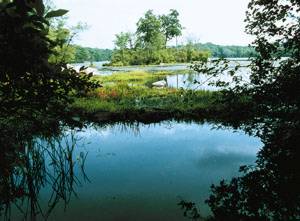
Ryker Lake,one of several bodies of water on the Sparta WMA | Photo by Wilma Frey

Sparta Mountain was preserved as part of the continuous forest of the Highlands that protects the drinking supply for half of New Jersey’s residents. But a proposed logging project may threaten that with increased silt and run-off that will affect trout streams and also that very high water quality water supply.

The NJDEP Division of Fish and Wildlife partnered with the NJ Audubon Society to revise the existing Forest Stewardship Plan (FSP) for the 3,461-acre Sparta Mountain Wildlife Management Area in Sussex County.

NJDEP states its primary goal of the plan is to "maintain ecosystem health, diversity, and integrity by creating a greater balance among the stages of forest succession throughout the property, minimizing further distribution of invasive exotic species, and enhancing biological diversity through responsible silviculture and mimicking natural 'gap disturbances'."


But some people view this "management" as just creating a different habitat more suitable for hunting. Groups such as the NJ Sierra Club say this proposal not only threatens the environment, but it will also interfere with public access, recreation, and hiking.

What NJDEP calls the "Sparta Mountain WMA Forest Stewardship Plan," environmental groups call "logging" and "clear-cutting" and a plan to "turn the Mountain into a field for bird habitat and deer over-population."

You only have until March 31st to let your feelings about this proposal be known, and can post those comments online for the NJDEP at http://www.state.nj.us/dep/fgw/spartamt_comments.htm

Friday, March 18, 2016

The New Jersey Highlands and Watersheds


The New Jersey Highlands are part of the Appalachian Mountains that run along the East Coast from Maine to Georgia, as does the Appalachian Trail.

This region of New Jersey is almost 860,000 acres of forested ridges, farmlands, and a variety of recreation, wildlife and historic gems.

It is also a very important watershed that is continually being threatened and defended to be preserved from pollution and development. It provides more than half of New Jersey's population with clean drinking water. It also supplies industry with water.

The Highlands stretch about 60 miles across our state from Phillipsburg in the southwest to Oakland in the northeast. Of course, it extends, as the map shows, beyond New Jersey.

It covers portions of seven northwest New Jersey counties — Bergen, Hunterdon, Morris, Passaic, Somerset, Sussex, and Warren — and more than 88 municipalities.

One of the main objectives of the Highlands Act was to protect the watershed.

I continue to believe that water will be the oil of the future - an investment that will grow in the very near future.

In 2004, Governor McGreevey signed the Highlands Act into law to establish an independent Highlands Water Protection and Planning Council. they were charged with creating a regional master plan.  That plan was meant to guide development into appropriate areas and protect water resources, forests, critical wildlife habitat, farmland, historic sites, recreation and scenic beauty.

To learn more about the Highlands and what is being done to protect it, go to state.nj.us/njhighlands. and www.njhighlandscoalition.org


Monday, December 6, 2010

A Billion Years Ago in New Jersey

How old are the oldest rocks in New Jersey and where are they located?

Geologists know that the rocks in the mountains of North Jersey’s Highlands are the remnants of ancient Appalachian Mountains that at one time rivaled the Rocky Mountains.

It has been accepted that they are the oldest in the state at about a billion years old.

But the actual dating wasn't known precisely until the New Jersey Geological Survey, within the Department of Environmental Protection, teamed up with the U.S. Geological Survey and the Australian National University in a project funded by private grants to provide the most precise dating ever of New Jersey’s oldest rocks.

Rocks collected from the Highlands were analyzed using a highly sophisticated dating technique at the Australian National University. The technique allowed researchers to date the rocks to within nine million years of certainty, a degree of specificity never attained before.

The NJ Highlands at the Wanaque Reservoir
 
They found that the rocks are actually quite a bit older than the generalized billion-year-old estimate ascribed to them. Most of the rocks fell in a range of 1.02 billion to 1.25 billion years old, but a narrow belt stretching from Wanaque to Ringwood was dated at 1.37 billion years old, making these the oldest rocks in New Jersey.

“Unraveling the geologic history of the New Jersey Highlands from the age of bedrock obviously is interesting to scientists,” said State Geologist Karl Muessig. “But it also has practical applications for environmental risk assessment. For example, potassium-rich granites of a certain age in the Highlands contain higher concentrations of radioactive elements than most other granites and are likely to produce higher radon levels in soil and water. More precise mapping of these granites will help better identify areas that may pose greater public health risks from radon.”


Geologists have long understood that the mountains of the Highlands were formed during a mountain-building period known as the Grenville Orogeny, which occurred about a billion years ago.

Amazingly, this was a time when land that is now part of South America was adjacent to what is today New Jersey.

“Rocks of the New Jersey Highlands form the roots of the ancestral Appalachian Mountains that were formed during a collision of continental land masses about one billion years ago,” Volkert said. “The result of this mountain-building event uplifted the earth’s crust in eastern North America, including the Highlands, to heights rivaling the present-day Rocky Mountains.”

Hundreds of millions of years of weathering have left erosion-resistant granite and gneiss that form the rugged ridges and steep-sided hills that are characteristic of the Highlands region. But the wearing-away occurred unevenly, meaning the rocks that you see jutting from a hillside or at a valley floor - or even just a short distance from each other - are likely to be of differing ages.

When you consider that it has only been 65 million years since the extinction of the dinosaurs, and 200 million years since continental drift and plate tectonics opened up the Atlantic Ocean, the age of the rocks is awe inspiring.

via http://www.nj.gov/dep/newsrel/2010/10_0137.htm

Monday, March 1, 2010

Hudson Farm Greenway in Sussex County

A recent report in The Star-Ledger reports good environmental news for Northern New Jersey.

A 222-acre tract in Byram Township (Sussex County) has been preserved for $4.2 million with an agreement that included the Land Conservancy of New Jersey, Green Acres program, New Jersey Conservation Foundation, Byram Township and the Sussex County Open Space Committee.

The Conservancy was part of a four-year effort to permanently save the Hudson Farm Greenway tract for natural and recreation purposes, including ballfields and trails.

The Hudson Farm Greenway tract includes mature forest, Johnson Lake, existing hiking trails and a scenic ridgeline that overlooks Cranberry Lake. It creates a greenway corridor that Johnson Park with Allamuchy State Park. The nearby Highlands Trail may also be re-routed through the new greenway.

New Jersey preserved 332 acres of hiking, natural, agricultural lands in the past year including:

First Time Fen: 54 acres, Green Township - greenway linking the Whittingham Wildlife Management Area to the Pequest River Blueway.

Mayapple Hill Extension: 11.2 acres, West Orange - now part of South Mountain Reservation.

Lake Iliff Access: 13.5 acres, Andover Township

Pompton River Walk: 0.43 acres, Pequannock

Polowy farm: 140 acres, Frelinghuysen

New Village Road Natural Area: 109 acres, Greenwich Township

Miller-Kingsland Historic Park: 2.81 acres, Boonton

Horseshoe Lake Athletic Complex: 0.63 acres, Roxbury

Wednesday, November 18, 2009

Backpacking


Backpacking is a great autumn and early winter recreational activity in NJ and our region.

For newbies, ultralight backpacking may be a good approach. Although that "advanced" style of backpacking emphasizes carrying the lightest weight safely possible for a given hike for the purposes of long distance hikes, it also is a good approach for the more casual day hikers and weekend backpackers.

To hardcore backpackers who set out on those long trips, I might be misusing the term backpacker here, but I'll take that risk.

Light and ultralight packs generally refer to base pack weights below 20 pounds and below 10 pounds respectively. (Traditional backpacking often results in base pack weights of 30-60+ pounds.)

Ultralight backpacking was popularized in a book by Ray Jardine (see below). He claimed his first Pacific Coast Trail thru-hike was with a base pack weight of 25 pounds and on his third PCT thru-hike, he was down to less than 9 pounds.

By carrying lighter and less equipment, backpackers usually cover longer distances per day with less wear and tear on the body.

What do you leave home? Camping luxuries such as camp chairs, coffee makers, electronic gadgets, camera equipment, multiple items of clothing, etc. all vanish.

Backpacker will also use or make lighter versions of items - remove the handle from a toothbrush, transfer boxed & canned food items to plastic bags etc. They substitute light nylon & other fabrics for packs, tents and covers for older & heavier materials.

And they use things that serve multi-purposes - the rain poncho that also is a tarp shelter or dressing more warmly s that a lightweight sleeping bag is sufficient.

Having partners on your hike - a good idea for any type of outdoor adventuring - also means that some equipment can be carried by one person for the group. How many compasses, maps or GPS nits do you need?

Okay, so you have considered how to keep that pack light. Now, where to go...

Since 1876, the Appalachian Mountain Club has been promoting the protection, enjoyment, and stewardship of the mountains, forests, waters, and trails of the Appalachian region. AMC is the nation’s oldest outdoor recreation and conservation organization.

The New York-North Jersey Chapter (originally the New York Chapter) has more than 13,000 members from New York City, southeastern New York, and northeastern New Jersey and would be a good place to begin your research.

Try their Trip Search. I checked our region and found three backpacking trips still open for this year:

11/21/09 - 11/22/09 NY Catskills Five Peaks Loop Backpack
11/28/09 - 11/29/09 Big Savage Mountain Backpack (MD)
12/05/09 - 12/06/09 Appalachian Trail in PA-Wind Gap to Delaware Water Gap

They offer local chapter activities and major excursions worldwide at all ability levels. It's not limited to hiking and climbing. There are also paddling, snowshoeing and skiing trips.

Want to go a distance and not carry that tent? They have AMC Lodges, Huts, Full-Service Camps, Cabins, Shelters and Campgrounds.

They also offer programs in the skills to be safe outdoors and care for the natural world around us, through for children, teens and adults.


Sunrise Mountain view via Flickr


More Information

http://www.thebackpacker.com offers trip information, like this Appalachian Trail hike from Culvers Gap to NJ Rt. 23. About 13 miles, along Kittatinny Ridge to the crest of Sunrise Mountain with great panoramas of the NJ Highlands and the Poconos before dropping down to High Point State Park.

http://en.wikipedia.org/wiki/Backpacking_(wilderness)

http://en.wikipedia.org/wiki/Ultralight_backpacking

Wednesday, July 29, 2009

The Highlands Trail


The Highlands Trail highlights the natural beauty of the New Jersey and New York Highlands region, and draws the public's attention to this endangered resource. It is a cooperative effort of the New York - New Jersey Trail Conference, conservation organizations, state and local governments, and local businesses.

When completed, the trail will cover over 150 miles from Storm King Mountain on the Hudson River in New York south to Riegelsville, New Jersey, on the Delaware River. The route will connect major scenic attractions in both states. Ultimately, a network of trails including alternate routes and multi-use paths is envisioned.

The Highlands Trail is a combination of co-alignment on established trails, new trails, and road walking. The Highlands Trail blaze is a teal-colored diamond. The co-aligned sections bear both trails' blazes, except for the Appalachian, Sterling Ridge, and Allis Trails, which have plastic Highlands Trail logos at critical points. Hikers must pay attention at intersections as the Highlands Trail often leaves one trail to join another.

Camping is not permitted along the Highlands Trail. Thru-hikers must stay at bed-and-breakfast facilities along the route, or at established State Park camp grounds.


Click image to enlarge