Showing posts with label rivers. Show all posts

Monday, July 8, 2019

Protecting Category 1 Rivers and Streams in NJ


New Jersey uses a tiered system to classify waterways with the highest tier being streams designated as “Outstanding Natural Resource Waters.” This allows them to be set aside in their natural state for posterity. Now, the New Jersey Department of Environmental Protection plans to designate about 750 additional miles of NJ's rivers and streams as “Category 1.” This designation will afford them stronger protections.

We already have about 6,800 miles of our state's waterways designated as Category 1. That means they are protected for their exceptional values ecologically, as a water supply, for recreation, and/or as fisheries For newly designated waterways, it means that they will be protected from development by 300-foot buffers, and any wastewater and discharges would have to meet more stringent standards so that “no measurable change” in water quality occurs.

This upgrade of waterways will be the first major one in more than a decade. Protecting waterways is far better - and less expensive - than cleaning up polluted ones.

“Category One waterways provide drinking water and sustain important fish and aquatic resources,’’ said Department of Environmental Protection Commissioner Catherine McCabe, noting that the Category 1 designations also help protect important wildlife habitats.

Looking northwest from Ramapo Lake Dam on the Hoeferlin Trail, Ramapo Mountain State Forest, NJ - Wikimedia
New Jersey is a water-rich state being surrounded by water on three sides, and having thousands of waterways acting as veins and arteries across the state. Many smaller headwaters streams connect to our major rivers and that water eventually flows into the Atlantic Ocean, Delaware River, Delaware Bay, Hudson River or New York Bay.

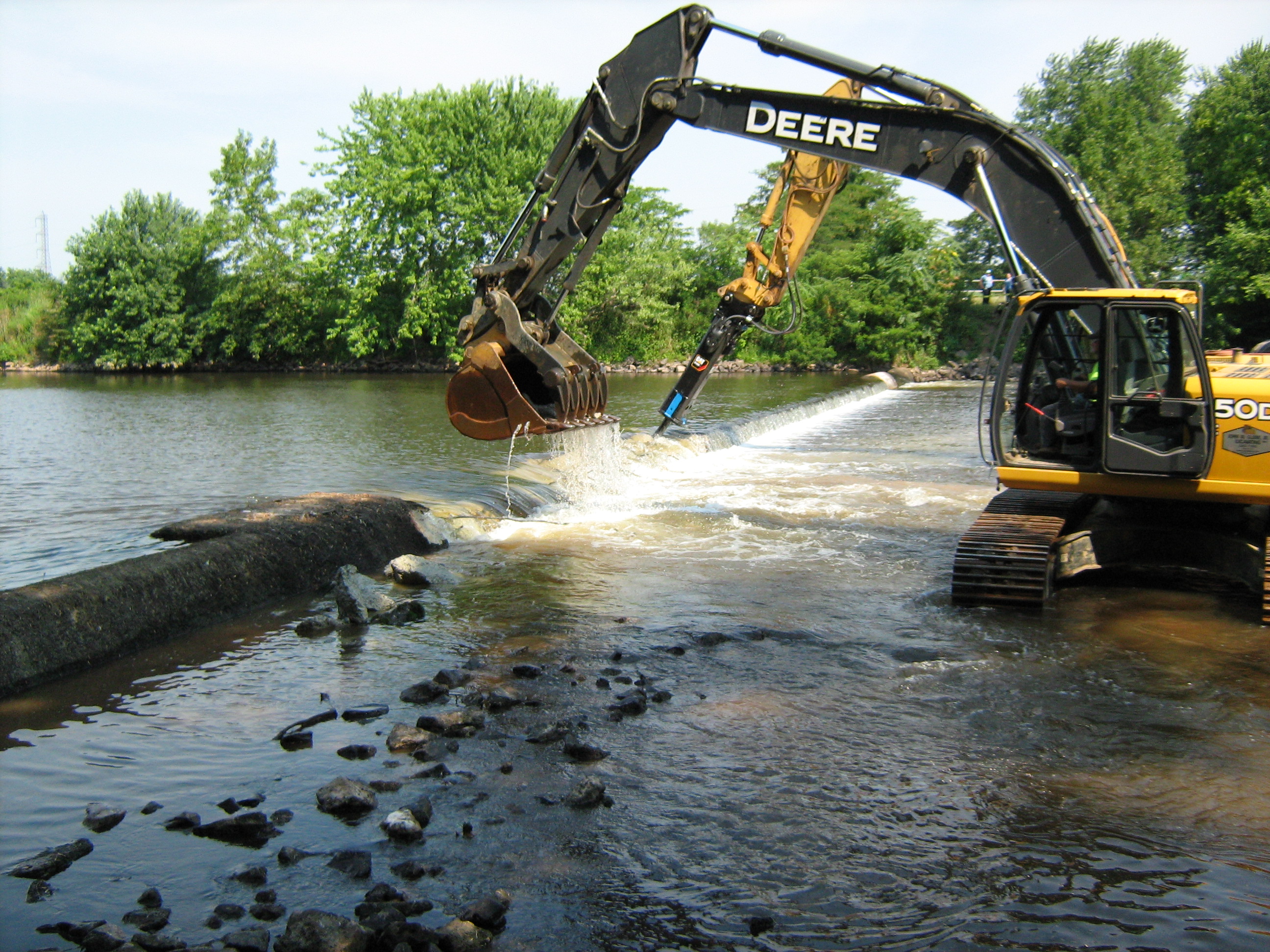
A good example of the connected nature of our waterways is the Ramapo River which gets its start at Round Lake in the Village of Monroe, New York. It flows southeast through the village and was dammed there in 1741 for a sawmill and grist mill. It then goes on to Harriman where the Nepera Chemical Plant was built. Though it has been dismantled, a Superfund site has been designated at the plant's location where barrels of toxic chemicals were buried. From Harriman, the river turns south through Ramapo, New York and then enters northern Bergen County, NJ.

In NJ, it follows the east side of the ridge of the Ramapo Mountains and into Potash Lake in Oakland and then into Pompton Lake in Pompton Lakes. The water that flows out of Pompton Lake forms the border between Pompton Lakes and Wayne. At its confluence with the Pequannock River between Pequannock and Wayne, it forms the Pompton River. Some of that water is diverted to the Wanaque Reservoir and the rest flows into the Passaic River, which flows into Newark Bay and, from there, New York Bay and then into the Atlantic Ocean.

Map of the Passaic/Hackensack watershed - Wikimedia

The NJ Department of Environmental Protection also proposes to reclassify waterways based upon fish sampling data, recognizing 24 stream segments as Exceptional Fisheries Resources, or “trout production” waterways. These waterways, located mostly in the New Jersey Highlands region, were found to have naturally reproducing trout. Trout that reproduce naturally are an excellent natural indicator of clean and healthy water, and that is important as the Highlands region supplies over two-thirds of the state with drinking water.

To see an interactive map of waterways proposed for reclassification, go to nj.gov/dep/workgroups/docs/2019c1_proposal/2019c1upgrade.html. Here are a few newly designated waterways:

  • Cooper River in the city of Camden, which flows into the Delaware River
  • Upper sections of the Maurice River in Cumberland County and also
  • many of its tributaries (Menantico Creek, Blackwater Branch and Little Robin Branch)
  • Much of the South Branch of the Raritan River in Hunterdon and Somerset counties, including tributaries like the Neshanic River, the Rock Brook and Prescott Brook.
  • Much of the Lamington River and its tributaries, which flow into the North Branch of the Raritan River;
  • Many waterways flowing into the upper Delaware River, including the Pequest River, Paulins Kill River, and the Lubbers Run, a Musconetcong River tributary;
  • Sections of the Salem River and its tributaries, including Oldmans Creek and Raccoon Creek. (The Salem River flows into the lower Delaware River)
  • The Fishing Creek in Cape May County, which flows into the Delaware Bay.


Source: Press Release state.nj.us/dep/newsrel/2019/19_0013.htm

Tuesday, November 20, 2018

Passaic River Coalition

Passaic River Basin
The Passaic River Watershed is an interdependent system of water retention, transportation and use formed by nature and adapted to human needs. This water falls as rain in the wilderness headwaters regions of the the Highlands of New York and New Jersey. It then flows through aquifers and rivers into reservoirs and wells to be used by people and industry in the downstream communities of the Lower Valley. The Passaic River moves through vast tracts of wetlands in the central basin, into the heavily urbanized lower valley and out to Newark Bay and the Atlantic Ocean.

The Passaic River Coalition (PRC) is an organization that provides assistance and stewardship for the preservation and protection of over 1,000 miles of waterways. It was established in 1969 and incorporated in 1972.

They works towards positive results, improvements in land-water resource management, and public health issues by working as an advisor to citizens, other environmental organizations, governments, and businesses. They gather scientific data and convert it into informed policy.

An example is one of their objectives to dredge all 17 miles of the Lower Passaic River and Newark Bay in order to significantly improve water quality and ensure that the contaminants will not create problems for future generations. Aspart of this, they want to make sure that the dredged sediment will not be reburied in a Confined Disposal Facility (CDF) in Newark Bay. rather, a land based treatment facility should be built in the region that will decontaminate the dredged material and produce a safe and useful product.

They also want navigability to be taken into consideration when plans are developed to dredge the river. They envision a future where the river is used, particularly for recreational and commercial boating.

PRC has been involved in the creation of new surface supply systems such as the Monksville Reservoir and the development of three Water Supply Master Plans for New Jersey. PRC has assisted in plans to restore Greenwood Lake, a primary water source for northern New Jersey and is creating the overall restoration guide for the Lake. In 1980, PRC established the Ground Water Protection Committee, which obtained federal recognition for the Buried Valley Aquifer system of the central Passaic and published studies on its contamination and protection. They created a Well-Head Protection Program to keep groundwater hazards out of municipal wells.

In 1993, PRC created a Land Trust to acquire properties of ecological significance and unique landscape character for water resource protection. With a policy of offering fair market value, PRC has acquired nearly 1,000 acres of dedicated open space that will never be developed, but will become sites for passive recreation like hiking or birding, outdoor research areas for students and scientists, and places for threatened and endangered species to find sanctuary.

PRC relies on a dedicated Board of Trustees, professional staff, and volunteers. You can donate to them or become a member and help continue their efforts.

Wednesday, May 16, 2018

Clean Waters


The Federal Water Pollution Control Act of 1948 was the first major U.S. law to address water pollution. Growing public awareness and concern for controlling water pollution led to sweeping amendments in 1972. As amended in 1972, the law became commonly known as the Clean Water Act (CWA).

Clean Water Action is one group that has worked to win strong health and environmental protections. They organize strong grassroots groups and coalitions, and campaigns to elect environmental candidates and to solve environmental and community problems.

Some of those campaignsTake action to protect drinking water and clean up polluted waterways:

  • Get health-harming toxics out of everyday products
  • Protect our water from dirty energy threats - drilling and fracking for oil and gas, and power plant pollution
  • Build a future of clean water and clean energy
  • Keep our clean water laws strong and effective to protect water and health.

In New Jersey, you can reach Clean Water Action at:
198 Brighton Avenue
Long Branch, New Jersey, 07740
p: 732.963.9714
and
559 Bloomfield Avenue
Montclair, New Jersey, 07042
p: 973.744.3005


A group protecting the water offshore is Clean Ocean Action which helps to identify the sources of pollution and attack each source by using research, public education, and citizen action to convince our public officials to enact and enforce measures which will clean up and protect our ocean.

Clean Ocean Action (COA) is a broad-based coalition of 125 active boating, business, community, conservation, diving, environmental, fishing, religious, service, student, surfing, and women's groups.

Their campaigns include:

  • Improve programs and laws that protect public health at swimming beaches.
  • Reduce plastics and litter that pollute waterways, spoil beautiful beaches, and harm or kill marine life including turtles, whales, seals, birds, and fish.
  • Protect coasts from oil and gas drilling in the ocean, including Maine to Florida.
  • Establish the nation’s first Clean Ocean Zone to start a national chain reaction for all coasts.
  • Reduce toxins in waterways to ensure fish and shellfish are free of pollution and safe to eat.
  • Educate and motivate citizens from the small to the tall.


Monday, September 26, 2016

Passaic River Symposium October 13-14 2016


The seventh Passaic River Symposium on October 13-14, 2016 will be an event featuring and integrating environmental management, watershed science, flood prevention, urban environments, sustainable development, and the Lower Passaic River Restoration Project. 

Registration Deadline: Friday, September 30  

The symposium will include invited keynote speakers and plenary sessions/presentations on all aspects of environmental management challenges relevant to the Passaic River Basin and other regional watersheds. 

The event will be held at Montclair State University.

This conference year will focus on the Record of Decision for the Lower 8.3 Miles of the Lower Passaic River, environmental monitoring results, flooding, storm water management, water quality and water supply, ecosystem restoration, and environmental advocacy and public outreach efforts. Projects in the upper River and tributary watersheds will also play a prominent role in this conference. Together, the Symposium will discuss in the context of how to achieve a vision for a sustainable Passaic River.

MORE INFORMATION   www.csam.montclair.edu/pri/conferences 
 

Wednesday, May 11, 2016

Water Trails in New Jersey


If you're one of the people who paddles along a New Jersey lake or river, you're probably not all that different from the oldest inhabitants of this area. Long before roads,  Indians and then settlers to this area traveled on our waterways across the area. These water trails became the places for towns and eventually paralleled the paths, roads and highways.

When most people think about "trails" they imagine paths through the woods. But some of those paths through wilderness are liquid and the mapping of "water trails" is happening more and more.

This mapping and designation can help protect natural areas as well as provide places for kayaking, canoeing and stand-up paddling.

In New Jersey, we have designated water trails including ones on the Delaware River, the South Branch of the Raritan River, the Egg Harbor River, the Maurice River and the Hackensack River.

But we don't have any water trails that are designated such by the National Park Service.


There are two in New York, but none in NJ or Pennsylvania. The Bronx River Blueway which passes directly through the New York Botanical gardens, the Bronx River Forest, cityscapes, and the Bronx Zoo is one.

The other NY water trail is the Hudson River Greenway Water Trail which is designed for day-users as well as long-distance paddlers. It includes 94 designated access sites, wildlife marshes, islands, historic sites, cities, downtowns, and hiking trails.

Some paddling enthusiasts in Burlington County are trying to get the Rancocas Creek to become New Jersey's first nationally-designated water trail. Certainly our Jersey waterways must have more than a few places suitable for the designation!

The National Park Service loks for sites with boat landings in protected areas, existing parkland and multi-use recreation areas along the creek, and also educational and cultural heritage opportunities along the way on the shore or nearby.


The Rancocas Creek watershed is one of the state's largest, covering 360 square miles.

The North Branch flows about 30 miles, from its headwaters in the pitch pine lowlands of the Pine Barrens in western Ocean County to the main stem in Hainesport.

The Burlington County park system maintains a 14-mile canoe trail with access points in Pemberton, historic Smithville and Mount Holly.


The South Branch of the Rancocas flows for about 22 miles to the main stem, and the Southwest Branch is about 18 miles long. The three branches join the creek's main stem, a wide, tidal waterway used by motorized boats as well as canoes and kayaks.


For more about the efforts to get the Rancocas Creek designated, go to www.rcnwt.com

Sunday, April 12, 2015

Bringing the Assunpink Creek Back Into the Daylight in Trenton

Assunpink Creek flowing through Trenton near Mill Hill Park
Work is expected to begin on a $4 million restoration this spring that is being financed 75 percent by the U.S. Army Corps of Engineers and 25 percent by the DEP through a federal Clean Water Act grant.

What the project hopes to accomplish is to restore the Assunpink Creek in downtown Trenton. You say you've never seen it? That's because decades ago this tributary of the Delaware River was channeled into an underground culvert. It disappears from view between South Broad and South Warren streets.

The idea years ago was certainly to allow for greater development where the creek flowed, but the culvert prevented fish from migrating into the Delaware. The downtown also lost the natural beauty of the stream.

Maybe it was a sign from nature when the nine years ago part of the culvert roof collapsed. The immediate effect was not good - a safety hazard that was fenced off and became an overgrown lot.


But this project to restore the creek looks like it will now happen.

On the New Jersey Future website at www.njfuture.org, you can see maps and historic photos.

The term for this restoration is "daylighting," as in bringing back the water to the light of day from its capture underground.

The Assunpink Creek is 25 miles long, and drains approximately 91 square miles in central New Jersey. The main tributaries that feed Assunpink Creek are Shabakunk Creek and Miry Run. The headwaters begin in Millstone Township, in Monmouth County, and flow into the Delaware River in Trenton.

The creek gathers intensity as it meanders west from Millstone Township in Monmouth County, through the Assunpink Wildlife Management Area and Mercer County Park, across the old, flat clays and silts of the Raritan and Magothy formations into Trenton.

The Lower Assunpink Creek Ecosystem Restoration Project study area is located on a 3- mile section of the Assunpink Creek between the Delaware River and the Trenton city limits. Several former industrial sites, abandoned bridges, and a 500-foot section of the creek between Broad and Warren Streets, contained within a buried box culvert were identified as candidates for ecological restoration.

The buried box culvert, known locally as the Broad Street culvert, was evaluated during the feasibility study and approved for removal and restoration of a natural creek channel. The Broad Street culvert removal project is located in the heart of the downtown Trenton business and historic district on a recovering urban stream that also serves to connect several greenway and urban park facilities.

illustration via www.trentonhistory.org


The project site is also the location of the the Battle of Assunpink Creek (AKA the Second Battle of Trenton) during the American Revolution. On Jan. 2, 1777, the Continental Army and supporting militias held a defensive line along the creek's south shore. Under George Washington's command, the Americans repelled charges by British and Hessian soldiers across a stone bridge spanning the creek, as well as an attempt to ford the creek near its mouth.

By morning, Washington had reached Princeton and after a brief battle, the British there were decisively defeated and most of the garrison was captured. With their third defeat in ten days, Cornwallis' superior, General William Howe ordered the army to withdraw from southern New Jersey and most of the way back to New York. The British left forward positions at New Brunswick and Washington moved his army to Morristown for winter quarters.

The daylighting of the stream this year will mean the removal of the culvert structure, allowing the stream to be exposed to natural sunlight, and the resulting open channel design will improve anadromous fish migration. Low-light conditions can disorient migrating fish, hindering their ability to spawn upstream.

The project will also benefit businesses adjacent to the site, provide recreational options for visitors and local residents, and provide historical and educational opportunities for the community.

The name Assunpink comes from the Lenape word for "stony, watery place," describing the gravelly springs of New Jersey's 65 million-year-old ancient coastline. This ironstone "cuesta," or ridgeline divides the inner and outer coastal plains.

Wednesday, July 24, 2013

Removal of Third Dam on Raritan River Will Aid Fish Spawning and Migration

Nevius Street Raritan Bridge

Department of Environmental Protection (DEP) Commissioner Bob Martin announced the start of the removal of a third dam from the Raritan River in Somerset County that will further open a 10-mile stretch of the middle and upper portions of the river to fish spawning and migration and also allow more recreational opportunities.

Removal of the Nevius Street Dam in Raritan Borough is the third and final dam elimination project on the Raritan River over the past three years that is financed by a landmark natural resource damages settlement secured by the DEP in 2010 with El Paso Corporation, which is now Kinder Morgan. This restoration project is being implemented as compensation to the public for harm to natural resources caused by past pollution at a refinery that was operated by or affiliated with El Paso.

In addition to the dam removals, the DEP received nearly $160,000 from Kinder Morgan for herring research on the Delaware River as part of the settlement.

“This is another example of the Christie Administration’s commitment to improved water quality and enhanced recreational opportunities in our state,’’ said Commissioner Martin. “This project makes excellent use of pollution settlement dollars to provide a major environmental improvement on the Raritan River. Also, residents and sportsmen in the region will enjoy the recreational benefits of this dam removal for generations to come.’’

“The significant ecological benefits of removing this dam are consistent with the efforts of Duke Farms to be a model of stewardship, and we are delighted to see the progress which has been made to enhance the Raritan as the true queen of New Jersey rivers,’’ added Michael Catania, Executive Director of Duke Farms, which owns the dam.

The Nevius Street Dam is being removed over the next two weeks as part of a watershed-wide effort to re-establish historically significant migratory fish passage, restore riverine habitat and the natural flow of the Raritan River, and enhance recreational uses.

Its elimination will add to habitat improvements realized from removal of the Calco Dam in Bridgewater in 2011 and the Robert Street Dam in Bridgewater and Hillsborough townships in 2012. Removal of the Nevius Street Dam should be completed within two weeks by Kinder Morgan’s contractor, River Logic, said Kinder Morgan project manager John Jengo.

Meanwhile, the DEP’s Office of Natural Resource Restoration continues to study additional dams in the Raritan River watershed and will evaluate and implement appropriate options for future enhanced fish passage and recreational opportunities.

The Nevius Street Dam is located just south of the Borough of Raritan at river mile 27.0 in Somerset County. It was constructed in 1901 by James Buchanan (Buck) Duke, the tobacco and hydropower industrialist, for aesthetic and recreational purposes as part of his development of Duke Farms, a 2,740-acre estate in Hillsborough Township.

The dam is constructed of mortared stone block over a concrete core, with a stair-step design on its downstream side. The dam length is approximately 195 feet.

A water intake structure was installed in the early 1960s on the north end of the dam and Duke Farms began utilizing this intake system for its primary water supply when their pumping withdrawals from the Raritan Water Power Canal were discontinued in the 1970s.

All three dam removals will open up 10 miles of migratory fish habitat along a stretch of the Raritan that twists through a highly diverse residential, commercial and agricultural portion of Somerset County that includes Bridgewater, Hillsborough, Bound Brook, Somerville and Manville. It also will open up about 17 miles of tributaries, including the Millstone River, to spawning. None of the dams were built for flood control:

Calco Dam, demolished in 2011, was located at river mile 20.9 and built by the Calco Chemical Co. in 1938 to disperse chemicals from its facility.
The Robert Street Dam, a 6 ½-foot-high sheet piling and concrete dam had been located at river mile 27.9 and was originally constructed prior to 1930 for purposes that are not known today.
The Nevius Street Dam, located at river mile 27.0, was constructed of rocks and mortar in 1901 for aesthetic purposes and later retrofitted to provide water to Duke Estate ponds.
Fish to benefit most from the removal of the dams are American shad, American eel, herring, and striped bass, which once migrated in prodigious numbers through the gravelly shallows of the Upper Raritan. Better water flow also will improve flushing of sediments, reduce nutrient loadings and improve conditions for tiny aquatic organisms that are critical to the food web in the river system.

"Somerset County is delighted to see this initiative of the Christie Administration and the DEP provide such tangible improvements to the Raritan River to help improve the quality of life for the citizens of Somerset County,” said Somerset County Freeholder Director Peter Palmer.

“The removal of the Nevius Street Dam will complement the borough's plans to make the Raritan River more accessible to our residents and a focal point for our own recreational and redevelopment efforts, added Raritan Mayor Jo-Ann Liptak.

Calco Dam in Bridgewater

The voluntary settlement with El Paso – now Kinder Morgan -- resolved Natural Resource Damage claims made by the DEP against the Houston-based company that stemmed from contamination at EPEC Polymers Inc. in Flemington, Hunterdon County; Nuodex Inc. in Woodbridge, Middlesex County; EPEC Polymers Inc. in Burlington City, Burlington County; and the Eagle Point Refinery in West Deptford, Gloucester County. Investigations and/or cleanups are under way at those sites.

The DEP uses funds secured from Natural Resource Damage settlements toward ecological restoration projects, typically in the same watershed or general area where resource damages occur.

For a copy of the settlement agreement, visit: http://www.nj.gov/dep/docs/elpaso-nrd-settlement.pdf

For more information on the DEP's Office of Natural Resource Restoration, visit: http://www.nj.gov/dep/nrr/

Tuesday, April 16, 2013

Politics and Pollution on the Passaic River

a Passaic River cleanup, Lyndhurst

An article this past weekend by Tom Moran in The Star-Ledger gives a good summary of the complicated history of the pollution and cleanup attempts on the Passaic River.

It is a tale of corporations, environmentalists and politicians. The article opens by saying:

A half-century has passed since workers at Diamond Shamrock were ordered to dump dioxin into the Passaic River in Newark, and then to march out at low tide and knock down the toxic mud piles with rakes so that no one would know.

So began the long history of polluters evading responsibility for the murder of this river, an effort that continues to this day. Workers with rakes have been replaced by consultants and lawyers.

continue reading

Wednesday, February 27, 2013

Preserving Land To Preserve Rivers

The Passaic River Coalition’s Butler Forest Preserve & Butler Raceway are two preserves which are contiguous (connected).

Combined they have a combined acreage of 14.9 acres.Four of those acres are deciduous wooded wetlands.

The preserve is Butler, NJ and these areas were purchased to prevent the development of townhouses and provide protection for the Pequannock River.

At PequannockRiver.org, we are reminded that the area around that river and the Wanaque River is often called the "Heart of the Highlands."

Average citizens may not consider the importance of the lands surrounding rivers when they think about preserving the river itself.

This particular area provides critical water supplies to millions of New Jersey citizens.

It also serves as a refuge for sensitive wildlife endangered, threatened and thankfully stable including otters, eagles, bears and bobcats.

Though some of this area seems quite rugged, other sections are at the edge of suburban sprawl. It is quite rugged at the headwaters on Hamburg Mountain, but the flood plains of eastern Morris County are much more suburban. The latter area is also one that continues to demand more land and water for growth.

Pequannock River
Want to learn more and explore the area? Check out their site and events calendar for meeting, hikes and information.

Monday, February 25, 2013

NJ Urban Forests and Saddle River County Park


The purpose of NJ Urban Forest site is to raise awareness for what is in our own literal and figurative backyards.

They point out some economic incentives: "Tax Ratables are often king more than not it seems. Open space is the best ratable. NJ is the most populated state in the country and should preserve it’s remaining natural areas."

An example is Bergen County’s Saddle River County Park. This 577 acre linear greenway parallels the Saddle River and  has 6 park areas, a historic site and an easy to walk 6 mile  paved path used by bicycles, pedestrians and skaters.


Though it is hardly the wilderness, it was a great place to take my kids when they were younger for some easy fishing which is allowed throughout the park.

Adults will need a license at the trout-stocked Saddle River and Ho-Ho-Kus Brook as well as the three ponds found throughout the park. The Ho-Ho-Kus Brook is trout stocked from Whites Pond in Waldwick until its confluence with the Saddle River.

Monday, January 14, 2013

Reopening Shellfish Beds in NJ After Hurricane Sandy

The Department of Environmental Protection has continued to reopen shellfish beds that they had closed to commercial and recreational harvesting on October 29, 2012 in preparation for Hurricane Sandy. The closing was because of concerns over the degradation of coastal water quality from the storm.

Shellfish is both a culinary and fisheries term for exoskeleton-bearing aquatic invertebrates used as food. This includes various species of mollusks, crustaceans, and echinoderms.

Although most kinds of shellfish are harvested from saltwater environments, some kinds are found only in freshwater.

Despite the name, shellfish are not a kind of fish, but are simply animals that live in water. Many varieties of shellfish (crustaceans in particular) are actually closely related to insects and arachnids, making up one of the main classes of the phylum Arthropoda.

Cephalopods (squid, octopus, cuttlefish) and bivalves (clams, oysters) are mollusks (or molluscs), as are snails and slugs.

Quahogs are a hard clam familiar yo New Jerseyeans. They are found in estuaries
where the water is relatively warm and salt water mingles with fresh.
Quahog (ko-hog) is from the Narragansett Indians' word for the clams, "poquauhock."
These are the shells they used to carve the purple and white wampum beads used for trading.

At our tables, we are likely to see clams, mussels, oysters, and scallops. Popular crustaceans at the dinner table are shrimp, lobster, crayfish, and crabs. Echinoderms are not as frequently harvested for food as molluscs and crustaceans, however sea urchin roe is quite popular in many parts of the world.

Beds in the Raritan Bay remain closed until further notice due to intermittent bypasses of temporary pumps at the Sayreville pump station in the Raritan River resulting from storm damage from Hurricane Sandy. The DEP is continuing to monitor water quality and shellfish tissue, and will reopen shellfish beds in the remaining closed areas when monitoring and sampling criteria are met.

In late December, the northern end of Barnegat Bay was reopened following water monitoring and tissue sampling that found no issues with contamination from bacteria or viruses as a result of the storm. The area of Barnegat Bay reopened for shellfish harvesting is north of the Mathis Bridge, also known as the Route 37 Bridge, in Toms River.

Earlier on November 11, the DEP reopened shellfish beds in Delaware Bay from Lower Alloways Creek south to Cape May Point. On November 14, the DEP reopened shellfish beds in Atlantic coastal waters from Little Egg Inlet south to Cape May Point. On Dec. 7, the shellfish beds in the Navesink and Shrewsbury rivers in Monmouth County were reopened, followed by the reopening of the beds in Sandy Hook Bay on Dec. 14


More information and a map of reopened shellfish beds nj.gov/dep/wms/bmw/sandy.html.

Thursday, September 6, 2012

New Jersey's Pearl River and the Paterson Pearl

I wrote recently about the Alonzo F. Bonsal Wildlife Preserve in Montclair. This urban forest is the remnants of wetlands and uplands that surround the Third River. The river is a major tributary of the lower Passaic River watershed.

The source (headwaters) of the Third River are in Rifle Camp Park in Woodland Park. The headwaters were impounded in 1899 to form the Great Notch Reservoir which greatly reduced the river’s flow.

The Third River’s current name was derived from the fact that it lies north of two other Passaic River tributaries - the First and Second Rivers.

At one time, the river was known as Pearl River due to the discovery of the "Queen Pearl," also known as the "Paterson Pearl."

freshwater mussels   via fws.gov
Freshwater pearls are found in a river’s mussel population. The Paterson Pearl was a 93 grain pink pearl and was one of the first freshwater pearls to be discovered in the United States. Other pearls were found in the Third River but none matched the Paterson Pearl.

Although freshwater mussels are most diverse in North America, where there are 281 species and 16 subspecies, they are among the most rapidly declining animal groups on the continent. The Nature Conservancy recognizes 55% of North America's mussel species as extinct or imperiled compared to only 7% of the continent's mammal and bird species.

The Paterson Pearl was discovered in Notch Brook, near Paterson, in 1857 by a carpenter named Jacob Quackenbush. It started a "pearl rush" that almost stripped the streams of Notch Brook of freshwater mussels and led to the discovery of some lesser pearls but worth around $15,000.

The pearl rush flowed over to other streams and rivers in New Jersey and it had a very negative impact on mussel populations. High quality pearls were found the Rock Road Brook, the Godwinville Brook and Cherry Lane Brook. The exploitation of the freshwater mussels in the waters of Passaic county and other counties depleted the mussel population, and within a few years the entire population of mussels were totally decimated. That eliminated the natural pearl industry.

The pearl fever spread to other states, and pearls were discovered in New York, Ohio, Texas, Arkansas, Florida, Connecticut, Mississippi and Wisconsin.

IMAGE: Royal Ontario Museum - the
pearl believed to be the "Paterson Pearl"


The "Paterson Pearl" was purchased by Charles L. Tiffany of Tiffany & Co. New York City, for $1,500, and as it was difficult to find buyers for the pearl in the United States, the company sent it to their Paris House for sale at 12,500 francs (about $2,500). The French dealer sold it to Empress Eugenie de Montijo, the Queen consort of Emperor Napoleon III, and it then became known as the "Queen Pearl" or the "American Queen Pearl" or the "Tiffany Queen Pearl."


Other extraordinary pearls are also sometimes referred to as "Queen Pearls."

Today, the mussels and pearls are long gone from these waters and the name Pearl River has been replaced by Third River as designated by cartographers.

SOURCE:
For more history on the Paterson Pearl and the resulting pearl fever, see internetstones.com

Wednesday, September 30, 2009

Bergen SWAN


Bergen SWAN's (Save the Watershed Action Network) primary focus has been, since its founding in 1988, on the preservation of the natural lands surrounding the drinking water supply reservoirs in Bergen (NJ) and Rockland (NY) counties.

They have been a major force in saving over 8oo acres from residential and commercial development, and work with numerous national and regional land trusts to negotiate land preservation deals.

In 1997, they established the Hackensack River Watershed Fund to facilitate the financing of local watershed lands threatened with development.

Bergen SWAN has been working for the preservation of the watershed buffer forests around drinking water reservoirs. These narrow, protective, forest buffers around reservoirs represent some of the only unbroken stretches of woods in an intensely populated, increasingly urban northern New Jersey area.

The watershed buffers are a critical link to sound watershed management for the Upper Hackensack, helping to maintain safe drinking water quality for nearly one million Bergen and Hudson County residents in New Jersey and in Rockland County, NY.

Watershed buffers not only filter and slow runoff while absorbing pollutants, but help control erosion, mitigate flooding and provide habitat for wildlife.

Additionally, these areas can provide areas for hiking and passive recreation

Part of the preservation process is educating residents of the area about good "streamkeeping" by those residents living alongside waterways. The installation of stormwater controls (such as rain gardens), eliminating the use of high phosphorus fertilizers, and promoting non-toxic, environmentally sound practices in public places and golf courses.

See also: HackensackRiverkeeper.org

Wednesday, June 3, 2009

Sharing The Waters

Delaware River - via Trout Unlimited NJ State Council http://www.njtu.org/

Conservationists have argued for years that there has been environmental damage from mismanagement of the Delaware River. Back in 2007, a new plan for the river and its three reservoirs was adopted. The plan allows for releases of water from reservoirs into the Delaware River depending on the reservoir capacity and the season of the year.

Such a plan is necessary, but critics still believe it harms the river, its fish and
wildlife, and the communities that border it.

Wylie, an avid fisherman, wrote to me to say that he would like to see more posts about the environmental issues on the Delaware River System. (He attached the photo with a Delaware River brown trout.) He is particularly concerned about browns and the McCloud rainbow trout which he feels are threatened because of the policies concerning the releasing of water from New York reservoirs.

The Delaware River, which flows for hundreds of miles through Pennsylvania, New Jersey and New York, is home to many fish and wildlife species.

American shad are another interesting case. They travel hundreds of miles each spring from the Atlantic Ocean up the Delaware River, where they spawn. The Delaware is one of the only East Coast river ecosystems that supports a healthy, self-sustaining shad population.

Disagreements about how water is released from New York State reservoirs - which provide drinking water to New York City's five million residents - is long standing.

Of course, the river is also important for tourism in all three states, and a concern for residents who experience floods.

The problems with this "unnatural" release of water into river ecosystems is not unique here. A Web search will turn up plenty of ther cases with small and large rivers (like the Colorado River) around the world. Many of the problems stem from the inconsistency of the flow.

When the Delaware gets a surge of water flowed from the Catskill's Cannonsville reservoir into the West Branch of the Delaware River in New York State and then a week later it is cut down to just 5% percent of what it was just days before, you are going to do damage to an ecosystem. Not only the Delaware, but its tributaries get smaller and fish and wildlife habitat is compromised.

Back in April, the NJ Department of Environmental Protection cut back the amount of water being released from Lake Hopatcong from a high of more than 7 million gallons a day to about 4.2 million gallons by adjusting the gates on the dam

The state sometimes reduces flow to inspect dam structures, analyze aquatic vegetation and lakeshore structures for repairs.

In April, the concern was for businesses surrounding the lake that are concerned about the low water level hampering lake-related tourism.

On the environmental side, the DEP needs to take into account the needs of the downstream Lake Musconetcong, various trout streams and also a sewage treatment plant.

Springtime is a critical time for spawning fish, hatching insects and birds, all of whom would be negatively affected by fluctuations of the flow.

Our human engineering of water needs to be done in a way that acknowledges the needs of people and wildlife.

Friday, May 29, 2009

Cleaning Up the Raritan River

The Raritan River is New Jersey's largest river that is entirely contained in the state. Still, it does not get the attention of the Hudson or the Passaic rivers when it comes to pollution and cleanup.


There are 1,100 square-miles of rivulets and streams that spill into the Raritan. The river's source is Budd Lake in the more rural northwestern part of the state. Its path through the state takes it through 100 municipalities and seven counties to an industrial end in Middlesex County.

The Star Ledger reported on a recent symposium dedicated to the Raritan that plans to address on an annual basis the toxic cleanup and needed public access points for the Raritan River.

The Edison Wetlands Association, co-sponsored the event along with Rutgers University's Edward J. Bloustein School of Planning and Public Policy.

They discussed the fate of this waterway which was nicknamed "the Queen of Rivers" two centuries ago by poet John Davis, but whose estuary in Middlesex County goes today by the name "Valley of the Dumps." It was a sad turn for the river that gave refuge to General GeorgeWashington during the Revolutionary War to make the list as the country's 14th most-polluted river in the country in 1994.


Executive director of the Edison Wetlands Association,
Robert Spiegel, examines a dead turtle found
along a polluted stretch of the Raritan River in Edison.

The 12 miles of the lower Raritan River (New Brunswick and south) is the worst section. This area has ten Superfund sites either on the river or in places that drain into it.

The river also touches on 16 species on the state endangered list, such as bald eagles, rare butterflies and a type of mussel known as tidewater mucket.

Monday, May 11, 2009

Rivers Can Be Endangered Too


Here's a list we don't want New Jersey to make it onto - the ten most endangered rivers in the U.S. as selected by AmericanRivers.org

A much better list is that of green infrastructure projects involving our waterways. There are a number of ready-to-go projects in New Jersey. These projects would be worth over $53 million in jobs and materials, but, more importantly to this blog, they would also improve clean water and boost natural flood protection.
“Clean water is our nation’s most vital resource, but our water infrastructure is outdated and crumbling, unable to cope with our drinking water, wastewater, and flood protection needs,” said Betsy Otto, vice president of strategic partnerships for American Rivers. “The good news is, investments in green solutions to these water infrastructure problems will create jobs, save money, and protect public health and safety.”
A wetland restoration project in Oxford, NJ could restore 225 acres of failing agricultural lands and a failing private levee along Furnace Brook to forested and floodplain wetlands. Nearly one mile of levees would be removed, ditching would be backfilled, and the land would be planted again to forested and marsh wetland vegetation. This project would restore natural flood protection and reduce downstream flood damage, improve wildlife habitat and expand an adjacent state wildlife area.

In Trenton, the Assunpink Creek restoration project would remove a culvert and improve the health of this Delaware River tributary. The effort would also include the construction of a multiple-use trail for public recreation. 

The Lower Millstone River Fish Passage Project is another project. The Millstone River, a tributary to the Raritan River, is near the townships of Franklin and Hillsborough, NJ. The Stony Brook-Millstone Watershed Association will conduct a study to examine the feasibility of restoring American shad and other fish in the lower Millstone River in central New Jersey. Among other potential restoration strategies, the project will explore the possibility of removing two dams on the lower Millstone River which would open an additional 14.1 miles of the river to fish. The study will assess the potential positive and negative effects of dam removal as well as other potential methods for providing fish passage on the river.

Tuesday, May 5, 2009

The Passaic River Watershed

The Passaic River runs almost 80 miles (129 km) through northern New Jersey.

It starts by winding its way around the swamp lowlands in and around the Great Swamp taking in through tributaries much of the surface waters of northern portion of the state. In its lower portion, it moves through some of the most urbanized and industrialized areas of the state.

The Passaic River formed as a result of drainage from the massive proglacial lake that formed in Northern New Jersey at the end of the last ice age, approximately 13,000 years ago. Glacial Lake Passaic, as we call it now, had its center in the present lowland swamps of Morris County.


The lake rose as the river was blocked, but eventually broke through at the Millington Gorge and the Paterson Falls as the glacier retreated.

Much of the lower river suffered severe pollution during the nineteenth and twentieth centuries because of the development that grew on its banks - in many cases in order to use the river as a resource or as a garbage dump.

The river's health has improved in the past 30 years. Some of that comes from the enactment of the 1972 Clean Water Act and other environmental legislation. Some improvement has come as a result of the decline of industry along the river.

The water quality is still poor. Sediment at the mouth of the river near Newark Bay still registers contamination by pollutants such as dioxin. Dioxin was produced at the Diamond Shamrock Chemical Plant in Newark as a waste product resulting from the production of the agent orange defoliation chemical used during the Vietnam War. The issue of responsibility for the cleanup of the dioxin contamination has been in the courts for decades without resolution.

The Passaic River flows close to my hometown, but even closer is the Peckman River which is one of the many small tributaries. The Peckman River originates in West Orange and flows northeasterly through Verona, Cedar Grove and Little Falls to its confluence with the Passaic River in the borough of Woodland Park (formerly West Paterson).

The New Jersey Department of Environmental Protection (NJDEP) has issued notices banning commercial fishing and advising the general public that fish caught in the tidal Passaic River (from Dunedee Dam to the mouth at Newark Bay) should not be eaten. Still, I see people fishing along the banks - particularly for catfish.

You can access the the Passaic from a number of county parks. It is pretty much free of industrialization until it reaches the Summit/Chatham border. The upper portion before Summit is far more natural in appearance. I have seen canoeists and kayakers there.

When it enters Essex County, there are some natural marsh lands and wooded areas that make it more inaccessible and somewhat protected.

The more heavily populated areas of Passaic County come next with the lower portions of the river south of Paterson being much wider but more industrialized as it flows into Newark Bay.

The Passaic River is known for chronic flooding problems during heavy rainfall or snow-melt. The worst area is where the Pompton River joins the Passaic River in Wayne, New Jersey.

Unfortunately, building has long been allowed in this flood plain. A plan has been proposed for years to build a 20 mile river flood tunnel. The tunnel would divert flood waters directly into the bay. Some riverside residents have already taken buy-outs from the federal government but many people still live within the flood plain.

The Passaic River Coalition (PRC) gives valuable assistance and stewardship for the preservation and protection of over 1,000 miles of waterways including the Passaic River. It was established in 1969.

Their goals include improvements in land-water resource management, and public health issues by working as an advisor to citizens, other environmental organizations, governments, and businesses. They gather scientific data to be used for creating wise management policies. They create maps and graphic displays that illustrate the physical, demographic, and socioeconomic characteristics of the River and its watershed for reports, open space plans, and natural resource inventories.

Their scope goes beyond the Passaic River's banks and into the larger watershed. They have met a Land Trust goal of obtaining 1000 acres by acquiring 34 properties in 6 counties (Passaic, Morris, Bergen, Essex, Sussex, and Somerset).

Protecting the watershed means protecting drinking water, preserving sensitive wildlife habitat, improving water quality, creating new open space, and promoting natural flood control management.

The PRC has been involved in the creation of new surface supply systems such as the Monksville Reservoir and the development of three Water Supply Master Plans for New Jersey. PRC has assisted in plans to restore Greenwood Lake, a primary water source for northern New Jersey and is creating the overall restoration guide for the Lake.

The next challenge is to address the 46 million gallon per day groundwater deficit in the NJ Highlands. You can join the PRC and donate to their fight.


A Great Conveniency - A Maritime History of the Passaic River,
Hackensack River, and Newark Bay


MORE INFORMATION