Showing posts with label Middlesex County. Show all posts

Friday, March 9, 2018

Eagle Scout project helps ospreys at Cheesequake State Park

One Cedar Grove Boy Scout, Dylan Green, chose for his Eagle Scout project chose to help a bird species other than an eagle that is also threatened in New Jersey. He coordinated the construction and installation of three osprey nesting platforms in Cheesequake State Park in Old Bridge.

Dylan had an earlier interest in raptors having brought orphaned birds to the Raptor Trust wild-bird rehabilitation center in Long Hill Township.

Ospreys are the only water-based raptors in America. These "fish hawks" are one of New Jersey’s largest raptors. They are well known and highly visible along coastal marshes. When hunting, they can completely submerge in water for fish which makes up almost all of their diet.

Ospreys winter in southern Florida and South America, but return to their previous nesting areas north to breed.

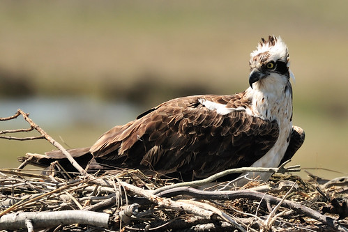
Osprey
Osprey - photo via flickr.com/photos/albertovo5


Another species, like the eagle, that has been threatened by the past use of certain pesticides and loss of their natural habitat, the osprey is a threatened species of wildlife in New Jersey.

Listed as endangered in New Jersey in 1973, the osprey’s status rose to “threatened” in 1986 due to an increase in pairings increased from about 50 to more than 100. And our coastal sightings in NJ for 2017 were at 668 pairings.

Dylan worked with Ben Wurst, a habitat program manager for the Conserve Wildlife Foundation of New Jersey. Environmentalists began providing platforms for nesting in the 1970s and today about 75 percent of the state's ospreys nest in platforms.

The nesting areas have a 3-foot perch for the birds on 16-foot posts. Like many Scout projects, Dylan had many helpers. Major Hardware, a Cedar Grove store, donated all the hardware and
West Essex Building Supply Co. in nearby Verona discounted the lumber. The project cost still amounted to $1400 for the three platforms.

Eagle Scout project helps ospreys - via northjersey.com

Wednesday, July 24, 2013

Removal of Third Dam on Raritan River Will Aid Fish Spawning and Migration

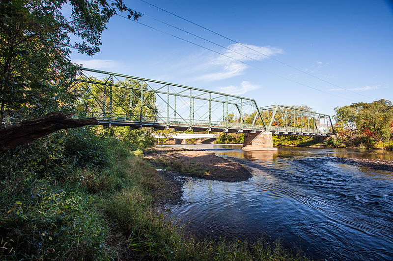
Nevius Street Raritan Bridge

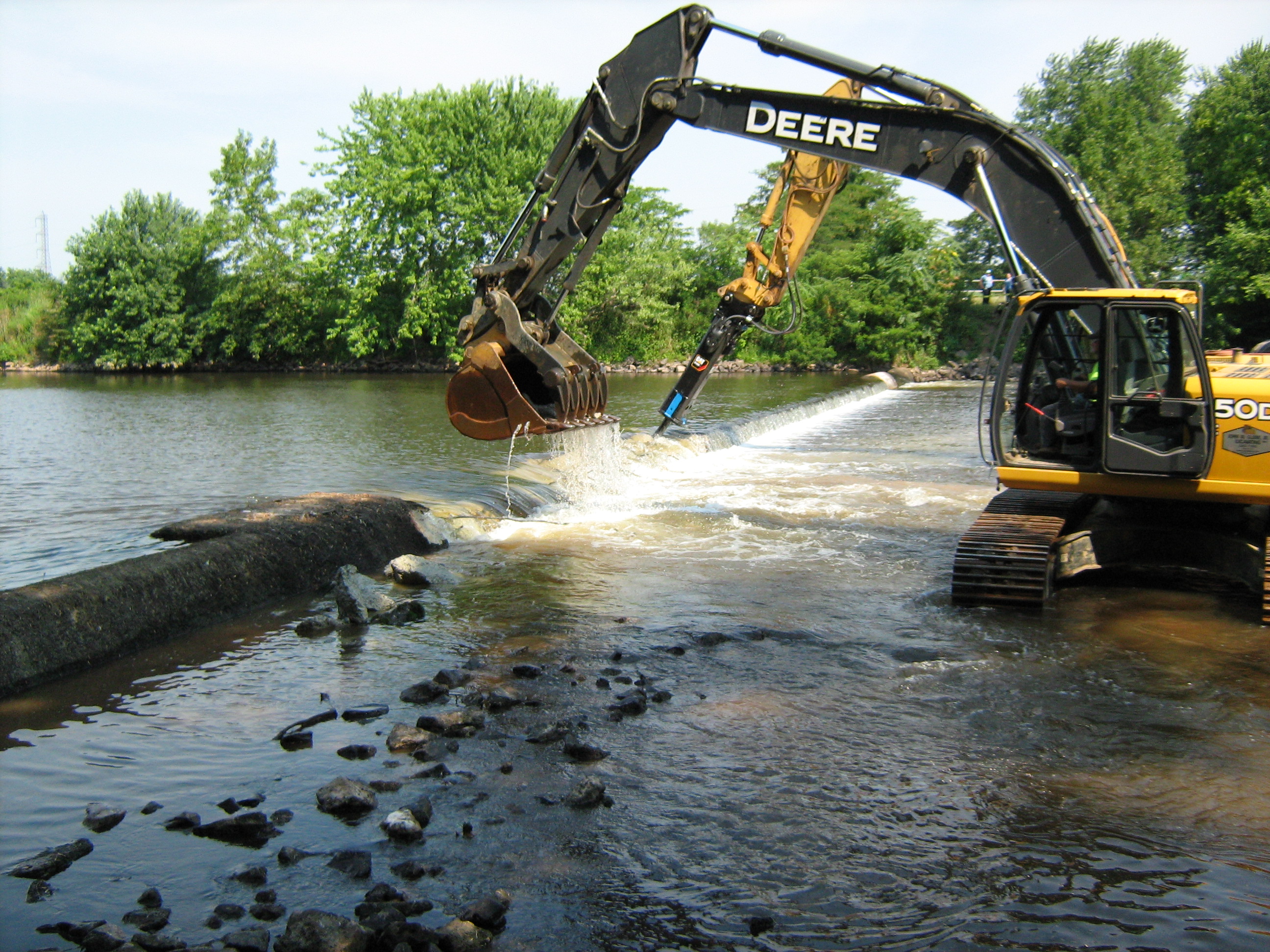
Department of Environmental Protection (DEP) Commissioner Bob Martin announced the start of the removal of a third dam from the Raritan River in Somerset County that will further open a 10-mile stretch of the middle and upper portions of the river to fish spawning and migration and also allow more recreational opportunities.

Removal of the Nevius Street Dam in Raritan Borough is the third and final dam elimination project on the Raritan River over the past three years that is financed by a landmark natural resource damages settlement secured by the DEP in 2010 with El Paso Corporation, which is now Kinder Morgan. This restoration project is being implemented as compensation to the public for harm to natural resources caused by past pollution at a refinery that was operated by or affiliated with El Paso.

In addition to the dam removals, the DEP received nearly $160,000 from Kinder Morgan for herring research on the Delaware River as part of the settlement.

“This is another example of the Christie Administration’s commitment to improved water quality and enhanced recreational opportunities in our state,’’ said Commissioner Martin. “This project makes excellent use of pollution settlement dollars to provide a major environmental improvement on the Raritan River. Also, residents and sportsmen in the region will enjoy the recreational benefits of this dam removal for generations to come.’’

“The significant ecological benefits of removing this dam are consistent with the efforts of Duke Farms to be a model of stewardship, and we are delighted to see the progress which has been made to enhance the Raritan as the true queen of New Jersey rivers,’’ added Michael Catania, Executive Director of Duke Farms, which owns the dam.

The Nevius Street Dam is being removed over the next two weeks as part of a watershed-wide effort to re-establish historically significant migratory fish passage, restore riverine habitat and the natural flow of the Raritan River, and enhance recreational uses.

Its elimination will add to habitat improvements realized from removal of the Calco Dam in Bridgewater in 2011 and the Robert Street Dam in Bridgewater and Hillsborough townships in 2012. Removal of the Nevius Street Dam should be completed within two weeks by Kinder Morgan’s contractor, River Logic, said Kinder Morgan project manager John Jengo.

Meanwhile, the DEP’s Office of Natural Resource Restoration continues to study additional dams in the Raritan River watershed and will evaluate and implement appropriate options for future enhanced fish passage and recreational opportunities.

The Nevius Street Dam is located just south of the Borough of Raritan at river mile 27.0 in Somerset County. It was constructed in 1901 by James Buchanan (Buck) Duke, the tobacco and hydropower industrialist, for aesthetic and recreational purposes as part of his development of Duke Farms, a 2,740-acre estate in Hillsborough Township.

The dam is constructed of mortared stone block over a concrete core, with a stair-step design on its downstream side. The dam length is approximately 195 feet.

A water intake structure was installed in the early 1960s on the north end of the dam and Duke Farms began utilizing this intake system for its primary water supply when their pumping withdrawals from the Raritan Water Power Canal were discontinued in the 1970s.

All three dam removals will open up 10 miles of migratory fish habitat along a stretch of the Raritan that twists through a highly diverse residential, commercial and agricultural portion of Somerset County that includes Bridgewater, Hillsborough, Bound Brook, Somerville and Manville. It also will open up about 17 miles of tributaries, including the Millstone River, to spawning. None of the dams were built for flood control:

Calco Dam, demolished in 2011, was located at river mile 20.9 and built by the Calco Chemical Co. in 1938 to disperse chemicals from its facility.
The Robert Street Dam, a 6 ½-foot-high sheet piling and concrete dam had been located at river mile 27.9 and was originally constructed prior to 1930 for purposes that are not known today.
The Nevius Street Dam, located at river mile 27.0, was constructed of rocks and mortar in 1901 for aesthetic purposes and later retrofitted to provide water to Duke Estate ponds.
Fish to benefit most from the removal of the dams are American shad, American eel, herring, and striped bass, which once migrated in prodigious numbers through the gravelly shallows of the Upper Raritan. Better water flow also will improve flushing of sediments, reduce nutrient loadings and improve conditions for tiny aquatic organisms that are critical to the food web in the river system.

"Somerset County is delighted to see this initiative of the Christie Administration and the DEP provide such tangible improvements to the Raritan River to help improve the quality of life for the citizens of Somerset County,” said Somerset County Freeholder Director Peter Palmer.

“The removal of the Nevius Street Dam will complement the borough's plans to make the Raritan River more accessible to our residents and a focal point for our own recreational and redevelopment efforts, added Raritan Mayor Jo-Ann Liptak.

Calco Dam in Bridgewater

The voluntary settlement with El Paso – now Kinder Morgan -- resolved Natural Resource Damage claims made by the DEP against the Houston-based company that stemmed from contamination at EPEC Polymers Inc. in Flemington, Hunterdon County; Nuodex Inc. in Woodbridge, Middlesex County; EPEC Polymers Inc. in Burlington City, Burlington County; and the Eagle Point Refinery in West Deptford, Gloucester County. Investigations and/or cleanups are under way at those sites.

The DEP uses funds secured from Natural Resource Damage settlements toward ecological restoration projects, typically in the same watershed or general area where resource damages occur.

For a copy of the settlement agreement, visit: http://www.nj.gov/dep/docs/elpaso-nrd-settlement.pdf

For more information on the DEP's Office of Natural Resource Restoration, visit: http://www.nj.gov/dep/nrr/

Monday, January 28, 2013

Hibernating Bats

In autumn, bats will find their traditional hibernation locations and often migrate hundreds of miles to the abandoned mines and caves where they will spend the winter months.

Some of our common New Jersey bats congregate in colonies, often in caves, mine or buildings. These "social bats" usually return to the same roost year after year and start maternity colonies in the spring.

Nine species of bats are considered regular residents of New Jersey. These include the little brown bat, big brown bat, northern long-eared bat, small-footed myotis, Eastern pipistrel, Indiana bat (state and federally endangered), hoary bat, red bat and silver-haired bat. The hoary, red and silver-haired bats are part-time residents that are found here from spring through fall. They migrate to southern states for the winter. The other six species remain here throughout the entire year and require special habitats for winter hibernation.

Natural caves once provided hibernating habitat for bats, but today most caves are subject to disturbance by people and thus are not suitable for use by bats. Abandoned mines and tunnels, storm drains and sewers have replaced natural caves as the primary winter habitat for many bats. Since those places are often unsafe to enter or inaccessible to people, they are desirable locations. But bats will sometimes hibernate in homes, garages, sheds and barns if there is access and it appears isolated to them.

New Jersey's largest known bat hibernaculum is the Hibernia Mine in Rockaway Township, Morris County. It was abandoned as a mine in the early 1900s and there are records of bats using the mine going back to the 1930s. After decades of the bats being disturbed, chased or even killed and landowner attempts to seal the mine, it is now a protected location.

Since they are particularly vulnerable to pollution and pesticides, the presence or absence of bats can tell scientists a lot about the overall health of the local environment.


Hibernating hoary bat on garage in Hunterdon County

I recently received via this site an email from someone in Hunterdon County who had discovered a bat hibernating attached to the outside of their garage. They were concerned about its exposure to the weather.

I recommended that they leave it alone and use the contact page at NJbats.org/ifoundabat.html in the hope that they could give them advice or take the bat.

I'm pleased that this bat was picked up by Jackie of NJ Bats and she was very excited that it was a female hoary bat and was most likely pregnant.

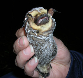
Hoary Bat - Photo by Jennifer Linehan - nps.gov 

Hoary bats are the most widespread of all bats in the United States and are thought to occur in all 50 states. They range from the tree limit in Canada down to at least Guatemala in Central America, and throughout South America. They are the only bats found in Hawaii.

They are rarer in most of the eastern United States but have also been found in Michigan, New York and Connecticut during December and in Indiana during January. This suggests that some may winter farther north than was previously expected.

Hoary bats are migratory and move north in spring and south in winter. It tends to be rather solitary and frequents wooded areas where it roosts in the open (not in buildings) by hanging from a branch or twig. It is more easily recognized by its large size and its swift, erratic flight. This bat usually emerges rather late in the evening, but during migration, it is frequently observed in daylight hours

Two kinds of bats in New Jersey are often found roosting in colonies inside buildings: the big brown and little brown bats.

The big brown bat has a wingspread of about 14 inches and is our most common species. Colonies of up to 200 individuals return each spring to locations (including homes and other buildings) in New Jersey.

Although they have relatively long lives, reproduction is slow. Generally, one is born each year. The big brown bat accounts for over 75 percent of the bat contacts with people and pets and is the bat most often tested for rabies.

Little Brown Bat
The little brown bat is also quite common in homes during the spring and summer, and large numbers hibernate in our abandoned iron mines. However, the number of human and animal exposures, and the number of little brown bats found to be rabid, are much less than for the big brown bat.

When bats are hibernating, it is a time that scientists often study them. Much of the research and surveying on White Nose Syndrome is done at this time.

White Nose Syndrome is a "bat plague" that has killed nearly 7 million bats since it first appeared in the US in New York State. The deadly fungal disease has spread to 19 states as far west as Missouri, as far south as Alabama and north into Canada.

The little brown bat (Myotis lucifugus) has been hardest hit by the sickness because it is the most common of our bat species, but there are 22 other species of American bats that also hibernate in caves that are being affected. 

Like a number of other threatened and endangered species, such as snakes, wolves, and wood rats,  there are many myths and misunderstandings about bats. For example, all of the bats found in New Jersey are strictly insect eaters. No vampires in Jersey. Many people fear a bat bite because of rabies. It makes sense not to touch bats that you find, but less than one percent of bats carry rabies, and attacks by bats are extremely rare. They rarely get tangled in people's hair, despite my mother's warnings about that.

They are not blind, but they depend more on their sonar hearing than eyesight to navigate and avoid obstacles - and to capture insects. Because a bat can consume hundreds of insects in an hour, they keep our mosquito population down in areas where they congregate.

Bats are the only truly flying mammals. They belong to the order Chiroptera and are not rodents. They are mammals because they have hair, give birth to live young, and feed their young milk produced by mammary glands.

Most bats produce only one offspring (called a pup) annually and rear their young for the first few weeks of life until they can fly and feed on their own. These reproductive and rearing practices make them the slowest reproducing mammals on earth for their size. Despite their slow reproduction, bats exist in large numbers and encompass one quarter of all mammal species, second in population only to rodents.

Individual bats can live to be 30 years old, and colonies can be present at the same location for over 100 years.

A story last year on the Wild New Jersey site said that while bat populations are on the decline across New Jersey and the United States, in Central New Jersey's Dismal Swamp Conservation Area (DSCA), the Edison Wetlands Association (EWA) and Eagle Scouts have taken action and are doing something about this worldwide bat extinction crisis. Bat populations in Northern Central New Jersey are actually increasing due to conservation activities.

MORE INFORMATION
ABOUT BATS IN NEW JERSEY

Friday, October 12, 2012

Cheesequake State Park


Cheesequake State Park is just off the Garden State Parkway. This 1,274-acre park in Old Bridge, Middlesex County, has fishing, kayaking, hiking and camping available among the coastal wetlands and forests also make for quality and sometimes surprising getaways in the well-developed Raritan Bay region.

“Cheesequake State Park is another jewel in the state’s incredible park system, offering our residents a wealth of affordable recreational opportunities and not far from home,’’ said Department of Environmental Protection Commissioner Bob Martin. “We urge residents from all parts of the state to take a drive, spend a day and explore this terrific venue.’’

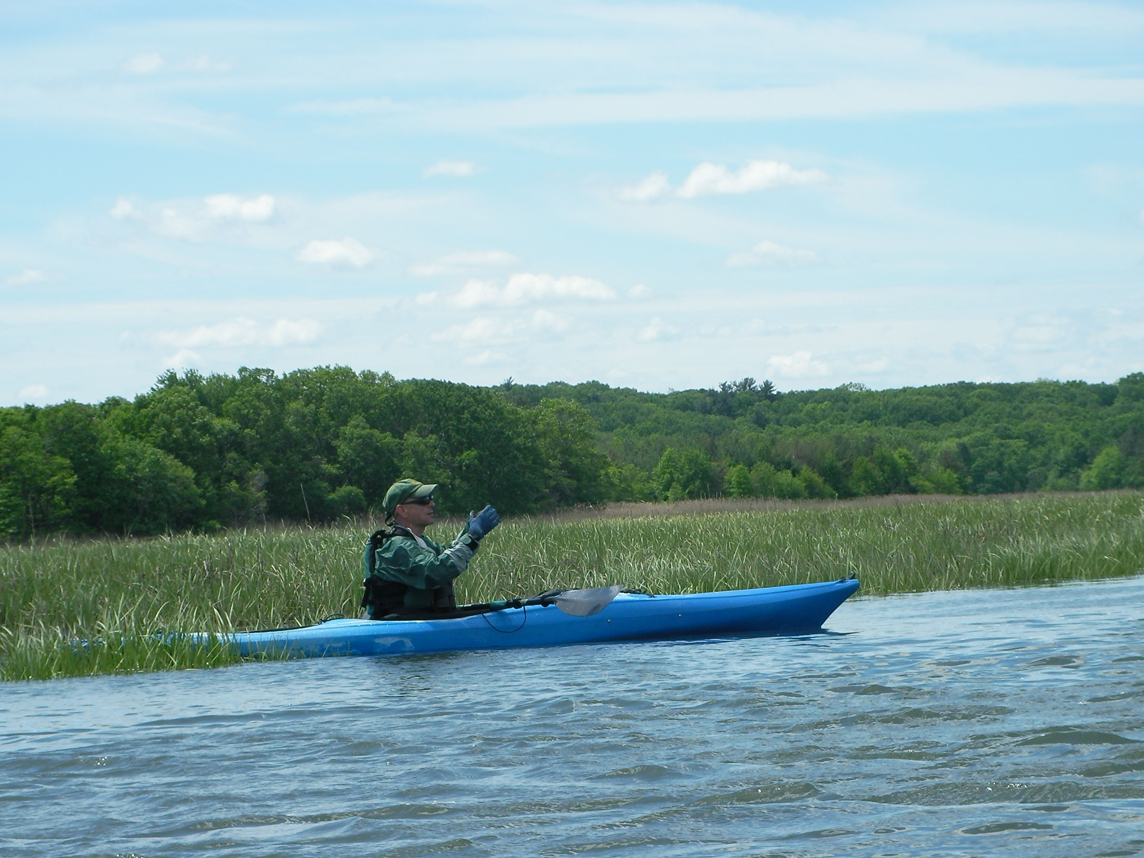
Self-guided tours are also available for visiting kayakers who’d like to navigate the well-marked Cheesequake Water Trail. A corresponding, waterproof brochure pointing out historic locations and unique plants and wildlife is available.

For those who enjoy the simple pleasures of enjoying a park on foot, Cheesequake also has much to offer. There are five designated trails ranging from 1-1/2 to 3-1/2 miles. The Red, Yellow, Green and Blue trails, which range from easy to moderate with inclines, are for hiking and walking. The multi-use White trail is for hikers and mountain bikers.

The fresh-water fishing of Hooks Creek Lake – about six acres large – offers ample opportunity to land a trout, bass, catfish or sunfish, while crabbing from the ADA-accessible Crabbing Bridge is also available.

More than 40 tent and trailer sites with fire ringers and picnic tables are available for campers. Each site has flush toilets and shower facility within walking distance. The summer fun continues with swimming and boating on the lake, but there are certainly those who enjoy the fall hikes and winter sledding, cross-country skiing and snowshoeing available at the park.

SOURCE: http://www.nj.gov/dep/daw/cheesequake/

Wednesday, January 11, 2012

Busy New Jersey Beavers

USFWS.gov photo
The beaver is the second largest rodent in the world. Even children are familiar for its wide, flat tail, trre-gnawing and for building dams.

Those tails are useful for slapping the surface of the water to warn other beavers of approaching danger. Although these critters are rather awkward on land, they can navigate quickly under water and can stay submerged if necessary for up to 20 minutes.

Trees (bark and leaves) are their favorite winter food, but in summer other vegetation, especially aquatic plants like water lilies, make up their diet.

Beavers are known for their engineering of dams on rivers and streams. Their intent is to build their lodges (homes) in their preferred pond setting. They ingeniously place vertical poles, and then fill in the spaces between the poles with horizontally placed branches. Then, they further fill in the gaps with a combination of weeds and mud to hold back the water around their lodge. They have even been known to create "canals" in order to float larger tree materials they need rather than dragging them over land.

Their powerful front teeth are cartoonish but they are effective for cutting trees and plants for building and for food.

Though beavers are found throughout New Jersey, it is likely that many residents have never actually encountered one in the wild. Children and adults might mistake a groundhog for a beaver.

NJ's beaver population is strong because they generally coexist well with humans and they have few natural predators. 

Not all cases of beaver building have been met with amazement by humans. There have been reports over the years of busy beavers encroaching on human activities.  In Camden County, beavers on Kirkwood Lake created dams that made the water rise so that homes that normally had about 100 feet of land between them and the lake wound up with only a few feet of land.

In Middlesex County, a beaver blocked a culvert on a road in the Jamesburg Park Conservation Area and built a dam between two cranberry bogs. The town wanted to avoid flooding that had occurred in previous years. In that case, the town got a permit to trap the beaver out of season. They snared a 31.5-pound, 40-inch-long female beaver in an underwater trap.

This past year, in Princeton Township, human intervention with beavers also made the news.
A pair of busy beavers killed by a local animal control officer activated animal lovers who wondered why the beavers were not relocated rather than killed.

The beaver pair were contributing to flooding at the Pettoranello Gardens section of Community Park North, which has a pond and several streams. Workers tried to dismantle the dams, but the beavers got busy and rebuilt.

It didn't help that the state Division of Fish and Wildlife said the Princeton animal control department had not gotten the proper permit prior to killing the beavers. It seems odd but, according to a spokesman for the department, beavers trapped either in conibear traps, which kill them, or in live traps, still must be euthanized and may not be relocated.

As said earlier, our state beaver population is healthy. The state regularly surveys the 30 hunting and trapping zones in the state. Permits obtained from the Division of Fish and Wildlife are required to trap beaver and/or otter.

During the 2009-2010 season, more than 600 beavers were trapped and killed. The beaver season runs from the end of December to early February. (The duration of the trapping season for beaver on 23 Wildlife Management Areas is January 1 through February 9, 2012, but if the anticipated harvest of beaver and/or otter has not been accomplished during this season, up to 14 additional days may be authorized by the Director.)


More on "Beavers as Master Builders of Wildlife Habitats"

North American beaver (Castor canadensis)


Tuesday, August 9, 2011

The Everglades of Central Jersey

Image via appliedeco.com

Well, the marketing people weren't called in when they named Dismal Swamp in Central New Jersey. The Dismal Swamp Conservation Area is anything but dismal, in the same way that the "Pine Barrens" is not barren.

David Wheeler, Director of Operations for Edison Wetlands Association, (EWA) did several posts on the G.R. Dodge Foundation blog on protecting the Dismal Swamp.

Known as the “Everglades of Central Jersey,” the 1,240-acre Dismal Swamp Conservation Area is the largest natural area remaining in northern Middlesex County, spanning portions of Edison, Metuchen and South Plainfield. EWA is leading a number of coalitions to preserve, restore, promote, and transform this natural oasis from a long-overlooked area in one of New Jersey’s most overdeveloped regions into a nature sanctuary treasured by the public and immensely valuable to wildlife. EWA’s vision, leadership and collaboration resulted in the creation of the Dismal Swamp State Preservation Commission in 2009, with EWA’s Bob Spiegel continuing to strengthen this state oversight as Chair of the Commission.

The Dismal Swamp serves as a natural oasis holding United States Environmental Protection Agency Federal Priority Wetlands. The Dismal Swamp is home to over 180 species of birds, and two dozen species of mammals, amphibians and reptiles, as well as a dozen threatened and endangered species, such as the American bittern, bald eagle, and spotted turtle. The Dismal Swamp also provides natural flood control and wildlife habitat, while its forests produce oxygen, and its wetlands clean and purify water. 
EWA has worked since then to preserve many other key Dismal Swamp properties, partnering with groups like NY-NJ Baykeeper and New Jersey Audubon Society, and agencies like the Middlesex County Freeholders and the NY/NJ Port Authority to save over 800 acres in Edison and nearly 100 acres in South Plainfield from overdevelopment.

EWA is also working on a number of trails projects to expand opportunities for hiking, birding, and wildlife viewing in the area.
  • In 2011 the Middlesex Greenway just opened the newest leg of its trail connecting hikers and bicyclists from Perth Amboy, Woodbridge, and Edison with Metuchen’s portion of the Dismal Swamp. EWA continues to work with elected officials and the Edison Greenways Group to extend the greenway into the heart of South Plainfield’s Dismal Swamp.

David Wheeler is the author of Wild New Jersey. David also posted on the restoration of the Raritan River

Friday, February 25, 2011

Delaware and Raritan Canal


Historic map of the D&R Canal
click image for large size via http://mapmaker.rutgers.edu
The Delaware and Raritan Canal (D&R Canal) is a canal in central New Jersey, that was built in the 1830s and served to connect the Delaware River to the Raritan River.

Delaware and Raritan Canal Company 24x36 Giclee
D&R Canal Company
It was intended as an efficient and reliable means of transportation of freight between Philadelphia, Pennsylvania and New York City, especially coal from the anthracite coal fields in eastern Pennsylvania. Before the advent of the railroads, the canal allowed shippers to cut many miles off the traditional route from the Pennsylvania coal fields. That route took the coal down the Delaware, into the Atlantic Ocean, around Cape May, and up along the coast to New York City.

Delaware and Raritan Canal at Work, The (NJ) (Images of America)The canal system was dug mostly by hand tools, mostly by Irish immigrants. Work began in 1830 and was completed in 1834, at an estimated cost of $2,830,000. When the canal first opened, teams of mules were used to tow canal boats through it (the steam engine was not yet applied to such uses).

The canal's greatest usage occurred during the 1860s and 1870s during the area's Industrial Revolution. On May 18, 1872, the D&R Canal Company was merged with several parallel railroads into the United New Jersey Railroad and Canal Company, and leased by the Pennsylvania Railroad. Over time, the importance of the D&R Canal waned as railroads were used to perform, more rapidly, the same function as canals, but it remained in operation until 1932.

Over the years, sections were filled for various road and rail projects and other sections of the canal were piped underground.

Today, the D&R Canal offers us a number of natural and historical resources, including 160 species of birds, wooden bridges, canal locks, historic bridge & canal houses, and former mill sites. The park can be enjoyed individually or at one of the many nature and history related programs that are offered throughout the year by the park's naturalist and historian.

The total length of the entire canal system was approximately 66 miles (106 km).

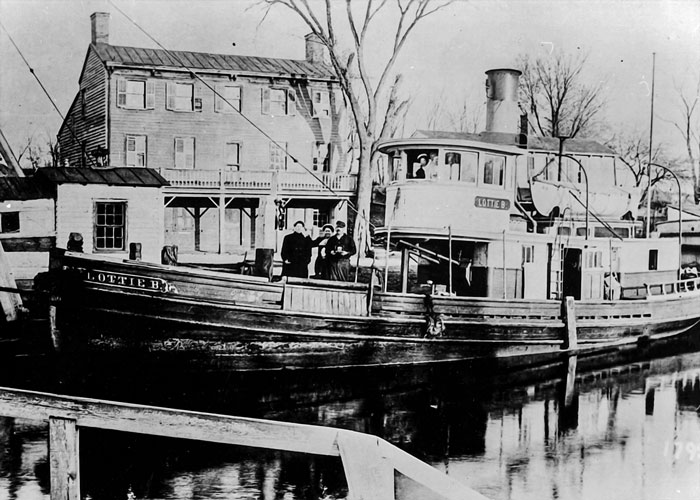
A steam tug docked on the canal in front of a Princeton hotel.

Unfortunately, some sections of the canal are forever lost. A section of the main D&R Canal in Trenton, along Mulberry Street, has been covered over (the water still flows below) and redeveloped, and is inaccessible to public use. The portion of the canal that provided access to the Delaware River in Bordentown is also abandoned. In Trenton it has been covered by NJ Route 129, which opened in 1996. Another section south of Trenton is located in Hamilton Township, Mercer County, New Jersey between the southern boundary of Trenton and the Crosswicks Creek.

Locks were used to overcome elevation differences along the D&R canal. Many of the locks are still present along the canal route; however, the lock gates have been replaced on the upstream side with small dams and water outfalls. The downstream gates have been removed, so the water in the locks is level with the water on the downstream side. Some of the locks have been buried or removed due to construction projects in the vicinity of the canal.

A number of spillways, which drained excess water from the canal into nearby waterways during periods of heavy flow, are located along the canal route. Spillways are evident as a dip in the tow path along the canal.


Image: bikinghikingwithkids.com

In 1974, most of the canal system was declared a New Jersey state park. It remains one today, and is used for canoeing, kayaking, and fishing.

A graded natural-surface trail along the side of the canal, which was the tow path that mules used to tow barges on the canal before steam powered barges, is now used for hiking, jogging, bicycling, and horseback riding. Some 36 miles (58 km) of the main canal, and all 22 miles (35 km) of the feeder canal, still exist. The feeder canal along the Delaware, being a former railroad rather than a towpath, is especially suited to bicycling. The park is operated and maintained by the New Jersey Division of Parks and Forestry.

The D&R Canal trail is a recreational trail of 77 miles (124 km) trail is made up of three segments that transverse three counties: a canal towpath from New Brunswick to Trenton; a canal towpath / rail trail from Trenton to Bull's Island; and a rail trail from Bull's Island to Frenchtown. The three combined trails together form the largest completed trail entirely in New Jersey. Much of the trail runs inside the state park. [Note: There is no direct connection between the main canal and the feeder canal paths along the Delaware River. Signed on-street connections are required to traverse the entire trail system.]

The proposed Capital to Coast Trail is planned to connect to the D&R Canal Trail.

The canal is accessible from many points along its route, with small parking areas providing access at most road crossings. One of the most scenic and popular sections of the D&R Canal state park is the segment along Lake Carnegie in Princeton, New Jersey, which features the canal on one side of the path and the lake on the other side. Another attractive section borders the Colonial Park Arboretum and Gardens in East Millstone.

The Delaware and Raritan Canal was added to the National Register of Historic Places in 1973 and the many historic canal houses where the bridgetenders lived (such as the Blackwells Mills Canal House and the Port Mercer Canal House) were listed as contributing properties.

Monday, January 31, 2011

Removal of Dams Will Open Up Fish Spawning

The Department of Environmental Protection has secured a landmark agreement that will open up a large stretch of the Raritan River for fish spawning as compensation to the public for harm to natural resources caused by past pollution at a refinery and three polymer plants that were operated by or affiliated with the El Paso Corp.

The removal of the dams, financed and carried out by El Paso, will open up a nearly 10-mile stretch of the middle and upper Raritan to fish migrations for the first time in more than a century, at the same time expanding recreational opportunities along the river.

"This unique and unprecedented settlement will make valuable habitat in the Raritan River available for fish spawning while improving overall environmental conditions in the river system," Commissioner Martin said. "In addition, dam removal will make it easier for kayakers, canoeists, and other lovers of the outdoors to enjoy a river system that has been undergoing a steady and impressive ecological comeback over the years."

The settlement resolves Natural Resource Damage claims by the DEP against the Houston-based company that stem from contamination at EPEC Polymers Inc in Flemington, Hunterdon County; Nuodex Inc. in Woodbridge, Middlesex County; EPEC Polymers Inc. in Burlington City, Burlington County; and the Eagle Point Refinery in West Deptford, Gloucester County. Investigations and/or cleanups are under way at those sites.

The settlement marks an important first step in what the DEP hopes will become an even broader effort to enhance fish passage or remove additional dams in the Raritan and its tributaries, including the Millstone River.

"This portion of the river was once an important spawning area for fish migrating from Raritan Bay," said Amy Cradic, Assistant Commissioner for Natural and Historic Resources. "This agreement is a major win for the environment by reopening these spawning areas and helping to restore balance to the estuary."

Natural Resource Restoration is the remedial action that returns the natural resources to pre-discharge conditions. It includes the rehabilitation of injured resources, replacement, or acquisition of natural resources and their services, which were lost or impaired. Restoration also includes compensation for the natural resource services lost from the beginning of the injury through to the full recovery of the resource.

Examples are:
  • GROUND WATER: non-point source pollution abatement projects, acquisition of land for aquifer recharge
  • WETLANDS and HABITAT: rehabilitation or creation of wetlands / habitat in the appropriate ratios to compensate for the functions and services lost
  • INJURED SPECIES: restoration of appropriate habitat and monitoring of success / research projects
  • LOST PUBLIC USE: enhanced public access, information and interpretive centers


Dam removal will open up 10 miles of migratory fish habitat along a stretch of the Raritan that twists through a highly diverse residential, commercial and agricultural portion of Somerset County that includes Bridgewater, Bound Brook, Somerville and Manville. It will also open up some 17 miles of tributaries to spawning. None of the dams were built for flood control.

The fish to benefit most from the removal of the dams are American shad, American eel, herring, and striped bass. These species once migrated in prodigious numbers through the gravelly shallows of the upper Raritan, most to spawn.

Striped bass and shad are important recreational species. Herring and eel are important food sources for other species in the ocean and estuaries, including game species such as striped bass, weakfish and bluefish.

Better water flow in the river will also improve flushing of sediments, reduce nutrient loadings and improve conditions for tiny aquatic organisms that are critical to the food web in any river system, Assistant Commissioner Cradic said.

The dams to be removed are:

Calco Dam, located at river mile 20.9 and built by the Calco Chemical Co. in 1938 to disperse chemicals from its facility. The dam is essentially a large concrete pipe spanning the river that today carries and disperses wastewater into the river for Somerset Raritan Valley Sewerage Authority. The authority has constructed a new outfall that will be operational shortly.

The Nevius Street Dam, located at river mile 27 and constructed of rocks and mortar in 1901 for aesthetic purposes and later retrofitted to provide water to ponds on the Duke estate. The DEP and El Paso are working on a plan to ensure the river continues to feed water to these ponds after the dam is removed.

The Robert Street Dam, a 6 ½-foot-high sheet piling and concrete dam located at river mile 27.9 and constructed prior to 1930 for purposes that are not known today.

The Island Farm wier, a dam located between the Calco and Nevius dams and constructed in the 1990s for the Elizabethtown Water Co. and the New Jersey Water Supply Authority, is not affected by the agreement with El Paso. A large fish ladder in operation at this dam is routinely monitored by the DEP's Division of Fish and Wildlife.

El Paso approached the DEP several years ago to cooperatively resolve its Natural Resource Damage liability. Natural Resource Damage claims seek to restore natural resources such as wetlands or groundwater and compensate the public for the amount of time the resources were harmed by pollution.

The DEP uses funds secured from Natural Resource Damage settlements toward ecological restoration projects, typically in the same watershed or general area where resource damages occur.

The Flemington and Woodbridge polymer facilities are located in the Raritan's watershed. The Eagle Point refinery, which El Paso once owned, and the Burlington County polymer facility are located in the Delaware River watershed. El Paso has agreed to provide the DEP $156,655 for a migratory fish study for the Delaware watershed.

The DEP has been working closely with stakeholders, including dam owners, environmental groups, property owners, local utilities, the U.S. Fish and Wildlife Service and the National Oceanic and Atmospheric Administration to make the Raritan River project a reality.

The DEP will continue working with El Paso as the company designs and implements the project. The company has already completed significant engineering studies and is expected to soon file for dam safety, land use and other DEP permits. The company is expected to launch the project this summer with the removal of the Calco Dam.

For a copy of the settlement agreement, visit: http://www.nj.gov/dep/docs/elpaso-nrd-settlement.pdf

For more information on the DEP's Office of Natural Resource Restoration, visit: http://www.nj.gov/dep/nrr
Friday, March 26, 2010

D&R Greenway


D&R Greenway Land Trust is central New Jersey's non-profit land preservation organization, founded in 1989 through the collaboration and vision of four organizations: the Stony Brook - Millstone Watershed Association, Friends of Princeton Open Space, Regional Planning Partnership, and the Delaware & Raritan Canal Commission.

They were originally named the Delaware & Raritan Greenway, but they changed their name in 2004 to better reflect their preservation work as a Land Trust, and because their work expanded beyond the focus on the Delaware & Raritan Canal.

I actually heard about them because of a poetry event they offered recently called "Living Among Giants, Seeing the Forest for the Trees." It's one of a number of public programs they offer at at the Johnson Education Center.

They cover a lot of ground. Their operating region consists of over 1,500 square miles, encompassing portions of the Delaware, Raritan and Millstone River watersheds and the Delaware & Raritan Canal. This includes Mercer, Hunterdon, Somerset, Middlesex, Burlington and Monmouth counties.

Recently, they have also worked at preserving preservation of farmlands in Salem County in the area of Mannington Meadows.

Since 1989, D&R Greenway Land Trust has preserved 223 properties. The total acreage preserved as of February 1, 2010 is 14,320.69 acres valued at $316,177,653.

Thursday, February 18, 2010

Harp Seal in Woodbridge, NJ

You don't really expect to find a seal wandering along an avenue in New Jersey.

But, a Woodbridge township snow plow driver came across one this month on Sixth Avenue in the Port Reading section of the township early one snowy morning.

It tuned out to be an adult harp seal. The police and a township control officer were notified and, according to reports, they dragged the seal to the Woodbridge River.

Seals are Arctic mammals that live on ice flows, but in cold weather, many are carried by currents and swim south looking for food. It's not that rare that seals will make the 1,500 mile journey to the New Jersey coast. Seals often come onto beaches to escape the cold water where they will lay in the sun and build up their oxygen levels.

New Jersey sees more seals in the winter now than in earlier decades. Two colonies live off the Jersey shore in the winter, with one visible from Sandy Hook.

Beach visitors of the human variety should avoid going near the seals and not try to feed them.

Harp seals are part of the family Phocidae, known as the "true" or "earless" seals because they lack external ear flaps. They have a robust body, a relatively small, broad, flat head, and a narrow snout that contains eight pairs of teeth in both the upper and lower jaws.

During breeding in February and March, and when molting in late spring, harp seals aggregate in large numbers of up to several thousand seals on the pack ice. During extensive seasonal migrations, large groups may feed and travel together.

Harp seals are highly migratory. Following the breeding season, adults assemble north of their "whelping" sites to undergo an annual molt before continuing to migrate north to Arctic summer feeding grounds. In late September, after feeding all summer, most adults and some immature seals of the Western North Atlantic stock migrate south along the Labrador coast to the entrance to the Gulf of St. Lawrence, generally arriving by early winter. There they split into two groups, one moving into the Gulf and the other remaining off the coast of Newfoundland.

In recent years, the number of sightings and strandings from January to May have increased off the east coast of the United States from Maine to New Jersey. During this time, the Western North Atlantic stock of harp seals is at the most southern point of their migration.

Robert Schoelkopf, founding director of the Marine Mammal Stranding Center in Brigantine, says that the Center has been called this season to rescue seals already. He said that the township officials had tried to put a net around the seal but failed and were finally able to grab the seal with a mouthpiece normally used to capture dogs.

Probably, dragging the seal into the Woodbridge River was not the best course of action. Acting more out of fear for the animal's safety, the treatment might have caused injuries, and also may have put it in an unfamiliar waterway where it would not know how to navigate to open water.

The best sceanrio would be that the seal would swim out to Arthur Kill. If the seal went upstream, it would be in less water, probably without food, and would be more likely to wander on land again.

The Marine Mammal Protection Act bans anybody without proper training from handling seals. The proper course of action would be to to call the Marine Mammal Stranding Center (609) 266-0538.


Adopt A Seal through the  MarineMammalStrandingCenter.org

The Marine Mammal Stranding Center is a private, non-profit organization, started in 1978 with a handful of volunteers and a C.E.T.A. grant. It was founded and is still directed by Robert Schoelkopf. He and his wife, Sheila Dean, along with a small paid staff and volunteers with a wide variety of talents and professional backgrounds, continue to work with the animals. The Center is now located on the barrier island of Brigantine, which borders coastal New Jersey’s largest wildlife refuge.

With a permit and authorization from the state and federal governments, the Center has responded to over 3450 strandings of whales, dolphins, seals and sea turtles that have washed ashore over the years. Even though these governments sanction the handling of strandings in New Jersey only, the Center is occasionally called upon to assist with animals in other states. All funding comes through donations, grants, memberships, and fund-raising efforts. Since there is no permanent funding at this time, your donations and membership dollars are vital.

Harpo, the Baby Harp Seal 

Harp Seals (Early Bird Nature Books) 

Plush Twinkle Harp Seal 15" 

Friday, January 29, 2010

On the Banks of the Old Raritan


Albany Street Bridge over the Raritan in New Brunswick

Having spent four years at Rutgers College, I heard and sang the alma mater plenty of times at events. "On the Banks of Old Raritan"  (listen to it too)was more than a song in those years, because I spent a lot of time on the actual banks of the river and staring at it from my river dorm window (and flying some masterfully made paper planes over it to Johnson Park).

And so I settled down,
In that noisy college town,
On the banks of the old Raritan.


The River Dorms


The Raritan River is New Jersey's largest river that is entirely contained in the state.

Its watershed drains much of the mountainous area of the central part of the state, emptying into the Raritan Bay on the Atlantic Ocean. There are 1,100 square-miles of rivulets and streams that spill into the Raritan. The river's source is Budd Lake in the more rural northwestern part of the state. Its path through the state takes it through 100 municipalities and seven counties to an industrial end in Middlesex County.

The Raritan River forms at the confluence of the North and South Branches just west of Somerville. It flows 16 miles before slowing in tidewater at New Brunswick. Its estuary extends 14 miles more until the Raritan Bay at South Amboy.

So, naturally, there would be some further Raritan and Rutgers connections. The Sustainable Raritan River Initiative is one where Rutgers and the over thirty partner organizations and businesses are collaborating to restore and revitalize the Raritan River.


The threats facing the Raritan include over 150 significantly contaminated sites, the legacy of its industrial heritage, and stormwater runoff that erodes riverbanks and brings trash and pollutants into the waterway, the legacy of antiquated infrastructure in a highly urbanized region.

The lower watershed, cited as 14th among US rivers polluted by direct and sewer discharges of toxic chemicals (from 1990-1994), has been heavily impacted by intense industrial and storm runoff pollution and heavy flooding due to extensive urban impervious surfaces and climate change.

But the Raritan River basin also has spectacular natural areas, wildlife habitat, trails and recreational boating areas. It also has scenic waterfront redevelopment opportunities that create the potential for long-term balance and sustainability for the River and the towns that border it.


Some History
The Raritan River was an important water transportation route for the Native Americans. The “Raritan” was an Algonquin word meaning “stream overflows.” The Raritan people were also an Algonquin tribe.

In colonial days, early industry around developed along the Raritan around New Brunswick. During the Revolutionary War, the river provided a means for troop conveyance.

However, before the American Revolution, early Dutch settlers built grist mills on the Raritan, called the “Forked River” by Native Americans.

In the 1830s the Raritan-Delaware Canal provided a waterway connecting Philadelphia and Pennsylvania’s coal fields to New York.

Marshall 1836 Antique Map of Raritan River to Elk Head - $259


The Lower Raritan Watershed’s environmental health has rebounded over the past decade, but there is a long way to go. Bald eagles, peregrine falcons, and osprey again soar the Raritan skies, and a thriving fish population has helped seals, otters, and marine life recover here.

The Edison Wetlands Association (EWA) Raritan River Project has fought since 1989 for the cleanup and restoration of the hazardous waste sites posing the greatest threats to human health and environment.

The Lower Raritan Watershed has a disproportionate amount of the NJ 25,000 toxic waste sites draining into its watershed. Most of these are not remediated to levels that are protective of human health or the environment. Federal and State regulatory agencies responsible for cleaning up these sites have abdicated their responsibilities and the pollution remains unchecked. Over-development threatens the remaining natural areas along the Raritan and her tributaries.

To end on a positive note, the relatively pristine Upper Raritan is a habitat for endangered ancient wild brook trout. It is challenged by an excessive deer population that is seriously reducing vegetative and forest renewal and by the need to preserve its farms and open space.

“Ode to the Raritan, Queen of Rivers”
by John Davis, 1806

All thy wat’ry face
Reflected with a purer grace
Thy many turnings through the trees,
Thy bitter journey to the seas,
Thou Queen of Rivers, Raritan!


More...

Monday, January 18, 2010

Dismal Swamp Conservation Area

It doesn't sound too exciting to visit a place called the Dismal Swamp, but the Dismal Swamp Conservation Area (DSCA) in highly developed Middlesex County was recognized last fall as New Jersey’s newest State Preservation Conservation Area which places regional protection on this area that is also known as “the Everglades of Central Jersey. This area is not to be confused with the Great Dismal Swamp National Wildlife Refuge in North Carolina and Virginia.

In October 2009, Governor Corzine signed the bill at the Triple C Ranch which established the Dismal Swamp Preservation Commission. Assemblymen Peter Barnes and Patrick Diegnan, and the nonprofit Edison Wetlands Association (EWA) joined Corzine to form this state commission to preserve the Dismal Swamp Conservation Area in Edison, South Plainfield, and Metuchen.

The 1,240-acre Dismal Swamp Conservation Area is home to nearly 200 species of birds, such as the yellow-crowned night-heron, American bittern, and northern harrier, and two dozen species of mammals, amphibians and reptiles. A dozen threatened and endangered species also use the area, such as the American bittern, bald eagle, and spotted turtle.

The DSCA also provides natural flood control and wildlife habitat, while its forests produce oxygen, and its wetlands clean and purify water.

It is the largest wildlife refuge in the densely-populated northern Middlesex County, The DSCA holds the United States Environmental Protection Agency Federal Priority Wetlands status.

The EWA is a grassroots nonprofit environmental organization that has worked since 1989 to preserve and restore the few remaining natural areas in Central New Jersey. They own and operate the 40-acre Triple C Ranch, the last remaining farm in northern Middlesex County, which is located within the Dismal Swamp Conservation Area. They have helped to preserve more than half of the remaining DSCA to date. 

EWA recently worked with NY-NJ Baykeeper, New York-New Jersey Port Authority, and the Middlesex County Freeholders to purchase the Adams Farm and South Plainfield Holdings properties for preserved greenspace and prevent them from being developed.

They are currently fighting the proposed construction of a building on an environmentally sensitive area of land in Edison known as the Visco property, one of the last privately owned sections of “The Diz.”

Friday, May 29, 2009

Cleaning Up the Raritan River

The Raritan River is New Jersey's largest river that is entirely contained in the state. Still, it does not get the attention of the Hudson or the Passaic rivers when it comes to pollution and cleanup.


There are 1,100 square-miles of rivulets and streams that spill into the Raritan. The river's source is Budd Lake in the more rural northwestern part of the state. Its path through the state takes it through 100 municipalities and seven counties to an industrial end in Middlesex County.

The Star Ledger reported on a recent symposium dedicated to the Raritan that plans to address on an annual basis the toxic cleanup and needed public access points for the Raritan River.

The Edison Wetlands Association, co-sponsored the event along with Rutgers University's Edward J. Bloustein School of Planning and Public Policy.

They discussed the fate of this waterway which was nicknamed "the Queen of Rivers" two centuries ago by poet John Davis, but whose estuary in Middlesex County goes today by the name "Valley of the Dumps." It was a sad turn for the river that gave refuge to General GeorgeWashington during the Revolutionary War to make the list as the country's 14th most-polluted river in the country in 1994.


Executive director of the Edison Wetlands Association,
Robert Spiegel, examines a dead turtle found
along a polluted stretch of the Raritan River in Edison.

The 12 miles of the lower Raritan River (New Brunswick and south) is the worst section. This area has ten Superfund sites either on the river or in places that drain into it.

The river also touches on 16 species on the state endangered list, such as bald eagles, rare butterflies and a type of mussel known as tidewater mucket.

Sunday, April 5, 2009

Lead Closes Three Areas on Raritan Bay

The federal Environmental Protection Agency says it found contaminated soil at a beach in Sayreville and at two spots in Old Bridge and will close the areas in order to begin removal action at the contaminated locations.

The 3 locations include one near the Laurence Harbor sea wall and another near popular fishing jetty near Cheesequake Creek inlet. The areas are being called the Raritan Bay Slag Site.

According to the EPA, the slag columns were dumped in those areas and are too heavy (several hundred pounds each) to have drifted in via the water. Reports say that lead slag from blast furnace bottoms had been deposited along the beachfront in the late 1960s and early 1970s.

What is most disturbing about this story is that it is not a newly-discovered problem. Contamination was first detected in Laurence Harbor in 2007. The New Jersey Department of Environmental Protection had already notified area residents of elevated levels of lead, antimony, arsenic and copper along the Laurence Harbor seawall.

According to a report in the Edison-Metuchen Sentinel, th mayors of Sayreville and Old Bridge have called for National Lead Industries to take responsibility for the cleanup of the areas. NLI is a defunct Sayreville-based manufacturer.

Lead exposure has been linked to neurological damage, kidney disease and other major health issues.