Showing posts with label Somerset County. Show all posts

Monday, August 4, 2025

The New Jersey Highlands

The Highlands of New Jersey is one of those areas that people from other parts of the country just don't associate with NJ. (The Pinelands is another area like that.) The forested ridges, rocky cliffs, and the streams, lakes, ponds, and reservoirs for fishing and recreation are all there. 

The Highlands covers 840,000 acres and includes 188 municipalities. There are 7 Highlands counties – Bergen, Passaic, Morris, Sussex, Warren, Hunterdon, and Somerset – and all contain a diversity of forests, wetlands and grasslands. That habitat diversity is also home to threatened and endangered wildlife.

There are 72 New Jersey-listed endangered, threatened, and rare animal species, including mammals, birds, amphibians, reptiles, butterflies, dragonflies, damselflies, and mussels, and two species (the Indiana bat and bog turtle) are Federally-listed. There are also 137 endangered, imperiled, and rare plant species.

The Highlands also contains historic structures and archaeological heritage sites that need protection.

Hikers can find miles of trails, including both the Appalachian Trail and the Highlands Millennium Trail.

For over half of New Jersey’s residents (4 million+), the Highlands is a critical area for their drinking water. The NJ Highlands Water Protection and Planning Act was passed in 2004, dividing the 840,000-acre region into a “Preservation Area” with strict NJDEP regulations and mandatory Regional Master Plan conformance, and a “Planning Area” with voluntary Plan compliance.

As is often the case in NJ, suburban sprawl is the greatest threat to the Highlands’ drinking water supply, and to the forests, farms, wildlife habitat, and historic, recreational and scenic resources.

There are several areas in NJ that are a focus for Highlands Coalition.

The Wyanokie and Farny Highlands (Passaic and Bergen) contain unprotected lands in nearby Wanaque and Split Rock reservoirs that would connect existing State and county parks and forests in these two heavily utilized recreational areas. This focal area was ranked highly due to its value for water resources and recreation, and secondarily for biodiversity and forest land.

The Pequannock Watershed (Morris, Passaic, and Sussex) serves as the core of the northern New Jersey Highlands and serves as a major hub connecting existing open space areas. This focal area was ranked highly due to its multiple values for water resources, forest land, biodiversity, and recreation.

The wooded ridges of Sparta Mountain/Lubber’s Run (Morris and Sussex) provide an important greenway corridor connecting Mahlon Dickerson Reservation in the north and Allamuchy Mountain State Park in the south. Major gaps in conservation protection include the nearby areas of Mase Mountain. This focal area was ranked highly due to its value for productive forest land, biodiversity, and recreation.

Upper Pohatcong/Pequest area (Warren) also contains forested ridges and wetlands centered around the Pequest Wildlife Management Area, which serve as an important groundwater recharge, wildlife habitat, and outdoor recreation area. This focal area was ranked highly due to its value for water resources and recreation and secondarily for its productive forest and farmland.

Scott Mountain/Musconetcong Ridge in Warren and Hunterdon counties and the neighboring productive farmland of the Delaware, Pohatcong, and Musconetcong valleys form a large contiguous area of high-quality rural landscape. This focal area was ranked highly due to its value for biodiversity and productive farmland, and secondarily for forest land and recreation.

MORE

Sunday, April 16, 2017

Does a Love Triangle Mean No New Bald Eagles at Duke Farms This Year?

In a page from a TV soap opera, two competing female bald eagles at Duke Farms resulted in a season with no eggs and no new eagles for the first time in 11 years.

A story on NJ.com tells of how this February a young female bald eagle started moving in on and trying to replace the current resident female eagle.

The nest has been quite productive in the past. Between 2005 and 2016, it produced 23 bald eagle chicks that were given tracking bands on the chicks when they were approximately five to six weeks old.

That rival female appeared just in time to interrupt the resident couple's mating behavior of courting, bonding and copulation.

And next year? 

The parenting couple are still around the nest and there is a good chance that they will nest in the area and breed next year. The nest was knocked down during Hurricane Sandy and rebuilt by the eagles who like the location on the Raritan River.


From the Eagle Cam at Duke Farms in Hillsborough, NJ.
This YouTube Live feed can be rewound using the scroll.

Friday, October 26, 2012

Proposed American Battlefield Protection Bill Could Preserve NJ Sites

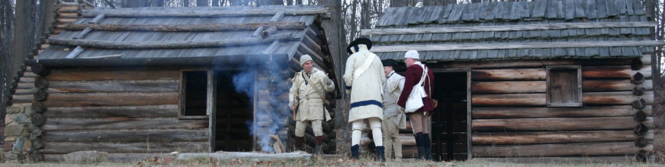
Reenactors at Morristown's Jockey Hollow   photo via nps.gov
"In the early Revolutionary struggle, few of the States among the old Thirteen had more of the battle-fields of the country within their limits than old New Jersey." 
~ Abraham Lincoln in an 1861 address to the New Jersey Legislature. 
If you went to school in NJ, you had a lesson at least once where you were told that General Washington not only slept here but spent more time in NJ with the Continental Army than any other state. Our best-known sites are the Trenton Barracks, the Princeton and Monmouth battlefields, the Jockey Hollow encampment, and Washington's Headquarters in Morristown.

The sites that are of concern are the many lesser-known sites that are being ignored and may end up being destroyed by development, like a Continental Artillery winter encampment in the Pluckemin section of Somerset County's Bedminster Township.

Michele Byers'  post on preserving some of New Jersey's historic landscapes alerted me to a bill introduced by New Jersey Congressman Rush Holt that would preserve our Revolutionary War sites.

The American Battlefield Protection Program already helps preserve Civil War sites, and the new bill would extend the program to the Revolutionary War and War of 1812 sites. The amendment was passed by the House of Representatives on September 10 and will now go to the Senate, where a companion bill has been introduced.

New Jersey has a good claim to being the "Crossroads of the American Revolution" being between the British stronghold in New York and our capital in Philadelphia.

If you want to learn more about the American Battlefield Protection Program Amendments Act, or S779 - go to the Library of Congress website at http://thomas.loc.gov/home/thomas.php.

If you are interested in this preservation, you can contact New Jersey's two U.S. Senators, Frank Lautenberg and Robert Menendez, and ask them to support S779 via the Senate website at www.senate.gov/general/contact_information/senators_cfm.cfm?State=NJ.

For more information about New Jersey's Revolutionary War history, visit the Crossroads of the American Revolution website at www.revolutionarynj.org.

Monday, October 22, 2012

The Blue Hills of NJ and the Revolutionary War

map via www.revolutionarynj.org/crossroads-guide/mountain-refuges
What we call the Watchung Mountains today was known to General Washington and the Continental Army as the Blue Hills. They were the natural barrier that could keep the Army safe from incursions by the British who held Manhattan.
You may have visited some of these sites, or you might drive by them every day. 
Bound Brook Village and the surrounding area were British targets during their encampment at New Brunswick in 1777. On April 13, there were 4,000 British and Hessian troops under General Cornwallis that moved from New Brunswick and surprised the American garrisons who were guarding the Raritan River crossings. They were overpowered and the Battle of Bound Brook was lost by the Colonists.

The village of Middlebrook, between the first and second range of the Watchung Mountains, was a site
where the Continental Army camped along in June 1777 and returned to in the winter of 1778-1779. 
That portion of the Army was made up of 10,000 troops - which equaled the population of Somerset County at the time. So as not to overwhelm the local residents, state brigades were spread out across the area. There was a Maryland brigade to the east of Middle Brook and the Virginia troops were on the west side. Pennsylvania was assigned across the Raritan, on the west side of the Millstone River, and the artillery was camped at Pluckemin. 
General Washington identified "Middlebrook" as the location in his dispatches. That 18th century village no longer exists. It is now the western end of Bound Brook. 

Wednesday, January 18, 2012

Visiting Revolutionary War New Jersey

Hopefully, anyone who grew up in New Jersey knows that our state was pivotal in the American Revolution and played an important part in the American colonists' victory. NJ is often referred to as both the "Crossroads of the Revolution" and the "Military Capital of the Revolution."

Throughout the Revolutionary War, there were 296 clashes between the Americans and British within the colony of New Jersey. That is more than any other colony in the Revolutionary War.

I have written here earlier about a key battle that occurred on January 3, 1777, in the town of Princeton, when the patriots were pushed back by a British charge, General Washington, with his staff, took to the field to rally the retreating troops back into battle.

    But there are many other historical locations that are less well-known.

    The Abraham Staats House is one of the finest surviving buildings from the Dutch Settlement of the Raritan Valley in the 18th century. The house was entered onto the New Jersey Register of Historic Places and the National Register of Historic Places in 2002. It is located on the Delaware-Raritan Canal. (For birders, there are a variety of birds which have been spotted on the property and on the canal.)

    Of course, not all Jersey colonists were in favor of breaking from the crown. Governor William Franklin was the illegitimate son of Benjamin Franklin and was a loyalist who supported the Stamp Act. Governor Franklin signed the charter for Queen's College, which would evolve into Rutgers University. He was like other colonists who had emigrated from England and still felt loyalty to England. On January 8, 1776, Governor Franklin was arrested for opposing the Revolution.


    Morven

    Another National Historic Landmark in Princeton is known as Morven. Now, it is a museum and public garden. The museum occupies the house called Morven, which was formerly the New Jersey Governor’s Mansion and 18th century home of Richard Stockton, a signer of the Declaration of Independence. Its restoration and conversion to a museum were completed in 2004. Morven Museum & Garden is administered by Historic Morven, Inc., a non-profit organization founded in 1987, in cooperation with the New Jersey Department of State. The state acquired Morven in 1954.

    The Jacobus Vanderveer House is located in Bedminster Township, Somerset County, on part of the 218 acres that make up River Road Park. The oldest part of the Jacobus Vanderveer House was built in the early 1770s. It is typical of the Dutch frame houses that dotted the countryside before the American Revolution. Much of the original fabric of the house remains intact. It includes a wall in the west parlor that features raised wood paneling above the fireplace with a barrel-back cabinet to the side, and the home has original flooring of wide pine boards. The house gained a Federal-style addition in the early 1800s.

     Some Revolutionary War Links for New Jersey
    1. Abraham Staats House
    2. Bergen County Historical Society
    3. Bravo - Battlefield Restoration and Archaeological Volunteer Organization
    4. Burlington County Historian
    5. The David Library of the American Revolution
    6. Fort Lee Historic Park
    7. Friends of the Hancock House
    8. Jacobus Vanderveer House & Museum
    9. Lawrence Historical Society
    10. The Meadows Foundation
    11. Monmouth Battlefield State Park
    12. Morven
    13. New Bridge Landing
    14. Old Barracks Museum – Trenton
    15. Princeton Battlefield Society
    16. Washington-Rochambeau Revolutionary Route

    Friday, March 11, 2011

    Further Along on the Watchung Mountains

    This post concludes our virtual walk along the parks and reservations of the Watchung Mountains.


    We pick up the trail in Washington Rock State Park which is a 52-acre (210,000 m2) state park on top the first Watchung Mountain in Green Brook Township, New Jersey. The park is operated by the New Jersey Division of Parks and Forestry and is currently being managed by the Somerset County Park Commission. It is open daily sunrise to sunset.

    It is famous for the scenic overlook which was used by General George Washington in 1777 to monitor British troop movements when the Continental Army was stationed at the Middlebrook encampment. The 30-mile (48 km) panoramic vista covers the eastern plains of New Jersey up to New York City, making it a valuable lookout point during the American Revolution. General Washington used it in June of 1777 when the British army under General William Howe was moving toward Westfield. From the vantage point of this natural rock outcropping, General Washington was able to instruct his troops to circle behind Howe’s troops and cut off their retreat.


    One of the oldest state parks in New Jersey, Washington Rock was originally purchased in 1913 to commemorate the historical events of 1777. Situated on top of Watchung Mountain, the park is a popular site for easy walks, picnicking and relaxation.

    Closely connected is Washington Valley Park. This 715-acre (2.89 km2) public park is between the first and second Watchung mountain ridge in the Martinsville section of Bridgewater Township. It is also administered by the Somerset County Park Commission.

    This partially developed park has a western and eastern section separated by the Bound Brook Gap with the Chimney Rock Road that connects Bound Brook with Martinsville. The terrain is rocky and mountainous and covered with pine and hemlock.

    At the center of the western section of the park is the 21-acre (85,000 m2) Washington Valley Reservoir. The reservoir was created in 1920 when the western branch of the Middle Brook was dammed. (Its former name was the Bound Brook/Elizabeth Reservoir.) The eastern section of the park has the much smaller East Branch Reservoir and the Buttermilk Falls of the eastern branch of the Middle Brook.

    Adjacent to the park is the Chimney Rock Quarry built atop the old Chimney Rock Copper Mine (a.k.a. Bound Brook Quarry or Washington Mine).  There are still copper mines over 165 feet deep and active mining continues today. Copper from here was used to mold a small brass cannon later used at the siege of Yorktown during the Revolutionary War. There is also still calcite mined from the Chimney Rock Quarry and marble and granite taken from this area.

    The reservoirs have no boat access but are of interest to anglers. Species that can be caught include largemouth bass, black crappie, bluegill, pumpkinseed, and yellow perch.

    The park contains numerous trails that are used by hikers and mountain bikers.

    At an outcropping of the first Watchung mountain ridge is Chimney Rock Hawk Watch. In the fall, the area is visited by birdwatchers to observe the annual southward migration of species including broad-winged hawks, sharp-shinned hawks, bald eagles and golden eagles. Hawk watching lasts from early September into November, the second half of September being the peak time.

    The eastern part of the park was the site of a military fortification that was used by the Continental Army near the site of the 1777-78 Middlebrook encampment. Remnants can be found in the shape of earth walls. A look-out point is preserved that was used to observe movements of the British Army in the plains towards New Brunswick.

    Two more areas to visit that are connected brings our walk to a close. The Leonard J. Buck Garden and the Moggy Hollow Natural Area are our last stops along the Second Watchung Mountain.

    The Moggy Hollow Natural Area is a 14-acre (5.7 ha) nature preserve near Far Hills in Somerset County. It's an area of geologic interest. The area was designated a National Natural Landmark in January 1970.

    As the Wisconsin Glacier advanced and ancient Glacial Lake Passaic formed, it deepened to 240 feet until it found an outlet to spill over at Moggy Hollow. From here the water drained to the Raritan river.

    The ledge of harder basaltic rock at 331 feet (101 m) above sea level served as a spillway for Lake Passaic carving a deep ravine out of the softer soil as the lake drained. Moggy Hollow remained the main outlet as the glacier retreated due to natural debris dams until Little Falls and Paterson (Passaic County) emerged from the ice.

    This 20-acre property adjacent to the North Branch of the Raritan River and the Far Hills Fairgrounds is a testament to the beauty of once-unchanged floodplains of the region. The floodplain is forested with a mixture of Oak, Maple, and some outstanding Sycamore trees. It is an excellent place to spot Kingfishers or Great Blue Heron. A trail runs parallel to the river and fishing is allowed in the trout-stocked waters.

    The woodland and bog have ecological value, providing a diverse mixture of trees, shrubs and herbaceous plant species. But this is not an especially visitor-friendly site. The terrain is very steep and hazardous. Rocky slopes abruptly meet the bog, and walking is difficult, but worth the challenge for those who are interested in glacial geology.
    The property is owned and managed by the Upper Raritan Watershed Association. Most of the current site was donated to the association in 1967 by J. Malcolm Belcher, a former mayor of Far Hills, on behalf of the Belcher family.


    The ravine is located adjacent to and above the Leonard J. Buck Garden. Visitors can either ask to cross the Buck garden to reach the lower portion of the ravine, or park above on Liberty Corner Road to access the top of the ledge.

    The garden is one of the premier rock gardens in the United States. It features native and exotic plants displayed in a naturalistic setting of woodland, streams, and rock outcroppings. A wooded, rocky ravine is home to numerous wildflowers interspersed among flowering trees and shrubs.

    The best and most popular time to visit is in the spring.

    The Garden began in the 1930s when geologist Leonard J. Buck, a trustee of the New York Botanical Garden, met landscape architect Zenon Schreiber and the two created varying exposures and microclimates.

    The garden is sculpted from the glacial stream valley where waterfalls once cascaded, leaving behind rock faces, outcroppings, ponds and a stream. After Mr. Buck's death in 1974, the garden was donated by Mrs. Buck to the Somerset County Park Commission and was opened up to the public in 1977. A small donation is requested.

    The plantings are extensive and include aconite, anemone, azalea, beech, birch, bloodroot, boxwood, Chinese fringe tree, columbine, cyclamen, daffodils, Dawn redwood, dogwoods, enkianthus, forget-me-nots, forsythia, geraniums, grape hyacinth, heathers, herbs, hornbeam, hydrangea, Japanese maple, Japanese painted fern, Japanese peonies, Labrador violets, magnolias, mahonia, maidenhair fern, maples, mountain laurel, narcissus, oak, ostrich ferns, primroses, rhododendron, saxifrage, shagbark hickory, Siberian squill, skimmia, snowbell, star magnolia, sweet woodruff, trillium, viburnum, violets, Virginia bluebells, and wind anemones. You can check their website to see what is in bloom during this season.

    Monday, January 31, 2011

    Removal of Dams Will Open Up Fish Spawning

    The Department of Environmental Protection has secured a landmark agreement that will open up a large stretch of the Raritan River for fish spawning as compensation to the public for harm to natural resources caused by past pollution at a refinery and three polymer plants that were operated by or affiliated with the El Paso Corp.

    The removal of the dams, financed and carried out by El Paso, will open up a nearly 10-mile stretch of the middle and upper Raritan to fish migrations for the first time in more than a century, at the same time expanding recreational opportunities along the river.

    "This unique and unprecedented settlement will make valuable habitat in the Raritan River available for fish spawning while improving overall environmental conditions in the river system," Commissioner Martin said. "In addition, dam removal will make it easier for kayakers, canoeists, and other lovers of the outdoors to enjoy a river system that has been undergoing a steady and impressive ecological comeback over the years."

    The settlement resolves Natural Resource Damage claims by the DEP against the Houston-based company that stem from contamination at EPEC Polymers Inc in Flemington, Hunterdon County; Nuodex Inc. in Woodbridge, Middlesex County; EPEC Polymers Inc. in Burlington City, Burlington County; and the Eagle Point Refinery in West Deptford, Gloucester County. Investigations and/or cleanups are under way at those sites.

    The settlement marks an important first step in what the DEP hopes will become an even broader effort to enhance fish passage or remove additional dams in the Raritan and its tributaries, including the Millstone River.

    "This portion of the river was once an important spawning area for fish migrating from Raritan Bay," said Amy Cradic, Assistant Commissioner for Natural and Historic Resources. "This agreement is a major win for the environment by reopening these spawning areas and helping to restore balance to the estuary."

    Natural Resource Restoration is the remedial action that returns the natural resources to pre-discharge conditions. It includes the rehabilitation of injured resources, replacement, or acquisition of natural resources and their services, which were lost or impaired. Restoration also includes compensation for the natural resource services lost from the beginning of the injury through to the full recovery of the resource.

    Examples are:
    • GROUND WATER: non-point source pollution abatement projects, acquisition of land for aquifer recharge
    • WETLANDS and HABITAT: rehabilitation or creation of wetlands / habitat in the appropriate ratios to compensate for the functions and services lost
    • INJURED SPECIES: restoration of appropriate habitat and monitoring of success / research projects
    • LOST PUBLIC USE: enhanced public access, information and interpretive centers


    Dam removal will open up 10 miles of migratory fish habitat along a stretch of the Raritan that twists through a highly diverse residential, commercial and agricultural portion of Somerset County that includes Bridgewater, Bound Brook, Somerville and Manville. It will also open up some 17 miles of tributaries to spawning. None of the dams were built for flood control.

    The fish to benefit most from the removal of the dams are American shad, American eel, herring, and striped bass. These species once migrated in prodigious numbers through the gravelly shallows of the upper Raritan, most to spawn.

    Striped bass and shad are important recreational species. Herring and eel are important food sources for other species in the ocean and estuaries, including game species such as striped bass, weakfish and bluefish.

    Better water flow in the river will also improve flushing of sediments, reduce nutrient loadings and improve conditions for tiny aquatic organisms that are critical to the food web in any river system, Assistant Commissioner Cradic said.

    The dams to be removed are:

    Calco Dam, located at river mile 20.9 and built by the Calco Chemical Co. in 1938 to disperse chemicals from its facility. The dam is essentially a large concrete pipe spanning the river that today carries and disperses wastewater into the river for Somerset Raritan Valley Sewerage Authority. The authority has constructed a new outfall that will be operational shortly.

    The Nevius Street Dam, located at river mile 27 and constructed of rocks and mortar in 1901 for aesthetic purposes and later retrofitted to provide water to ponds on the Duke estate. The DEP and El Paso are working on a plan to ensure the river continues to feed water to these ponds after the dam is removed.

    The Robert Street Dam, a 6 ½-foot-high sheet piling and concrete dam located at river mile 27.9 and constructed prior to 1930 for purposes that are not known today.

    The Island Farm wier, a dam located between the Calco and Nevius dams and constructed in the 1990s for the Elizabethtown Water Co. and the New Jersey Water Supply Authority, is not affected by the agreement with El Paso. A large fish ladder in operation at this dam is routinely monitored by the DEP's Division of Fish and Wildlife.

    El Paso approached the DEP several years ago to cooperatively resolve its Natural Resource Damage liability. Natural Resource Damage claims seek to restore natural resources such as wetlands or groundwater and compensate the public for the amount of time the resources were harmed by pollution.

    The DEP uses funds secured from Natural Resource Damage settlements toward ecological restoration projects, typically in the same watershed or general area where resource damages occur.

    The Flemington and Woodbridge polymer facilities are located in the Raritan's watershed. The Eagle Point refinery, which El Paso once owned, and the Burlington County polymer facility are located in the Delaware River watershed. El Paso has agreed to provide the DEP $156,655 for a migratory fish study for the Delaware watershed.

    The DEP has been working closely with stakeholders, including dam owners, environmental groups, property owners, local utilities, the U.S. Fish and Wildlife Service and the National Oceanic and Atmospheric Administration to make the Raritan River project a reality.

    The DEP will continue working with El Paso as the company designs and implements the project. The company has already completed significant engineering studies and is expected to soon file for dam safety, land use and other DEP permits. The company is expected to launch the project this summer with the removal of the Calco Dam.

    For a copy of the settlement agreement, visit: http://www.nj.gov/dep/docs/elpaso-nrd-settlement.pdf

    For more information on the DEP's Office of Natural Resource Restoration, visit: http://www.nj.gov/dep/nrr

    Friday, April 9, 2010

    New Jersey, Crossroads of the American Revolution

    Washington Crossing the Delaware by Emanuel Leutze, 1851

    Our state of New Jersey has more than 500 farmlands, hillsides and homesteads that played some part, saw some action in the American Revolution. NJ's Revolutionary War heritage has been federally recognized by the designation of the "Crossroads of the American Revolution National Heritage Area"  in New Jersey.

    Located between the British base at New York and the rebel capital at Philadelphia, New Jersey was the most war-ravaged of the 13 original states. More than 600 skirmishes and battles were fought on its soil, and more than 150 naval actions on its waters.

    Then, as now, New Jersey straddled roads connecting north and south. In 1775 and 1776, state regiments marched north. During November and December 1776, the remnants of the main Continental Army fled south across New Jersey, pursued by a British army. Just a month later, they retraced part of their route to defeat German and British detachments in Trenton and Princeton and march on to Morristown. This was the first of three winters that the Continental Army spent in New Jersey.

    In 2006, legislation designating the Crossroads of the American Revolution National Heritage Area in New Jersey was passed. This journey toward recognition by the Federal Government of our state’s significant role in the American Revolution began in 2000 when Congress directed the National Park Service to determine whether remaining resources related to the American Revolution in central New Jersey were of national significance.

    The study area comprised 14 counties between Bergen and Passaic in the north and Camden and Gloucester in the south. This area includes Morristown National Historical Park, Princeton and Monmouth Battlefield State Parks, Washington’s Crossing State Park, New Bridge Landing, the Old Barracks in Trenton, 13 National Historic Landmarks, and more than 250 other National Register of Historic Places sites and districts. All these sites have significant Revolutionary War period resources and that has secured their protection.

    Ultimately, the goals of the Crossroads Association will be to raise popular understanding of the historical significance of these sites, to provide an area-wide network between established historic sites, state parks, private property owners, local governments, not-for-profits, and other civic organizations in order to facilitate further preservation (including open-space preservation) and to offer a forum for new initiatives on site use, management, education and historical interpretation.

    Battleground NJ

    James Caldwell

    Revolutionary Chaplain James Caldwell was a Presbyterian minister from Elizabeth who served during the Revolutionary War. At the battle of Springfield, June 23, 1780, his company ran out of the paper wadding used to load their rifles. Caldwell was said to have gone into a nearby Presbyterian Church, grabbed as many Watts hymnals as he could carry, and distributed them to the troops. "Put Watts into them, boys," he said, and the soldiers ripped out the pages to use. Caldwell and his wife were both killed before the war ended.

    From July 1776 until November 1783, a British, German, and Loyalist army occupied Staten Island, western Long Island, and Manhattan, launching expeditions to collect supplies, probe local defenses, and attack the Continental Army. 

    Between January and June of 1777, skirmishes were fought up and down the Raritan River, as Continentals sought to limit British foraging and the British attempted to lure the Continentals from the safety of the Watchung Mountains. When Washington eluded them, the British withdrew from the Raritan Valley to attack Philadelphia.

    The September 1777 British occupation of Philadelphia brought the war to southern New Jersey. Fierce battles were fought for control of the Delaware River and the surrounding countryside. 

    On June 18, 1778, the British army evacuated Philadelphia and began marching toward New York, as Washington led the Continental Army eastward from Valley Forge. The resulting Battle of Monmouth was the last time the two armies met in New Jersey. In 1780, the British moved offensive operations to the south.

    Battle of Monmouth

    In June 1780, the New York garrison launched two large probes to test the Continentals at Morristown. These probes resulted in the burning of Springfield and Connecticut Farms. Along the coast, small British and Loyalist units continued pinpoint attacks.

    "Put Watts into them, boys!"  Battle of Springfield

    One of the American Revolution's last skirmishes was fought on December 27, 1782, at Cedar Bridge, Ocean County.

    After a peace treaty was signed in Paris, word reached the Continental Congress, assembled in Princeton, on November 1, 1783.


    Friday, March 26, 2010

    D&R Greenway


    D&R Greenway Land Trust is central New Jersey's non-profit land preservation organization, founded in 1989 through the collaboration and vision of four organizations: the Stony Brook - Millstone Watershed Association, Friends of Princeton Open Space, Regional Planning Partnership, and the Delaware & Raritan Canal Commission.

    They were originally named the Delaware & Raritan Greenway, but they changed their name in 2004 to better reflect their preservation work as a Land Trust, and because their work expanded beyond the focus on the Delaware & Raritan Canal.

    I actually heard about them because of a poetry event they offered recently called "Living Among Giants, Seeing the Forest for the Trees." It's one of a number of public programs they offer at at the Johnson Education Center.

    They cover a lot of ground. Their operating region consists of over 1,500 square miles, encompassing portions of the Delaware, Raritan and Millstone River watersheds and the Delaware & Raritan Canal. This includes Mercer, Hunterdon, Somerset, Middlesex, Burlington and Monmouth counties.

    Recently, they have also worked at preserving preservation of farmlands in Salem County in the area of Mannington Meadows.

    Since 1989, D&R Greenway Land Trust has preserved 223 properties. The total acreage preserved as of February 1, 2010 is 14,320.69 acres valued at $316,177,653.