Showing posts with label historical preservation. Show all posts

Monday, December 8, 2025

Is Lucy the Margate Elephant Endangered?

Margate, New Jersey’s most iconic resident, is definitely Lucy the Elephant. But Lucy is facing an uncertain future after landing on an unusual endangered species list.

Courtesy of the newly formed Department of Government Efficiency (DOGE), created by President Donald Trump earlier this year and led at that time by Elon Musk, DOGE has aggressively slashed federal spending, eliminating agencies, jobs, and grants across the country. One of the casualties is a $500,000 federal grant intended for Lucy’s much-needed restoration and fire-safety upgrades.

Lucy the Elephant in Margate, NJ, is a six-story, elephant-shaped building constructed in 1882 as a real estate attraction. Today, she is the oldest surviving roadside tourist attraction in America. In 1976, Lucy was designated a U.S. National Historic Landmark, joining icons like the Statue of Liberty and Mount Rushmore. 

Built in 1882 by Philadelphia entrepreneur James V. Lafferty, Lucy was originally called the Elephant Bazaar. Lafferty patented the idea of animal-shaped buildings, hoping to lure buyers to South Atlantic City (now Margate). 


Standing 65 feet tall and weighing about 90 tons, Lucy was modeled after Jumbo, the famous Barnum & Bailey elephant. Construction required nearly one million pieces of wood, 200 kegs of nails, 4 tons of bolts, and 12,000 square feet of tin.

Early visitors were escorted to Lucy’s howdah observation deck to view land parcels for sale. In 1887, she was sold to Anton Gertzen of Philadelphia, whose family owned her until 1970. Anton’s daughter-in-law, Sophia Gertzen, gave Lucy her name in 1902. 

Over the decades, Lucy served as a restaurant, tavern, summer residence, and even a business office. By the mid-20th century, Lucy fell into disrepair, battered by the coastal environment. In 1969, she faced demolition when developers bought the land. The Save Lucy Committee, formed in 1970, raised funds to move her a few blocks away and restore her. Lucy reopened to the public in 1974 after extensive restoration.

The latest restoration plans include interior repairs and installation of a modern fire suppression system. $300,000 in state funds had been secured, and Lucy's caretakers were relying on federal support to complete the project. 

With that funding gone, a grassroots fundraising campaign is now underway to fill the \$500,000 gap. Though Margate boasts many wealthy summer residents and a median home price in the seven figures, the campaign has yet to generate the widespread support needed to secure Lucy’s future.

Critics argue that preserving an aging elephant-shaped landmark may not be the best use of taxpayer dollars. Supporters, however, see Lucy as a symbol of local heritage and worry that federal efficiency has come at the cost of cultural preservation.

About Lucy - Lucy The Elephant 

Save Lucy Committee 

Lucy is at 9200 Atlantic Ave Margate City, New Jersey


LUCY IN THE MOVIES

In 1972, Lucy appeared in the movie The King of Marvin Gardens, starring Jack Nicholson and Bruce Dern. In 1980, Lucy can be briefly seen in the opening credits of Louis Malle's Oscar-nominated film, Atlantic City, starring Burt Lancaster and Susan Sarandon. 

In 1983, Lucy is shown on a postcard with a picture in the opening credits of the film National Lampoon's Vacation. In 2015, Lucy was featured in the opening credits of another film Vacation, similar to the original 1983 film, National Lampoon's Vacation, even though these films do not take place in NJ. That is also true for the ice cream shop with a living area above shaped like Lucy that appears in the 1991 Disney film The Rocketeer, although the film takes place in Southern California.

Even further from NJ is The Jardin, the Paris Elephant, a real-life large elephant structure inspired by “Elephantine Colossus” (a larger version of Lucy, built by Lafferty in 1885 on Coney Island), which is featured as the location of the boudoir of Nicole Kidman's character in the 2001 film Moulin Rouge.


Tuesday, May 14, 2024

Endangered NJ Historic Places

It is another kind of endangered...

Preservation New Jersey is a nonprofit group focused on preserving historic sites. They make an annual list of the top 10 most endangered historic places in the state


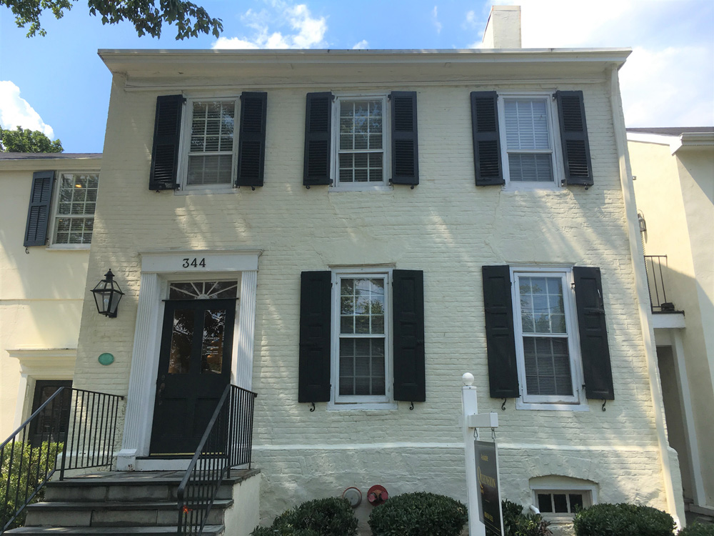
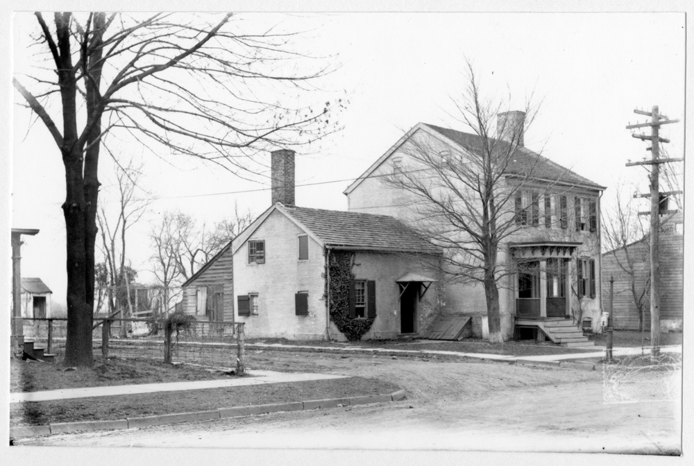
One example is the Joseph Hornor House located at 344 Nassau St. was built in the 1760s by the grandson of one of Princeton's Quaker founders. The two-story, brick, side-hall house originally had a one-story kitchen wing. In the early 20th century, a second story was sensitively added on top of the wing. The house is an anchor to the Local, State, and National Register Jugtown Historic District, and occupies the northeast corner of the historic crossroads of Nassau and Harrison Streets in the Jugtown section of Princeton. Nassau Street is also part of the Lincoln Highway National Register District. The corners of this historic crossroads retain two other Pre-Revolutionary buildings and an early-19th-century building. The proposed threat facing the Joseph Hornor House is its incentive design for redevelopment for the purpose of affordable housing units. The current project will include adding a four-story structure to the rear that would amass and surround the historic structure. Redevelopments in historic districts are on the rise with new Affordable Housing and tax credit initiatives. While the revitalization of neighborhoods contributes to reactivating historic places, there is a growing trend in demolition and insensitive changes to integral features of structures and streetscapes. More care and sensitivity to the impacts of historic districts are necessary through compliance with existing preservation standards and guidelines both at a local, state and federal level. Preservation New Jersey supports and encourages the development to comply with preservation standards and guidelines as it will set the precedent for other new development in the Jugtown Historic District and in other historic Princeton neighborhoods. 


Wednesday, July 5, 2023

Hinchcliffe Stadium

2020 aerial photo shows Hinchliffe Stadium with the Great Falls in the foreground

On May 19, 2010, the National Trust for Historic Preservation named Hinchliffe Stadium to its list of America’s 11 Most Endangered Historic Places. 

Hinchliffe Stadium is a 10,000-seat stadium located in Paterson, New Jersey. The stadium is located atop the Great Falls of the Passaic River, and is part of the surrounding National Historical Park. The stadium, built in 1932, was closed in 1996 after years of neglect. 

The stadium was designed as an Art Deco stadium with distinctive Spanish tile trim and OLympian decoration as an oval with near-continuous seating laid out like a classical amphitheater. Building the stadium was pushed through by its namesake Mayor John Hinchliffe, who made his fortune from Hinchliffe Brewing before it closed due to Prohibition. 

After 26 years, Hinchliffe Stadium opened its gates again on May 17, 2023, and on May 20th, the stadium hosted the first professional sporting event in a National Park. The stadium's primary user is the Paterson Board of Education, where it serves as a multipurpose facility for the city’s two high schools, Eastside High School and Kennedy High School. As of 2023, it also serves as the home stadium for the New Jersey Jackals of the independent Frontier League in Minor League Baseball. The Jackals spent their previous 25 seasons playing at Yogi Berra Stadium in Little Falls, New Jersey.

Hinchliffe Stadium had been the home of the New York Black Yankees of the Negro League from 1933-38 and is one of only four stadiums still standing that hosted Negro League baseball games.

Players who hit the field there include Monte Irvin, Satchel Paige, Josh Gibson, Oscar Charleston, and "Cool Papa" Bell, among many others. Hall-of-Famer Larry Doby, the legendary player who broke the American League color barrier in 1947, grew up in Paterson playing football and baseball in Hinchliffe Stadium for Paterson's Eastside High School and was scouted from Hinchliffe for the Newark Eagles in 1942.

Hinchliffe became an important venue for boxing (Diamond Gloves, precursor to the Golden Gloves), auto racing (precursor to NASCAR featuring stock car racing, pre-Indianapolis racing, and midget car racing events), and professional football.

Victory Bond rallies held at the stadium during World War II drew sports stars and New York and Hollywood celebrities by the dozens. Among the many notable events headlined at Hinchliffe were shows performed by Abbott and Costello. Lou Costello was born and raised in Paterson's Eastside section.

In addition to the stadium revival, the project includes senior housing, a parking deck, a food court and a museum dedicated to the Negro Leagues and the civil rights struggle. 


northjersey.com/story/news/paterson-press/2023/05/19/paterson-nj-hinchliffe-stadium

Friday, January 10, 2020

Endangered Historic Sites in New Jersey: East Point Lighthouse

Besides the species that are threatened and endangered in New Jersey, there are also places that are threatened and endangered.

Founded in 1978, Preservation New Jersey is a statewide member-supported non-profit historic preservation organization. They publish the annual 10 Most Endangered Historic Places in order to draw attention to remarkable sites and to their many challenges.

The point of the list is to bring attention and therefore be a catalyst for positive solutions. Their program spotlights irreplaceable historic, architectural, cultural, and archaeological resources in New Jersey that are in imminent danger of being lost.

The list is generated from nominations by the public. Half of the sites on this year’s list are owned by the government and suffer from prolonged deferred maintenance, damage by forces of nature, and from a general lack of awareness or respect for the resource. Not surprisingly, insufficient financial resources are a major problem in saving these places.


One example from the 2019 list is the East Point Lighthouse in Maurice River Township (Cumberland County). This lighthouse sits on an outcropping of land where the Nationally-designated Wild and Scenic River system of the Maurice River enters the Delaware Bay in Cumberland County.

It was built in 1849 making it the second oldest existing lighthouse in New Jersey.

Despite a full restoration done in 2017 through the assistance of New Jersey Historic Trust and Federal Department of Transportation grant funds, this picturesque brick Cape Cod style lighthouse is considered far from safe and secure. The mouth of the Maurice River and the adjacent bayshore is rapidly eroding, and tidal waters erosion has already washed out the protective dunes. Stewards of the lighthouse are left with sandbag brigades in a futile attempt to hold back tidal waters and storm surge. Even with this effort, bay waters regularly lap at the front of the lighthouse and the basement fills with water.

Certainly, some of the erosion is the same as other water-adjacent historic resources around the world caused by climate change. 

The East Point Lighthouse is still being used as an active navigational aid and so should get a more immediate response than what has been proposed to date. The site is owned by the State of New Jersey who will hopefully act expediently in 2020 to protect this National and State Register listed site before the structure is gone forever.

Friday, June 22, 2018

Awards for Preserving New Jersey History

The Department of Environmental Protection is joining the New Jersey Historic Sites Council and Preservation New Jersey in honoring projects that preserve the state’s history, Acting Commissioner Catherine R. McCabe announced. The 2018 award honorees include restoration of a World War II battery, a 19th-century lighthouse, a Victorian greenhouse, two downtown adaptive reuse projects, restoration of a Revolutionary War-era bridge, and a nomination of multiple maritime properties in a southern New Jersey community for listing on the National Register of Historic Places.

Awards were presented this month during the 28th Annual Historic Preservation Awards held at the historic Hamilton Club Building at Passaic County Community College.

One example is the East Point Lighthouse, which is located at the mouth of the Maurice River and Delaware Bay. Erected in 1849, East Point Lighthouse operated until after World War II. Once decommissioned by the U.S. Coast Guard, however, deterioration set in.

Since 2000, a combination of public funding sources has provided much-needed restoration work to address water damage, moisture levels, electrical and mechanical upgrades and accessibility. Today, the lighthouse is open to the public as a historic site.

A rehabilitation project that successfully combined development, design and preservation to become a model for urban revitalization is the historic 1901 Hahne & Company Department Store in downtown Newark. It was once one of the nation’s largest department stores until it closed in 1986.

Today, it is a 400,000 square-foot building that houses residential, retail, commercial and cultural uses as well as a newly expanded Rutgers University campus. The ornately detailed masonry and limestone exterior was meticulously restored as was the original monumental skylight over the interior public arcade.

A bridge on Route 206 over Stony Brook (Princeton, Mercer County) known as the Stony Brook Stone Arch Bridge, was built in 1792. It is New Jersey’s oldest stone-arch bridge still in use.

The ruins of Worth’s Mill Run, built in 1714, are next to the bridge, and the late 19th-century Stony Brook Floodplain Bridge is connected to the stone arch span. The collapse of a portion of the Stone Arch Bridge’s parapet in 2016 triggered a combined project to restore the Stone Arch Bridge and replace the Floodplain Bridge. Adhering to the Secretary of the Interior’s Standards, the design and preservation project yielded historic and scientific research benefiting the understanding of 18th-century stone bridge design and historic grist mill technology.

To learn more about the New Jersey Historic Preservation Office and its programs, visit: www.nj.gov/dep/hpo

SOURCE NJDEP - News Release 18/P048

Wednesday, December 13, 2017

Preserving New Jersey

Preservation in New Jersey means many things. It can mean preserving natural area for wildlife or recreation or establishing a local historic district, nominating a building to the New Jersey and National Registers of Historic Places, or even restoring your house.

Although on this site the focus is usually on fish and wildlife, we also look at historical preservation and preservation in general across the state.

Preservation sign at  John W. Berry House (Rutherford, New Jersey)


The New Jersey Historic Preservation Office is located within the Department of Environmental Protection and provides expertise and resources for preserving historic resources. They respond to more than 40,000 calls yearly from people working to preserve, protect and promote New Jersey's historic resources. This work requires historians, researchers, planners, architectural historians, architects, engineers, and archaeologists.

National Heritage Areas are places where we find historic, cultural, and natural resources but, unlike national parks, these areas are large lived-in landscapes. One New Jersey example is Crossroads of the American Revolution, a National Park Services program in our state that spans from the Palisades at Fort Lee to the shores of the Delaware River at Red Bank Battlefield. At revolutionarynj.org, you will find 14 places from the Long Pond Ironworks State Park in the northern part of NJ to Somers Mansion in the south.

Here are some links that can lead you to more information from both public and private organizations.

New Jersey Land Preservation and Environmental Organizations
Association of New Jersey Environmental Commissions
D&R Greenway Land Trust
Garden State Preservation Trust
Morris County Planning, Development and Technology Department
New Jersey Conservation Foundation
New Jersey Pinelands Reserve
The Nature Conservancy New Jersey
The Highlands Council
The Pinelands Commission
Crosswicks/Doctors Creek Regional Greenway Planning Group

Markers at Hemlock Ridge Preserve trailhead on Frog Pond Road, Warren County.


New Jersey History, Cultural and Arts Statewide Organizations
New Jersey Historic Trust
New Jersey Historical Commission
New Jersey Historical Society
New Jersey State Council on the Arts
NJDEP Division of Parks and Forestry
Preservation New Jersey who nominates the 10 most endangered historic places in our state each year.


Wednesday, August 9, 2017

Endangered New Jersey History

Yes, historic places are often on their own endangered lists around the world and New Jersey is no exception.

One list is at the www.thehistorygirl.com website (They are also on Twitter) and on Preservation New Jersey's site you'll find their annual list of the state's 10 most endangered historic places.

The places vary in age and usage. For example, there is the Colemantown Meeting House and Jacob's Chapel, in Mount Laurel (Burlington County). This circa-1865 chapel and meeting house along with an even older cemetery are all that remain of the 19th-century African-American community of Colemantown.

The meeting house was made even more endangered than it had been after Superstorm Sandy flooded it and made the building unusable. With an estimated $1.3 million needed for repair, restoration and site improvements, the price tag is well beyond the means of the congregation.

Jacob's Chapel  (NPS)
The Jacob's Chapel A.M.E Church property, which includes the Colemantown Meeting House, the Chapel and cemetery mark the emergence, growth, and decline of Colemantown. This antebellum African American settlement established in 1828 flourished into the 20th century and was an important event within Burlington County history.

The Colemantown Meeting House (moved to its current location in 1965) served as both the first worship sanctuary in Colemantown and as a schoolhouse for the hamlet's children and is one of the oldest all-black schoolhouses still extant in New Jersey.

The cemetery was inaugurated about 1849. In the immediate aftermath of the Civil War, the growing congregation, then led by Jacob Mitchell, an A.M.E minister known for his success in helping other black churches build their own sanctuaries, led the effort to build the present Jacob's Chapel in 1866-67.

Founder's Fountain in better days - Photo CC 2.5 
Not all endangered NJ history is a building or place. An example is Founders Fountain in Monmouth County's Founder's Park. The park was established on the site of the first Camp Meeting in Ocean Grove, off Pilgrim's Pathway.

This elaborate cast iron fountain was the centerpiece of the park when it was placed there in 1907 as a memorial. Vandals clogged it in 1977, but it remains partially intact, but in severe disrepair. Many of the original molds are available for the fountain’s restoration, but the expensive cost is beyond the means of the historical society that owns it.


You might not think of most school buildings as being historic, but Camden High School is a century-old Collegiate Gothic-style building that is also known as the "Castle on the Hill."

Camden High School's Class of 2017 is the last graduating class of "The Castle on the Hill" as the school is slated to be demolished this year to make room for a new $133 million state-of-the-art high school.

The chances are very slim that the building will be saved.

Tuesday, December 20, 2016

Saving Maxwell's Field in Princeton


This month it was announced that an agreement to save a portion of a Revolutionary War battlefield in Princeton, New Jersey from development was completed. 

The Civil War Trust has an agreement to buy nearly 15 acres of land across from Princeton Battlefield State Park for $4 million. The group has raised $1.4 million to buy the land from the Institute for Advanced Study and will now begin fundraising for the rest, with the intention to turn over the property to the state.

The Civil War Trust is the largest and most effective nonprofit organization devoted to the preservation of America’s hallowed battlegrounds. Although primarily focused on the protection of Civil War battlefields, the Trust also seeks to save the battlefields connected to the Revolutionary War and War of 1812.

The battlefield in Princeton is where American and British troops fought each other on January 3, 1777. The Battle of Princeton during the American Revolutionary War ended when the British soldiers in Nassau Hall (now part of the Princeton University campus) surrendered.

This victory came just after Washington's crossing of the Delaware River and capturing the troops at the Old Barracks in Trenton, and the two victories did a lot to improve American troop morale. This was just Washington’s first victory over British regulars in the field.

The 22 acres adjacent to Princeton Battlefield make up Maxwell’s Field where George Washington's charge first hit the British lines. Also adjacent to the site is the Institute for Advanced Studies which has been attempting to build faculty housing on Maxwell's Field. The institute is best known as the place where Albert Einstein worked. Under the new plan, they will build faculty housing on the part of the land it is keeping.

Approval from the Princeton planning board and Delaware and Raritan Canal Commission is still needed..

Thursday, April 14, 2016

The Great Falls Today


Yesterday, I wrote about some of the history of the Great Falls of the Passaic River in Paterson. Today, I'm looking at what is there today.

It is a natural wonder, but it is only 15 miles from downtown Manhattan and surrounded by a very urban and troubled city.

It is New Jersey's newest national park - officially the Great Falls National Historic Park.

We know it for the 77-foot falls that is so often photographed with its arched iron bridge and historic redbrick mill buildings that were once powered by the falls and its raceway system.

The smash hit Broadway musical Hamilton about Paterson's founding father has made Paterson a place to visit if the story intrigues you and you want to dig deeper. The connection between the musical's story and Alexander Hamilton's economic legacy began not in New York City but at Paterson's Great Falls.

Hamilton chose the site of the Great Falls to propel his brainchild, a "national manufactory," Paterson was America's first planned industrial city. In 1791 the Society for the Establishing Usefull Manufactures (S.U.M) was incorporated.

The Great Falls is the east coast's second largest waterfall. Everyone knows #1 - Niagara Falls - and the hope was that New Jersey could pull some tourists to our Great Falls and the surrounding Paterson historic district.

But, just like other natural areas like forests and beaches, and historic areas and wildlife species, the Great Falls needs protection.

The area was named a National Natural Landmark in 1967, a National Historic Landmark District in 1976, And getting a national historic park designation in 2009 helps, but it is not enough.

Last fall, Paterson's Planning Board approved a 156-unit apartment complex atop the ridge overlooking the historic district and falls. Huh? Doesn't that destroy the very thing that you want to promote?

Perhaps the tourism dollars from the park have not come or have not come quickly. Selling land and having construction done is fast and easy money, but will a dangerous half-life to the future.

Short-term tax ratables versus long-term planning and a revitalized Paterson is much more difficult and will take much longer - but will have a much longer and lasting impact on the city, area and state.


Cultural Center at the park

Sunday, April 12, 2015

Bringing the Assunpink Creek Back Into the Daylight in Trenton

Assunpink Creek flowing through Trenton near Mill Hill Park
Work is expected to begin on a $4 million restoration this spring that is being financed 75 percent by the U.S. Army Corps of Engineers and 25 percent by the DEP through a federal Clean Water Act grant.

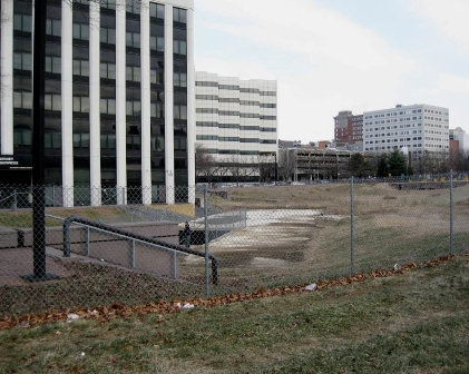
What the project hopes to accomplish is to restore the Assunpink Creek in downtown Trenton. You say you've never seen it? That's because decades ago this tributary of the Delaware River was channeled into an underground culvert. It disappears from view between South Broad and South Warren streets.

The idea years ago was certainly to allow for greater development where the creek flowed, but the culvert prevented fish from migrating into the Delaware. The downtown also lost the natural beauty of the stream.

Maybe it was a sign from nature when the nine years ago part of the culvert roof collapsed. The immediate effect was not good - a safety hazard that was fenced off and became an overgrown lot.


But this project to restore the creek looks like it will now happen.

On the New Jersey Future website at www.njfuture.org, you can see maps and historic photos.

The term for this restoration is "daylighting," as in bringing back the water to the light of day from its capture underground.

The Assunpink Creek is 25 miles long, and drains approximately 91 square miles in central New Jersey. The main tributaries that feed Assunpink Creek are Shabakunk Creek and Miry Run. The headwaters begin in Millstone Township, in Monmouth County, and flow into the Delaware River in Trenton.

The creek gathers intensity as it meanders west from Millstone Township in Monmouth County, through the Assunpink Wildlife Management Area and Mercer County Park, across the old, flat clays and silts of the Raritan and Magothy formations into Trenton.

The Lower Assunpink Creek Ecosystem Restoration Project study area is located on a 3- mile section of the Assunpink Creek between the Delaware River and the Trenton city limits. Several former industrial sites, abandoned bridges, and a 500-foot section of the creek between Broad and Warren Streets, contained within a buried box culvert were identified as candidates for ecological restoration.

The buried box culvert, known locally as the Broad Street culvert, was evaluated during the feasibility study and approved for removal and restoration of a natural creek channel. The Broad Street culvert removal project is located in the heart of the downtown Trenton business and historic district on a recovering urban stream that also serves to connect several greenway and urban park facilities.

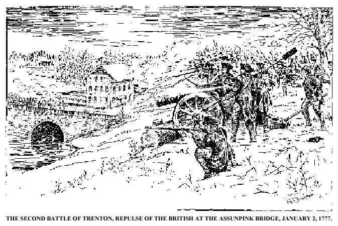
illustration via www.trentonhistory.org


The project site is also the location of the the Battle of Assunpink Creek (AKA the Second Battle of Trenton) during the American Revolution. On Jan. 2, 1777, the Continental Army and supporting militias held a defensive line along the creek's south shore. Under George Washington's command, the Americans repelled charges by British and Hessian soldiers across a stone bridge spanning the creek, as well as an attempt to ford the creek near its mouth.

By morning, Washington had reached Princeton and after a brief battle, the British there were decisively defeated and most of the garrison was captured. With their third defeat in ten days, Cornwallis' superior, General William Howe ordered the army to withdraw from southern New Jersey and most of the way back to New York. The British left forward positions at New Brunswick and Washington moved his army to Morristown for winter quarters.

The daylighting of the stream this year will mean the removal of the culvert structure, allowing the stream to be exposed to natural sunlight, and the resulting open channel design will improve anadromous fish migration. Low-light conditions can disorient migrating fish, hindering their ability to spawn upstream.

The project will also benefit businesses adjacent to the site, provide recreational options for visitors and local residents, and provide historical and educational opportunities for the community.

The name Assunpink comes from the Lenape word for "stony, watery place," describing the gravelly springs of New Jersey's 65 million-year-old ancient coastline. This ironstone "cuesta," or ridgeline divides the inner and outer coastal plains.

Monday, February 2, 2015

New Jersey's State-Owned Historic Sites

The NJDEP New Jersey State-Owned Historic Sites offer a variety of historical opportunities. They range from Revolutionary War battlefields, lighthouses, villages, and homes from the past of a president, poet, or industrial pioneer.

Here are just a few possibilities.


Trenton Battle Monument  Administered by Washington Crossing State Park
348 North Warren Street, Trenton, NJ 08638

The monument marks the site of the American artillery emplacement that commanded the streets of Trenton during the battle that led to the defeat of the three Hessian Regiments by the American Army at the Battle of Trenton, December 26, 1776. The monument was designed by John H. Duncan, architect of Grant's tomb.

Clarke House, Princeton Battlefield State Park
500 Mercer Road, Princeton NJ 08540
Built by Thomas Clarke in 1772, the house is located on Princeton Battlefield and was the scene of heavy fighting during the Battle of Princeton. General Hugh Mercer was mortally wounded nearby and was carried to the Clarke House, where he died nine days after the battle.


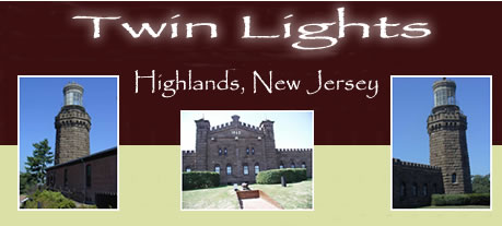
Twin Lights
Lighthouse Road, Highlands, NJ 07732

The current brownstone structure was built in 1862 and served as the primary seacoast light marking the entrance to New York Harbor. The towers are not identical twins; the south tower is square and the north is octagonal. This 1862 structure replaced an earlier twin tower lighthouse.

 Visit the Twin Lights virtual tour.


Wallace House
71 Somerset Street, Somerville, NJ 08876
The Wallace House was completed in 1776 as Hope Farm for John Wallace, a successful Philadelphia merchant. General Washington leased the house for use as his headquarters during the Middlebrook Winter Encampment, December 11, 1778, to June 3, 1779. The house is one of the best and most original examples of Georgian architecture in New Jersey.

NJN invites visitors to experience New Jersey's colonial history first-hand. View their short film about the Wallace House


Walt Whitman House
330 Mickle Boulevard, Camden, NJ 08103
The renowned poet lived in this house from 1884 until he died in 1892, and received many visitors during that time, including the painter Thomas Eakins, naturalist John Burroughs, and writers Oscar Wilde and Bram Stoker. The house is furnished with several pieces owned and used by Whitman.


Get the Official Guide for New Jersey State Parks, Forests & Historic Sites as a mobile app on your phone or tablet. It includes Enhanced GPS Features and is free. 
Go to www.pocketranger.com/apps/new-jersey on your mobile device.


Thursday, January 22, 2015

Following the Lenape Through Irvington and Paterson

I grew up in Irvington, New Jersey and despite its current unsavory reputation, it was a great place to be a kid in the 1950s and early 60s.

It is hard for any of us to really imagine New Jersey 15,000 years ago, but what is now Irvington was then buried under hundreds of feet of glacial ice. As the ice receded present-day contours of the town emerged, such as the Elizabeth River. As a kid, we called that "The Brook" and it's a natural feature that bisects the town from north to south.

The river enters Irvington 140 feet above sea level and gradually descends as it exits the town at Hillside at an elevation of 70 feet. The land east of the Elizabeth River is a gently rolling plain and west of the river is part of the Orange Mountains. The town's little "mountaintop" reaches 220 feet above sea level at Franklin Terrace.

The Lenape (who were later named Delaware Indians by Europeans) were the natives who lived in what is now New Jersey and along the Delaware River in Pennsylvania, the northern shore of Delaware, and the lower Hudson Valley and New York Harbor in New York when Europeans arrived in the sixteenth and seventeenth centuries.

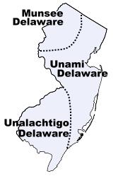
They were the major tribes that lived in our state

The first inhabitants of this Elizabeth River valley were the Awkinges or Hackensacks, who were a subtribe of the Lenni Lenape. I couldn't find any evidence that there was any significant village there, but before Europeans came to the area there was plentiful game and well-stocked streams.

Around 1676, Newark's first settlers spread out towards the "suburbs" and laid out highways. We know that one Lenape trail became Clinton Avenue which ran straight to the Elizabeth River.

The Lenape Trail of today doesn't pass through Irvington or follow a historical American Indian trail exclusively.  Look at a map of the Lenape Trail (which is a component of the Liberty Water Gap Trail). You can see it go through Becker Park with a side trail that goes to to the Walter Kidde Dinosaur Park. The dinosaur tracks there (including the smallest ones ever found) pre-date even the Lenape but it doesn't tell any of our New Jersey natives' story.

The Lenape Trail continues west across the Morristown and Erie Railway tracks and passes under I-280 and continues along Hatfield Swamp and the Essex County Environmental Center before ending at the Patriots’ Path.

The Lenni Lenape people of our area were divided into smaller groups, but all participated in both hunting and gathering as well as cultivation. Deer, elk, bear, fox, raccoon, opossum, muskrat, beaver, squirrel and rabbit were all hunted for food and furs were used for clothing, bone for fashioning tools, toys, and sewing needles. Sinew was used as sewing thread.

Fish leftovers were used as fertilizer. They made maple sugar and had an abundant supply of natural honey. Cultivated garden plots usually contained corn, beans, pumpkins or squash, and tobacco. 

The Minsi  (AKA Munsee) were the "people of the stony country" whose totem was the wolf. They lived in the rugged country along the upper Delaware and their principal village was Minisink, on the east bank at the Delaware Water Gap.

You might know Mount Minsi and Lake Lenape which are located within the Delaware Water Gap National Recreation Area.

They were the largest of the subtribes and most warlike of the Lenape because of their proximity to the fierce Mohawks of the Iroquois nation.

In the Central area of NJ lived the Unami, “the people down the river.”

The southern part of our state was home to the Unilachtigo, “the people who lived near the ocean.”

These were some of the Indians that I read about as a kid in The Last of the Mohicans and the other Leatherstocking Tales of James Fenimore Cooper. I don't think I had any sense that these people had walked over the same lands that I grew up walking over myself.  Many years later, I taught The Light in the Forest in which a European is adopted by a band of Lenape.

The Lenni Lenape people participated in both hunting/gathering as well as cultivation and fishing. In their lands were a great assortment of animals such as deer, elk, bear, fox, raccoon, opossum, muskrat, beaver, squirrel and rabbit. Nothing went to waste. Furs were used for clothing, bone was used for fashioning tools and toys for children as well as being used for sewing needles, and sinew was used as sewing thread.

They spoke what we call an Algonquian language, known as either Lenape or Delaware. Among other Algonquian peoples the Lenape were considered the “grandfathers” from whom all the other Algonquian peoples originated. Consequently, in inter-tribal councils, the Lenape were given the respect one would give to elders.

The Treaty of Easton, signed between the Lenape and the English in 1758, moved them west out of New York and New Jersey and into Pennsylvania. Then they were pushed to Ohio and beyond.

It didn't work to their advantage, but the Lenape were the first Indian tribe ever to enter into a treaty with the United States government. They signed the Treaty of Fort Pitt during the American Revolutionary War and supplied the Continental Army with warriors and scouts in exchange for food supplies.
When the white man arrived, the Lenape had developed an extensive system of trails through the wilderness. These trails were originally 18 inches wide and could only accommodate persons walking in single file. Warriors, messengers, hunters, diplomats and visiting families apparently used separate paths. These Indian paths became bridle trails, wagon roads and twentieth century highways.      via  newhopepa.com
The Lenni-Lenape of New Jersey were peaceful and they were sometimes intermediaries in resolving problems within the nation. The hostile Iroquois mockingly called them “The Old Women.”

North of my hometown of Irvington, the Lenape were also living in what is now the Passaic valley around where I worked for a number of years at Passaic County Community College.

At the Paterson Museum, I learned that the Lenni Lenape Indians knew the Great Falls as a prime camping and fishing site. They called it “Totowa” which meant "to be forced beneath the waters" which shows their respect for the power of the falls.

The Passaic Falls, more popularly known as the Great Falls. There is no record of who first "discovered" the Great Falls. History books record the white settlers who moved into the area following the settlement of Newark in 1666. Of course, the Lenape discovered the Falls long before any white hunters or land prospectors from that colony wandered up the river.

Acquackanonck was the land in lower Passaic County from Essex County line to Pompton. The name is said to be derived from several  Indian words meaning place of brush net + rapid stream. The V-shaped brush nets were set in the river in shallow places so that fish became entangled in the twigs during the seasons when spawning runs of shad and sturgeon were underway.

Over a long period of time, the area of the falls was a productive source of fish for the Indians and later for the white settlers. During the spawning season, shad and other anadromous species (fish that migrate up rivers from the sea to spawn) would come in great numbers to the waters below the falls, where their upstream progress would be stopped.

These large catches couldn't be consumed immediately and much of the catch was dried for later use. Sturgeon, as well as shad, made their way to the foot of the falls and, because of their size, were especially prized. One of the largest ever reported was taken on August 31, 1817, and was said to have weighed 130 pounds.

The Lenape were not the only Indian tribe in this area, but they were the dominant tribe. There is still a group of the Ramapough Lenape Indian Nation (AKA Ramapo Mountain Indians) numbering about 5,000 who live around the Ramapo Mountains of northern New Jersey and southern New York.


Sources

Thursday, November 6, 2014

NJ Voters Approve Ballot Question on Preservation


New Jersey voters voted YES this week on Ballot Question 2, amending the state constitution to set aside a larger percentage of the corporate business tax (from 4 to 6%) for preservation. This does not mean an increase in the corporate or other taxes, just a reallocation of how the collected taxes are dispensed. 
 
The question was approved by an overwhelming 65 percent of Garden State voters. According to the New Jersey Conservation Foundation, this is the fourteenth time in 52 years that voters have approved efforts to preserve New Jersey's clean water, productive farmland, parks, natural lands and historic sites.

Being the nation's most densely populated state, makes saving land for all of our communities even more critical. For example, with rising sea levels and increasingly severe storms, protecting lands that mitigate flooding all the more urgent.  

New Jersey is considered to be the first state projected to be fully "built out" - with all land either preserved or developed. Preserving and adding what we can to parks, farmlands,  and forests, and investing in open spaces can help protect and expand a healthy environment for current and future generations.


Friday, May 9, 2014

“Spirit of the Jerseys” State History Fair Celebrates NJ's 350th Anniversary


The 10th “Spirit of the Jerseys” State History Fair will take place on Saturday, May 10 at Washington Crossing State Park in Hopewell Township, Department of Environmental Protection Commissioner Bob Martin announced today.

The fair is a signature event in the commemoration of New Jersey’s 350th anniversary, which is being celebrated this year. The fair will showcase many contributions the Garden State has made to the country and world since New Jersey’s founding in 1664.

“As residents of New Jersey, we share a tremendous sense of pride in knowing our state has shaped so much of the progress that has defined the American experience,” said Lt. Governor Kim Guadagno. “From the American Revolution to the Industrial Revolution to generating innovation that continues to improve lives and change the world around us, New Jersey’s unique historical legacy is truly unparalleled. As we continue to commemorate the 350th anniversary of New Jersey’s founding, this year’s State History Fair will surely prove the most educational and exciting yet.”

The Spirit of the Jerseys Fair was first held in 2004 to celebrate the 100th anniversary of New Jersey’s State-owned Historic Sites – a system that began in 1903 with the state’s purchase of the Indian King Tavern in Haddonfield. The goal of the fair is to engage the public in discovering the state’s history in a fun and enjoyable manner.

New this year, the day starts with a 5k Trail Run and Walk, and ends with a free concert at 5:30 p.m. by the New Jersey 63rd Army Band.


“The State History Fair will give visitors an opportunity to experience five centuries of New Jersey history, and – fittingly – will be held at Washington Crossing State Park, which is the site of one of the pivotal events of the American Revolution,” said Commissioner Martin. “It is an example of the Christie Administration’s support of our state’s history – from the annual History Fair to the continued support for all of our state historic sites, which allow residents to better understand who we are, where we came from, and the role that our ancestors played in making New Jersey such a great state.”

More than 200 historical, government and nonprofit entities and organizations are partnering with the DEP at the annual event. All of the state’s 21 counties will be represented at the fair as well as exhibitors from Delaware, Connecticut, Pennsylvania and New York.

At the History Fair, you can take a step back in time and invent with Thomas Edison, tour the New Jersey Hall of Fame mobile museum, learn how to pound corn into flour, play historical games, see a historical fashion show, and experience New Jersey’s past by interacting with exhibitors who will provide insights into the state’s long history.

Activities at the State History Fair can help fulfill badge requirements for Cub Scouts, Boy Scouts and Brownie and Junior Girl Scouts. The Office of Historic Sites is offering three professional development hours to elementary and secondary school social studies teachers who attend the fair and engage in its historical activities.

A wide variety of gourmet food trucks will be stationed in the park. Vendors will offer a variety of refreshments, snacks and meals – everything from pastries to empanadas.

While admission is free, there will be an $8 fee per-vehicle parking donation to help defray the cost of the fair.

For more information on the State History Fair, including a listing of events and directions, visit  www.njhistoryfair.org and for more information on New Jersey’s 350th anniversary, visit  http://officialnj350.com

Friday, March 7, 2014

Protect the Palisades


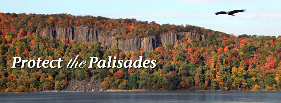
I only became aware this week that New Jersey is celebrating its 350th anniversary. That's pretty good, considering the United States is only 238 years old. But that doesn't seem like much if you consider that the now endangered Palisades cliffs over the Hudson River are 200 million years old.

An update from Michele Byers at www.njconservation.org alerted me to the Protect the Palisades website.

The issue is that LG Electronics wants to build a 143-foot office tower that would rise high above the tree line, more than four times the height of existing buildings next to Palisades Interstate Park.


What continues to amaze people about the Palisades is that the view from the Hudson River north of the George Washington Bridge has remained unchanged over centuries. Pretty amazing for this most densely populated state in the nation that gets plenty of abuse for it.

It's certainly not the first threat to the Palisades. In the early 1900s, it was threatened by rock quarrying. Citizens fought then for preservation and the Palisades Interstate Park Commission was created. Before we had land conservancy groups very visible, prominent families of the day bought lands along the cliffs and donated them for conservation. Zoning for towns north of the GW Bridge wrote height restrictions limiting building to 35 feet so that the tree line of Palisades Interstate Park was maintained.

The National Park Service supports the low-rise alternative continuing and reminds us that the Palisades have the rare distinction of being both a "National Natural Landmark" and a "National Historic Landmark."


But in 2012, Englewood Cliffs granted a variance allowing the LG office tower, and opening up a larger area for more high-rise development. (The NJ Federation of Women's Clubs sued to stop the project, along with Scenic Hudson and the NY-NJ Trail Conference and it is a case that's still before the courts.)

Hopefully, the NPS and concerned citizens can protect our vista in the same way that the Grand Canyon, Yellowstons and Yosemite National Park are protected.

In a Star-Ledger editorial last summer:
LG spokesman John Taylor said the company has not ruled out a redesign, although it would be costly. Opponents of the current design, such as Michele Byers of the New Jersey Conservation Foundation, said if the company lowers the building, they’ll get behind the project to expedite it and minimize costs. Taking the building down to a lower height would ensure the preservation of the Palisades and earn priceless goodwill for the company.

PROTECT THE PALISADES asks you to join in at 1pm on Saturday, March 8th around New Jersey and in NYC as people stand up and show LG how strong the opposition to their plan to build a tower on the Hudson River Palisades really is! Spread the word and sign up new supporters.

You can also follow Protect the Palisades on Facebook for updates.


Tuesday, June 18, 2013

Preservation New Jersey’s Ten Most Endangered Historic Places 2013

Each year, Preservation New Jersey releases a list of their "Ten Most Endangered Historic Places"in our state as a way to build awareness for landmarks and historic resources that are in danger of disappearing.

As with animal and plant species, sometimes the average person will look at items on the list and wonder why they are worth saving. So, educating the people of that area and in NJ is an important part of this preservation and conservation process.

Places listed as "most endangered" have architectural and historic integrity coupled with an identified threat to their existence.

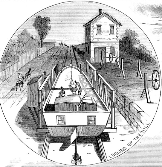
Illustration of Inclined Plane 11 East in Bloomfield from Scientific American, May 20, 1882. The house in the upper-left represents the Collins House, but is not an accurate depiction of the house’s location. via Collins House photo gallery


In my own Essex County, the 18th century Collins House in Bloomfield is one site that is historically and architecturally significant. It is one of the earliest houses built in Bloomfield and the only one that survives in its original open space landscape.

Very few of these "East Jersey Cottages" are left and it also has ties to local transportation and industrial history by way of the Morris Canal and the adjacent paper mill.

The Morris Canal Rockaway River Aqueduct, in Denville, also made the list because of the threat of demolition.

Collins House has been vacant since 2005 and is in poor condition and the Township of Bloomfield considers the house beyond restoration. But The Friends of the Collins House was formed to protect and raise awareness about the house.

image via www.preservationnj.org
It's a situation that is typical of historical preservation projects. The biggest problems are often not the actual physical preservation process itself, but the lack of public awareness about the significance of the place, a lack of support from the municipality, county or state and a lack of funding.

The Morris Canal Rockaway River Aqueduct is located on Diamond Spring Road, in Denville Township, Morris County. It is already part of the Morris Canal Historic District and is listed on the New Jersey and National Registers of Historic Places.

What remains of the components of the canal structure (masonry piers and abutments) are threatened with demolition by Denville Township in an attempt to alleviate flooding along the Rockaway River. It's not even clear about the ownership of the aqueduct site.

Groups like Preservation New Jersey acknowledge that consideration has to be given to serious flooding, but wants options that do not require a loss of historically significant elements. They point to similar structures, such as the Mule Bridge Pier in Boonton, that were saved and restored, and enrich the community's history.

Wednesday, November 28, 2012

The Twin Lights


The Navesink Twin Lights is a non-operational lighthouse and museum located in Highlands, New Jersey. It overlooks Sandy Hook Bay, the entrance to the New York Harbor and the Atlantic Ocean. The Twin Lights, as the name implies, are a pair of beacons located 246 feet (75 m) above sea level on the headlands of the Navesink Highlands.

In 1962, the State of New Jersey acquired Twin Lights. At the current museum facility, tours of the lighthouse, a climb of the North Tower and its expansive ocean view, and a view of the lighthouse equipment, await visitors. Twin Lights is listed on the State and National Register of Historic Places.

The Twin Lights State Historic Site is part of the New Jersey Coastal Heritage Trail Route.

The original Twin Lights were built in 1828 and were replaced in 1862 with a new structure made from brown stone that has the appearance of a fortress.

During the rehabilitation in 1841 a cannon was found buried on the lighthouse grounds. Today it is in front of the Keeper’s quarters and is now known as the "Mystery Cannon" of Twin Lights.

In 1899, Guglielmo Marconi placed an antenna and receiving station at the lighthouse to demonstrate his Wireless Telegraph.


Twin Lights holds a prominent place in American maritime history it is an excellent tour and a great learning experience and admission is free.

Lighthouse lens


Twin Light Historical Society
254 State Route 36
Highlands, NJ 07732

Friday, October 26, 2012

Proposed American Battlefield Protection Bill Could Preserve NJ Sites

Reenactors at Morristown's Jockey Hollow   photo via nps.gov
"In the early Revolutionary struggle, few of the States among the old Thirteen had more of the battle-fields of the country within their limits than old New Jersey." 
~ Abraham Lincoln in an 1861 address to the New Jersey Legislature. 
If you went to school in NJ, you had a lesson at least once where you were told that General Washington not only slept here but spent more time in NJ with the Continental Army than any other state. Our best-known sites are the Trenton Barracks, the Princeton and Monmouth battlefields, the Jockey Hollow encampment, and Washington's Headquarters in Morristown.

The sites that are of concern are the many lesser-known sites that are being ignored and may end up being destroyed by development, like a Continental Artillery winter encampment in the Pluckemin section of Somerset County's Bedminster Township.

Michele Byers'  post on preserving some of New Jersey's historic landscapes alerted me to a bill introduced by New Jersey Congressman Rush Holt that would preserve our Revolutionary War sites.

The American Battlefield Protection Program already helps preserve Civil War sites, and the new bill would extend the program to the Revolutionary War and War of 1812 sites. The amendment was passed by the House of Representatives on September 10 and will now go to the Senate, where a companion bill has been introduced.

New Jersey has a good claim to being the "Crossroads of the American Revolution" being between the British stronghold in New York and our capital in Philadelphia.

If you want to learn more about the American Battlefield Protection Program Amendments Act, or S779 - go to the Library of Congress website at http://thomas.loc.gov/home/thomas.php.

If you are interested in this preservation, you can contact New Jersey's two U.S. Senators, Frank Lautenberg and Robert Menendez, and ask them to support S779 via the Senate website at www.senate.gov/general/contact_information/senators_cfm.cfm?State=NJ.

For more information about New Jersey's Revolutionary War history, visit the Crossroads of the American Revolution website at www.revolutionarynj.org.

Monday, October 22, 2012

The Blue Hills of NJ and the Revolutionary War

map via www.revolutionarynj.org/crossroads-guide/mountain-refuges
What we call the Watchung Mountains today was known to General Washington and the Continental Army as the Blue Hills. They were the natural barrier that could keep the Army safe from incursions by the British who held Manhattan.
You may have visited some of these sites, or you might drive by them every day. 
Bound Brook Village and the surrounding area were British targets during their encampment at New Brunswick in 1777. On April 13, there were 4,000 British and Hessian troops under General Cornwallis that moved from New Brunswick and surprised the American garrisons who were guarding the Raritan River crossings. They were overpowered and the Battle of Bound Brook was lost by the Colonists.

The village of Middlebrook, between the first and second range of the Watchung Mountains, was a site
where the Continental Army camped along in June 1777 and returned to in the winter of 1778-1779. 
That portion of the Army was made up of 10,000 troops - which equaled the population of Somerset County at the time. So as not to overwhelm the local residents, state brigades were spread out across the area. There was a Maryland brigade to the east of Middle Brook and the Virginia troops were on the west side. Pennsylvania was assigned across the Raritan, on the west side of the Millstone River, and the artillery was camped at Pluckemin. 
General Washington identified "Middlebrook" as the location in his dispatches. That 18th century village no longer exists. It is now the western end of Bound Brook

Monday, October 15, 2012

Battery Potter at Sandy Hook

Battery Potter entrance today
Battery Potter
Gateway NRA/NPS Museum Collection
View of Battery Potter looking southeast.  One gun is raised in the firing position.
Fort Hancock's Battery Potter, constructed from 1890-1894, was the first disappearing gun battery in the U. S. Originally called Lift-gun Battery #1, it was the first and only disappearing gun battery powered by a steam hydraulic lift system. In operation from 1893-1906, it was obsolete by the time it was built because the fastest firing of the gun took over two minutes.

The Army had developed a new gun carriage that used a counterweight to raise and lower the gun called the Buffington-Crozier carriage. This carriage allowed the guns to fire two rounds per minute.
Battery Potter stayed in operation until 1906 because it had a 360 degree range of fire and was capable of covering Sandy Hook Bay. When Battery Arrowsmith was constructed on the bayside of Sandy Hook at Camp Low, Battery Potter's guns were no longer needed.

Drawing of soldiers loading Battery Potter's gun.
NPS/Harpers Ferry Center Commissioned Artwork


.