Showing posts with label Lenape. Show all posts

Friday, November 29, 2024

The Three Sisters on Native American Heritage Day

Allison Mitchell, Co-Executive Director of the New Jersey Conservation Foundation, wrote in her newsletter about "Honoring The Three Sisters" at our dinner tables. This day after Thanksgiving in November which is National Native American Heritage Month, is a good time to recognize and honor the culture, traditions, and achievements of the original inhabitants of North America. 

New Jersey is no different from the rest of the country in having significant Native American history. We are reminded of that by place names in the state, some of the land we visit, and food we eat, 

For NJ, it is the first people here, the Lenni-Lenape, who lived here at least 10,000 years ago that started planting using “The Three Sisters” which are corn, beans, and squash. According to the National Agricultural Library, the intercropping method of planting corn, beans, and squash together has been studied and described by scholars of anthropology, history, agriculture, and food for many years. This method involves planting pole beans, squash, and corn together in a mutually-beneficial arrangement. The sturdy corn stalks provide support for the climbing beans, while the squash vines spread out to retain soil moisture and suppress weeds. Meanwhile, the beans enrich the soil with nutrients, the broad squash leaves offer shade, and the corn adds structure and stability. This traditional companion planting system fosters a harmonious relationship between the three crops, enhancing their growth and supporting a thriving ecosystem of plants and animals.

Mitchell points to Michaeline Picaro and her husband, Chief Vincent Mann, of the Ramapough Munsee Lenape Nation, Turtle Clan who have leased 14 acres of farmland to create The Three Sisters Munsee Medicinal Farm. It serves almost as a charity feeding, nurturing, and healing members of the Turtle Clan. 

Many different Native American tribes practiced this traditional gardening technique, which is believed to have originated with the Haudenosaunee (hah-dee-no-shownee) of upstate New York, or "People of the Longhouse." At least 15 different indigenous nations in the northeastern United States and southeastern Canada planted The Three Sisters, including the Native American women of New Jersey who were responsible for planting.

To learn more about some of the tribes of New Jersey:

Tuesday, December 15, 2020

Jersey Devil - Protector of the Pinelands

Mësingw

According to The Paris Review, in the collections of Seton Hall University in South Orange, New Jersey, there is a round ceramic disk, about the size and shape of a cobblestone, with the barest image of a face on it. There are two eyes in a mushroom-shaped head, and a mouth opened in a howl or scream. Radiocarbon dating puts its age at about seven hundred years old, which would make it one of the earliest known images of the Jersey Devil.

Growing up in New Jersey, I heard about the Jersey Devil long before I ever went into the Pinelands (AKA The Pine Barrens) of southern Jersey where the creature is supposed to live.

The first story I heard was that it was called originally the "Leeds Devil." Mother Leeds was in labor with her thirteenth child when she cried out “Let this one be a devil!” Apparently, the real Devil heard and took up the invitation and the hideous creature that came forth was able to flee the house on its own immediately.

One depiction of the European Jersey Devil

That legend may have had some basis in the story of Anne Hutchinson, the Puritan leader who was expelled from the Massachusetts Bay Colony in 1637. After her expulsion, she gave birth to a “disturbing mass that bore little resemblance to a child. The Puritan devil-child explanation is now thought to have been "a molar pregnancy, in which a non-viable fertilized egg implants in the womb, resulting in a malformed mass of cells."

But a similar creature legend was known to the Lenape Indians who lived in Jersey before it was Jersey and before Europeans settled there, and that may have inspired our Jersey Devil.

The Lenape called it Mësingw. What is interesting - especially in the context of this blog - is that they did not view it as a monster but as a spirit that helped preserve the balance of the forest. 

Mësingw (“Living Solid Face,” “Masked Being,” or “Keeper of the Game”), according to Herbert C. Kraft, was one of the manetuwàk spirits who care for the world. Mësingw's job was to protect the animals of the forest, ensuring their health and safety. 

Mësingw doesn't resemble the more modern depictions of the Jersey Devil. It could sometimes be seen riding through the forest on a large buck, cov­ered in long, black hair from head to toe like a bear. The right side of his large, round face was colored bright red, the left side colored black. It was revered and feared. It both assured game in the forest and could avenge the mistreatment of the animals. It was a mediator.

White set­tlers saw Lenape images and masks of a strange creature who was supposed to live in the Pine Barrens which were at the edge of their settled world. To the Europeans, it looked more dangerous than benevolent.

But back to the Leeds connection. Daniel Leeds was an early New Jersey writer who brought English astrology to America and published astrological charts in his popular almanacs. This Devil legend was a warning to colonials about the dangers of living out­side of the carefully controlled Puritan rules. 

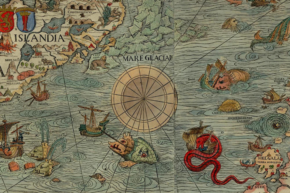
Like the monsters of sea and land that appear on the edge of civilization on old maps, the Jersey Devil lived in that strange Pinelands at the edge of civilization. 

It is one of many cryptids — strange creatures that exist beyond the reach of civilized humanity. They live in those not easily accessible places, at the edges and in ld maps in the spaces that were blank because they were unknown.

I have written earlier about the legend of the Jersey Devil and it's a good tale to tell around a campfire, late at night, deep in the Pine Barrens - or on a chilly December night when there are strange sounds outside your window at the edge of your property. It is New Jersey's Bigfoot, Loch Ness monster, or whatever cryptid you imagine lives in your dark woods.


Monsters at the edge of the Olaus Magnus, Carta Marina map, 1539

Sunday, October 11, 2015

New Jersey's Watchung Mountains

looking west
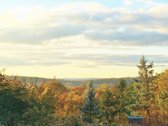
Looking west to Second Mountain from a ridge of First Mountain - part of the NJ's Watchung Mountains

Though New Jersey has many places that are called "mountains," we know that they do not compete with the western U.S. mountain ranges. Probably the best-known NJ mountain area is the northwestern area where we find the Appalachian Trail.

But New Jersey also has the Watchung Mountains (once called the Blue Hills), which are actually a group of three long, low ridges of volcanic origin, between 400 ft. (122 m) and 500 ft. (152 m) high, lying parallel to each other primarily in northeastern New Jersey.

All of the ridges lie to the east of the higher Appalachian Mountains, which in northern New Jersey are often referred to as the New York-New Jersey Highlands.

Together with the Appalachian Mountains to the west, the Watchungs pen in an area formerly occupied by the prehistoric Glacial Lake Passaic.

The Great Swamp, a large portion of which is designated as the Great Swamp National Wildlife Refuge, is a remnant of this lake. The swamp area is presently retained by what we call the Third Watchung Mountain.

200 million years ago, magma intruded into the Newark Basin, then an active rift basin associated with the breakup of the supercontinent Pangaea. The magma formed large intrusions like the Palisades Sill. But the magma ultimately broke out to the surface through large, episodic eruptions and formed the Watchung Mountains.


Throughout the early Jurassic period, the Newark Basin underwent extensive dipping and folding, and at the western edge of the Newark Basin, along the Ramapo Fault System formed alternating synclines and anticlines warped the layers of basalt and sedimentary rock. Jurassic sedimentary rock layers between and above the ridges form the Feltville, Towaco, and Boonton formations.

The Watchung Mountains are known for their numerous scenic vistas overlooking the New York City and New Jersey skylines, as well as their isolated ecosystems containing rare plants, endangered wildlife, rich minerals, and globally imperiled traprock glade communities.

If you drive on I-280 up or down the big hill in "The Oranges", you see the cliffs that consist of a single massive lava flow that cooled and cracked into columnar joints.

In some locations, the joints tend to radiate away from a central core in a pattern generated by an uneven cooling pattern in the flow. There are also complex areas in the middle of the outcrop that show a small normal fault that may have formed from seismic activity that occurred about the time that the flows were still cooling. There are also lots of boulders (glacial erratics) scattered in the woods along the hilltop.

The ridges once held back the westward spread of urbanization, forming a significant geologic barrier beyond the Piedmont west of the Hudson River. But in many places within the state, they are smaller islands of natural landscape within suburban sprawl.

Parks, preserves, and numerous historical sites dot the valleys and slopes of the mountains, providing recreational and cultural activities to one of the most densely populated regions of the nation.

From near the summit of High Mountain in Wayne - in the right foreground is the eastern slope of Mount Cecchino  (third-highest peak of the Watchung Mountains)
Garret Mountain in the background (First Watchung Mountain) overlooking Paterson.

The two most prominent ridges are known as First Watchung Mountain (the southeastern ridge) and Second Watchung Mountain (the northwestern ridge). They stretch for over forty miles (64 km) from Somerville (in Somerset County) in the southwest through Morris County, Union County, Essex County, and Passaic County to Mahwah (in Bergen County) in the northeast.

The less prominent and discontinuous ridge formed by Long Hill, Riker Hill, Hook Mountain, and Packanack Mountain is sometimes referred to as Third Watchung Mountain and lies on the northwestern side of Second Watchung Mountain.

The First and Second Mountains are often erroneously referred to as Orange Mountain and Preakness Mountain. "Orange" and "Preakness" more properly applies to specific geographic sections of these ridges.

Third Watchung Mountain is sometimes referred to locally as Hook Mountain.

A smaller fourth ridge exists south of Morristown and west of Third Watchung Mountain. This ridge lacks topographic prominence, only rising to about 100 ft (30 m) above the surrounding terrain and the only named portion (at Harding Township) is known as Lees Hill.

The original inhabitants of the Watchungs were the Native American Lenape. They referred to the mountains as the Wach Unks, or ‘high hills’. Evidence of the Lenape presence in the Watchungs can be seen in numerous camps sites that have been uncovered, mainly along the rivers coursing through mountains and in the small caves abundant in the volcanic rock.

It is thought the Lenape favored the Watchungs for their profusion of natural resources, including abundant freshwater rivers and streams, a variety of forests, and plentiful fish and game. They also took advantage of the rich soils and maintained many farm areas where they raised a variety of seasonal crops.

With the arrival of Europeans, the rivers and streams of the Watchungs also supported grain, grist, and saw mills. Later, the energy of these rivers would be harnessed for industry, most notably at the Great Falls of the Passaic River, where mechanical and hydroelectric systems exploited the energy of water falling over the face of First Watchung Mountain.

During the Revolutionary War, General George Washington used the protection of the Watchung mountains to erect the first and second Middlebrook encampment. This position on the high ground also allowed him to monitor the area between Perth Amboy and New Brunswick as well as to identify and disturb British movements between Manhattan and Philadelphia.

During World War Two, an anti-aircraft gun emplacement was made in Mills Reservation (Cedar Grove & Montclair) at the lookout point on the cliffs overlooking New York City. All that remains of this today is a circular cement platform.

In the twentieth century, the Hilltop in Verona, the highest point in Essex County, served as the site of a sanatorium for tuberculosis patients. The county hospital was built there because the high elevation provided clean, mountain air away from the cities to the east.

At the height of the Cold War, Campgaw Mountain was selected to house a Nike missile base. Installed on the mountain between 1955 and 1971, the base’s missiles served to guard New York City air space, standing by to intercept nuclear armed Soviet bombers. The facility ultimately was abandoned with the advent of intercontinental ballistic missiles. Two other missile sites were nestled into the forests atop peaks in Mountainside and Morris Township, creating a triangle of redundant sites.

NYC skyline seen from Mills Reservation, First Watchung Mountain

There are many parks and recreational areas to visit along the Watchung Mountains.

Campgaw Mountain Reservation (First and Second Watchung Mountain) is the northernmost ridge of the Watchungs and its northern terminus is the Ramapo Mountains, near the New York border. A shallow gap separates its southern end from Preakness Mountain and Goffle Hill.

Preakness Mountain comprises part of the northern extent of Second Watchung Mountain between the Passaic River and Campgaw Mountain.[ Along with Packanack Mountain (part of Third Watchung Mountain) to the west, Preakness Mountain forms the Preakness Range. The three highest peaks of the Watchungs are located in this range.

Great Falls State Park in Paterson is on First Watchung Mountain.

Nearby Garret Mountain Reservation is 568 acre park located within the Borough of Woodland Park (formerly West Paterson), although it also extends into the cities of Paterson and Clifton. The reservation covers the northernmost part of the First Watchung Mountain and reaches over 500 feet (152 m) above sea level.

Continuing along the Watchung Mountains, popular locations include:
* Mills Reservation, First Watchung Mountain
* Hilltop Reservation, Second Watchung Mountain
* Eagle Rock Reservation, First Watchung Mountain
* Riker Hill Park, Riker Hill (Third Watchung Mountain)
* South Mountain Reservation, First and Second Watchung Mountain
* Watchung Reservation, First and Second Watchung Mountain
* Washington Rock State Park, First Watchung Mountain
* Washington Valley Park, First Watchung Mountain
* Leonard J. Buck Garden/Moggy Hollow Natural Area, Second Watchung Mountain

Sunday, April 12, 2015

Bringing the Assunpink Creek Back Into the Daylight in Trenton

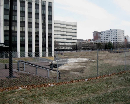
Assunpink Creek flowing through Trenton near Mill Hill Park
Work is expected to begin on a $4 million restoration this spring that is being financed 75 percent by the U.S. Army Corps of Engineers and 25 percent by the DEP through a federal Clean Water Act grant.

What the project hopes to accomplish is to restore the Assunpink Creek in downtown Trenton. You say you've never seen it? That's because decades ago this tributary of the Delaware River was channeled into an underground culvert. It disappears from view between South Broad and South Warren streets.

The idea years ago was certainly to allow for greater development where the creek flowed, but the culvert prevented fish from migrating into the Delaware. The downtown also lost the natural beauty of the stream.

Maybe it was a sign from nature when the nine years ago part of the culvert roof collapsed. The immediate effect was not good - a safety hazard that was fenced off and became an overgrown lot.


But this project to restore the creek looks like it will now happen.

On the New Jersey Future website at www.njfuture.org, you can see maps and historic photos.

The term for this restoration is "daylighting," as in bringing back the water to the light of day from its capture underground.

The Assunpink Creek is 25 miles long, and drains approximately 91 square miles in central New Jersey. The main tributaries that feed Assunpink Creek are Shabakunk Creek and Miry Run. The headwaters begin in Millstone Township, in Monmouth County, and flow into the Delaware River in Trenton.

The creek gathers intensity as it meanders west from Millstone Township in Monmouth County, through the Assunpink Wildlife Management Area and Mercer County Park, across the old, flat clays and silts of the Raritan and Magothy formations into Trenton.

The Lower Assunpink Creek Ecosystem Restoration Project study area is located on a 3- mile section of the Assunpink Creek between the Delaware River and the Trenton city limits. Several former industrial sites, abandoned bridges, and a 500-foot section of the creek between Broad and Warren Streets, contained within a buried box culvert were identified as candidates for ecological restoration.

The buried box culvert, known locally as the Broad Street culvert, was evaluated during the feasibility study and approved for removal and restoration of a natural creek channel. The Broad Street culvert removal project is located in the heart of the downtown Trenton business and historic district on a recovering urban stream that also serves to connect several greenway and urban park facilities.

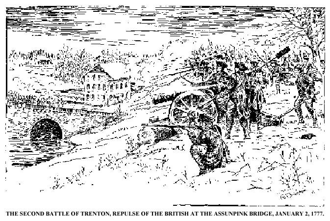
illustration via www.trentonhistory.org


The project site is also the location of the the Battle of Assunpink Creek (AKA the Second Battle of Trenton) during the American Revolution. On Jan. 2, 1777, the Continental Army and supporting militias held a defensive line along the creek's south shore. Under George Washington's command, the Americans repelled charges by British and Hessian soldiers across a stone bridge spanning the creek, as well as an attempt to ford the creek near its mouth.

By morning, Washington had reached Princeton and after a brief battle, the British there were decisively defeated and most of the garrison was captured. With their third defeat in ten days, Cornwallis' superior, General William Howe ordered the army to withdraw from southern New Jersey and most of the way back to New York. The British left forward positions at New Brunswick and Washington moved his army to Morristown for winter quarters.

The daylighting of the stream this year will mean the removal of the culvert structure, allowing the stream to be exposed to natural sunlight, and the resulting open channel design will improve anadromous fish migration. Low-light conditions can disorient migrating fish, hindering their ability to spawn upstream.

The project will also benefit businesses adjacent to the site, provide recreational options for visitors and local residents, and provide historical and educational opportunities for the community.

The name Assunpink comes from the Lenape word for "stony, watery place," describing the gravelly springs of New Jersey's 65 million-year-old ancient coastline. This ironstone "cuesta," or ridgeline divides the inner and outer coastal plains.

Thursday, January 22, 2015

Following the Lenape Through Irvington and Paterson

I grew up in Irvington, New Jersey and despite its current unsavory reputation, it was a great place to be a kid in the 1950s and early 60s.

It is hard for any of us to really imagine New Jersey 15,000 years ago, but what is now Irvington was then buried under hundreds of feet of glacial ice. As the ice receded present-day contours of the town emerged, such as the Elizabeth River. As a kid, we called that "The Brook" and it's a natural feature that bisects the town from north to south.

The river enters Irvington 140 feet above sea level and gradually descends as it exits the town at Hillside at an elevation of 70 feet. The land east of the Elizabeth River is a gently rolling plain and west of the river is part of the Orange Mountains. The town's little "mountaintop" reaches 220 feet above sea level at Franklin Terrace.

The Lenape (who were later named Delaware Indians by Europeans) were the natives who lived in what is now New Jersey and along the Delaware River in Pennsylvania, the northern shore of Delaware, and the lower Hudson Valley and New York Harbor in New York when Europeans arrived in the sixteenth and seventeenth centuries.

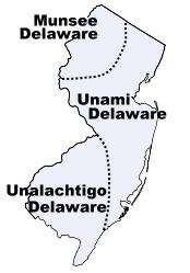
They were the major tribes that lived in our state

The first inhabitants of this Elizabeth River valley were the Awkinges or Hackensacks, who were a subtribe of the Lenni Lenape. I couldn't find any evidence that there was any significant village there, but before Europeans came to the area there was plentiful game and well-stocked streams.

Around 1676, Newark's first settlers spread out towards the "suburbs" and laid out highways. We know that one Lenape trail became Clinton Avenue which ran straight to the Elizabeth River.

The Lenape Trail of today doesn't pass through Irvington or follow a historical American Indian trail exclusively.  Look at a map of the Lenape Trail (which is a component of the Liberty Water Gap Trail). You can see it go through Becker Park with a side trail that goes to to the Walter Kidde Dinosaur Park. The dinosaur tracks there (including the smallest ones ever found) pre-date even the Lenape but it doesn't tell any of our New Jersey natives' story.

The Lenape Trail continues west across the Morristown and Erie Railway tracks and passes under I-280 and continues along Hatfield Swamp and the Essex County Environmental Center before ending at the Patriots’ Path.

The Lenni Lenape people of our area were divided into smaller groups, but all participated in both hunting and gathering as well as cultivation. Deer, elk, bear, fox, raccoon, opossum, muskrat, beaver, squirrel and rabbit were all hunted for food and furs were used for clothing, bone for fashioning tools, toys, and sewing needles. Sinew was used as sewing thread.

Fish leftovers were used as fertilizer. They made maple sugar and had an abundant supply of natural honey. Cultivated garden plots usually contained corn, beans, pumpkins or squash, and tobacco. 

The Minsi  (AKA Munsee) were the "people of the stony country" whose totem was the wolf. They lived in the rugged country along the upper Delaware and their principal village was Minisink, on the east bank at the Delaware Water Gap.

You might know Mount Minsi and Lake Lenape which are located within the Delaware Water Gap National Recreation Area.

They were the largest of the subtribes and most warlike of the Lenape because of their proximity to the fierce Mohawks of the Iroquois nation.

In the Central area of NJ lived the Unami, “the people down the river.”

The southern part of our state was home to the Unilachtigo, “the people who lived near the ocean.”

These were some of the Indians that I read about as a kid in The Last of the Mohicans and the other Leatherstocking Tales of James Fenimore Cooper. I don't think I had any sense that these people had walked over the same lands that I grew up walking over myself.  Many years later, I taught The Light in the Forest in which a European is adopted by a band of Lenape.

The Lenni Lenape people participated in both hunting/gathering as well as cultivation and fishing. In their lands were a great assortment of animals such as deer, elk, bear, fox, raccoon, opossum, muskrat, beaver, squirrel and rabbit. Nothing went to waste. Furs were used for clothing, bone was used for fashioning tools and toys for children as well as being used for sewing needles, and sinew was used as sewing thread.

They spoke what we call an Algonquian language, known as either Lenape or Delaware. Among other Algonquian peoples the Lenape were considered the “grandfathers” from whom all the other Algonquian peoples originated. Consequently, in inter-tribal councils, the Lenape were given the respect one would give to elders.

The Treaty of Easton, signed between the Lenape and the English in 1758, moved them west out of New York and New Jersey and into Pennsylvania. Then they were pushed to Ohio and beyond.

It didn't work to their advantage, but the Lenape were the first Indian tribe ever to enter into a treaty with the United States government. They signed the Treaty of Fort Pitt during the American Revolutionary War and supplied the Continental Army with warriors and scouts in exchange for food supplies.
When the white man arrived, the Lenape had developed an extensive system of trails through the wilderness. These trails were originally 18 inches wide and could only accommodate persons walking in single file. Warriors, messengers, hunters, diplomats and visiting families apparently used separate paths. These Indian paths became bridle trails, wagon roads and twentieth century highways.      via  newhopepa.com
The Lenni-Lenape of New Jersey were peaceful and they were sometimes intermediaries in resolving problems within the nation. The hostile Iroquois mockingly called them “The Old Women.”

North of my hometown of Irvington, the Lenape were also living in what is now the Passaic valley around where I worked for a number of years at Passaic County Community College.

At the Paterson Museum, I learned that the Lenni Lenape Indians knew the Great Falls as a prime camping and fishing site. They called it “Totowa” which meant "to be forced beneath the waters" which shows their respect for the power of the falls.

The Passaic Falls, more popularly known as the Great Falls. There is no record of who first "discovered" the Great Falls. History books record the white settlers who moved into the area following the settlement of Newark in 1666. Of course, the Lenape discovered the Falls long before any white hunters or land prospectors from that colony wandered up the river.

Acquackanonck was the land in lower Passaic County from Essex County line to Pompton. The name is said to be derived from several  Indian words meaning place of brush net + rapid stream. The V-shaped brush nets were set in the river in shallow places so that fish became entangled in the twigs during the seasons when spawning runs of shad and sturgeon were underway.

Over a long period of time, the area of the falls was a productive source of fish for the Indians and later for the white settlers. During the spawning season, shad and other anadromous species (fish that migrate up rivers from the sea to spawn) would come in great numbers to the waters below the falls, where their upstream progress would be stopped.

These large catches couldn't be consumed immediately and much of the catch was dried for later use. Sturgeon, as well as shad, made their way to the foot of the falls and, because of their size, were especially prized. One of the largest ever reported was taken on August 31, 1817, and was said to have weighed 130 pounds.

The Lenape were not the only Indian tribe in this area, but they were the dominant tribe. There is still a group of the Ramapough Lenape Indian Nation (AKA Ramapo Mountain Indians) numbering about 5,000 who live around the Ramapo Mountains of northern New Jersey and southern New York.


Sources

Thursday, April 24, 2014

Hackensack’s Borg’s Woods and Wawayanda Swamp Natural Area

The improving weather makes many of us more enthusiastic about getting out for a walk or hike. Looking through the many options at NJ Urban Forest, I came upon two North Jersey possibilities for this weekend.

Both of these rambles go through areas that were once commercially owned and that were obtained for preservation and recreation.


First up is Hackensack’s Borg’s Woods. About 14 acres of Borg’s Woods were originally owned by Macromedia, Inc., which planned to build a condominium development in the mid-1980s. After years of legal battles, Bergen County purchased the parcel in 1994, and an additional acre of the Summit Hill Ridge was purchased from two homeowners by the County in 1995.

Of course, these urban forests - as the name suggests - have pretty mild and shorter "hikes" that serious hikers would consider more of a walk.

The second trek goes through a section of Wawayanda State Park. The park was one of the first major acquisitions by the New Jersey Green Acres program in 1963 from the New Jersey Zinc Company.


“Wawayanda” is like many NJ locations of Lenape Indian origin. The word is said to mean "water on the mountain," although in modern parlance, some say it means “way way yonder” since the park is rather remotely located in northwestern Passaic and southeastern Sussex counties.

The hike offered takes you to a rare inland Atlantic White Cedar swamp in the 2,167-acre park. The Wawayanda Swamp Natural Area is the largest natural area in the park.

Friday, November 29, 2013

Beyond Thanksgiving

Now that the turkey has been digested, maybe you can chew on some information about that first Thanksgiving and consider visiting an exhibit in Paterson, NJ.

The Paterson Museum's permanent Delaware-Lenape exhibit, opens in early December. You can see tolls like axes, harpoons and fishing nets,plus murals and an 11-foot dugout canoe and a full-size eight-foot diameter wigwam. This is believed to be the only permanent Lenape exhibit in the mid-Atlantic states.

Sam Beeler, elder of the Sand Hill Delaware Indian tribe, was the technical adviser for the exhibit. He says that American Indians (not "Native Americans" which he dislikes) play a much wider role than the Thanksgiving story.

Beyond that historic meal is the idea that potatoes, peppers, tomatoes, chocolate, corn, and all the beans we use comes from this hemisphere and were passed on and exported by those colonists.

The Thanksgiving story has always been a little vague and is now full of popular cultural additions. We know that the first pilgrim Thanksgiving in 1621 has lots of venison. We're not sure about turkey, although it makes sense that it might have been included.(A letter from a colonist tells us that the local Wampanoag Indians brought five deer.)

In the 392 years since, we have added a lot of information - much inaccurate and some offensive to the Indians.


In what we know of as northern New Jersey,  the people of the Munsee ("stony country") region of the Lenni-Lenape held a  regional autumn celebration that, Beeler says, that broght people to the Great Falls in Paterson for "The Rendezvous" or "The Pawwaw."

The Lenni Lenape Indians knew the Falls as a prime camping and fishing site and called it “Totowa” (to sink or be forced down beneath the waters by weight).

Passaic County's 5,000 or more Lenape celebrate on the Thursday before the federal holiday. A typical meal will include the "three sisters" (corn, beans and squash). Since the Indians were the original American locavores, the meal would include what was available here in the season, including seafood, venison, turkey, rabbit and squirrel.

SOURCE: northjersey.com/community/233195111_Thanksgiving__the_Lenape_way.html

Monday, May 6, 2013

The Delaware River Shad Run


Spring marks the return of the shad, a fish in the herring family, to the Delaware River.

Shad festivals, like the one in Lambertville that was held April 27 & 28 this year and another on the NY side of the Hudson River, are held when the shad begin to spawn.

Shad are primarily saltwater fish, but they swim up freshwater rivers to spawn in the springtime. Unlike some other species such as trout, many shad survive to swim back to sea.

Shad are found in all areas of the Atlantic Ocean, as well as several seas across the world.

As the fish travel up the Delaware River, there are some seining (netting) activities which recall the method used by the Lenni Lenape Indians when they were the original inhabitants of the area.

The Delaware River was so polluted for many years that the number of shad that came to spawn each spring had dwindled to an alarmingly low number. That was a clear indicator of an unhealthy environment. The shad have returned to using the deeper waters of the Delaware River as a spawning ground which is happily an indicator of the success of some environmental reforms that were enacted in the past decades in cleaning up the waterway.

Andy Still wrote me to say that "When I was a boy the river ran red from the dye coming out of Cyanamid. Greatest success story in New Jersey" and enclosed the shad photo above.

Thursday, April 18, 2013

The Lenni-Lenape, New Jersey's Original People

The Lenni-Lenape, who inhabited New Jersey long before the Europeans arrived, considered themselves to be the "Original People."

Unfortunately, they did not survive long after the arrival of the Europeans. The Colonists wanted to own the land. As with other Native Americans, European diseases, guns and alcohol all led to the death of natives and flight from the original homelands. By 1700, the Lenni-Lenape population was probably one fourth of what it was when the Dutch arrived and estimated it at 2000.

Lenape traditions and lifestyle seemed strange to the Europeans. Rather than settling and staying in one place and home, the Lenape moved with the seasons in what is now New Jersey, Pennsylvania and Delaware.

In spring, planting was done in around their permanent settlements. In summer, they moved to the shore for oysters and clams and to escape the heat. In autumn, they returned to their village and harvested crops. In the winter, they lived by hunting deer and other animals.


The Lenape Indians lived in bark houses called wigwams. The frame was made by bending branches to form a dome shape. These branches were tied together with vines or leather thongs and it was then covered by bark or hides. A hole at the top let out smoke from the small fire circle inside.

The Algonquin Nation, including Lenni-Lenape, sided with the French in the French & Indian War hoping that they would move the settlers away from their homeland. The French and the Indians were fighting British colonists in what was the final Colonial War here. (It was fought in Europe by Austria, England, France, Great Britain, Prussia, and Sweden and was called the Seven Years War. although it extended from 1689 to 1763.)

The French and Indians lost the war on our soil. Some peace came through negotiations in 1758 with the New Jersey Governor Francis Bernard and Lenape leader, Teedyuscung. A home for the Lenni-Lenape in Burlington County was established and this was the first "Indian reservation."

There were about 200 Lenape who made a home in what was called Brotherton and was supervised by a hopeful Reverend John Brainerd.  A grist mill and sawmills were set up for the Lenape to create a new life and the area became known as Indian Mills.(Now, Shamong Township.)

The experiment was not successful and in 1796 the Oneida tribe (also Algonquin by language) in New Stockbridge, NY, invited the Brotherton tribe to live with them, and almost all of them moved to NY.

The New Jersey Assembly sold the reservation in 1801 and gave the proceeds to the less than 100 remaining tribe members.

Although Elisha Ahhataina (Lashar Tamar), the last chief of the Brotherton Indians, did go to New York, he eventually returned to New Jersey with some members and settled near the town of Rancocas, NJ.

Those who stayed with the Oneida asked the New Jersey Legislature in 1832 for the balance of the money from the sale of their Brotherton Reservation and were given $3,551. Forty remaining members resettled in Statesburg, Wisconsin. A small number moved west to be with the Cherokees and Osages.

The modern day Lenape Trail was intended to follow some of original trails and areas where the "Original People" lived.

There is still a group of the Ramapough Lenape Indian Nation (AKA Ramapo Mountain Indians) numbering about 5,000 who live around the Ramapo Mountains of northern New Jersey and southern New York.

Source:  New Jersey Homepage of the American Local History Network

Saturday, January 5, 2013

Walking the Lenape Trail

Originally posted in a slightly different version on Weekends in Paradelle

I was recently on one of my many walks on the local Lenape Trail. It’s not hardcore hiking. Chunks of it don’t even run through woods as you might expect of a trail.

I was looking at a map of the trail and realized that many parts of my own childhood and the childhood days of my sons are on that trail.
The trail crosses Essex County, N.J., one of the most congested counties in the United States. It connects Newark, New Jersey with Roseland, New Jersey.

This trail forms a segment of the Liberty-Water Gap Trail and incorporates the West Essex Trail (the Lenape Trail’s only rail-to-trail section) and it connects with Morris County’s Patriots Path trail. It was only established in 1982, though some of the trails it followed have been used for a long time. It is the fifth-longest trail in the state behind the Delaware and Raritan Canal Trail, the Appalachian Trail, the completed section of the Highlands Trail in NJ, and the Batona Trail.

It’s a suburban-urban trail and it traverses Newark (Jersey doesn’t get more urban than that) and its suburbs, through parks as well as the Watchung Mountains and Passaic Meadows.
I walked the mostly urban street parts of the trail when I worked at the New Jersey Institute of Technology in Newark. I have walked all of its 34 miles piece-by-piece. The eastern terminus is in Newark’s Ironbound district. A nice urban start with plenty of places to eat.

It’s street walking through downtown Newark and through the Frederick Law Olmsted-designed Branch Brook Park (home to the city’s Cherry Blossom Festival with 3,500 cherry trees and the most diverse cherry blossom display in the country).

Do you want old trails? The Passaic Meadows was the former basin of Glacial Lake Passaic. We are talking about dinosaurs and the earliest natives. Glacial Lake Passaic was a prehistoric proglacial lake at the end of the last ice age approximately 13,000 years ago.

I read about it when I was a kid. I had found some fossils and wanted to be a paleontologist. The lake was formed from waters released by the melting of the retreating Wisconsin Glacier that had pushed large quantities of earth and rock ahead of its advance, blocking previous natural drainage.
The drainage basin is what we call today the Passaic Meadows and the part near our walking trail is the Hatfield Swamp. The lake was formed on the western side of the Watchung Mountains by a blockage of the Passaic River.

Eventually, the river formed its present course, a circuitous detour around the north end of the Watchung range through present-day Paterson. And the lake found a new outflow to the ocean via the Great Notch in Little Falls, near Totowa and Montclair. And when the glacier retreated farther to the north, the outflow of the lake drained toward the north and formed the gorge of the Great Falls of the Passaic River in Paterson, which is just a short walk from my office at Passaic County Community College.

What is left of Glacial Lake Passaic is several swamps in northern New Jersey, particularly, the Great Swamp.

Back on the trail.

Leaving Newark, it goes west through Belleville, Nutley, Bloomfield, Montclair, and into my town, Cedar Grove. That part of the trail I have covered many times. It’s my favorite section.

Mills Reservation is a county park, 157.15 acres that bridges Cedar Grove and Montclair. I walked these woods many times with my sons when they were young Indians, soldiers, hunters, wolves, and Cub Scouts.

The reservation has no development other than a small parking area and the trails. It is a minimalist design by the Olmsteds in their last association with Essex County. The three of us made maps of the area, brought our lunch packs, hiking staffs, compasses, cowboy hats, Indian weapons, and lots of energy and imagination into those woods.

The Eastview Trails runs the edge of a cliff that overlooks the New York City skyline to the east. It was a part that my sons loved to walk. It was a part that terrified me when they were young - the cliff, the edge - stay close.

On a clear day, you can see to the south and east the Verrazano Narrows Bridge, the New York City skyline including the Statue of Liberty. To the northeast is the Palisades and to the north and west, peaks from the Ramapo Mountains can be glimpsed and the beginning of the Second Watchung Mountain.

The outcrop at Quarry Point was the site of a World War Two anti-aircraft gun emplacement and the remaining cement circle was our resting place. My son, Drew, at age 5, planted a circle of trees near there, and again at the north end so that the forest people would have a place for their ceremonies.

Right across from that point you can see the Montclair Hawk Lookout. Atop a 500-foot basalt ledge, it’s a stone-filled platform that is the site of a sanctuary of the New Jersey Audubon Society where birders gather to watch the migration mixture of both coastal and ridge flights in autumn.

After Mills Reservation, the yellow blazes lead you to a place where it combines with the West Essex Trail on the former Caldwell Branch of the Erie Railroad. You enter Verona on the old Erie Railroad line, hit some pavement, and go into Verona Park.

Verona Park was the fishing hole for my sons. Sunfish, stocked trout, catfish and even once a big carp that someone must have released. I spent many happy hours in that park with my boys.
Then, the trail moves into Eagle Rock Reservation passing the Eagle Rock lookout on the ridge of the First Watchung Mountain (AKA Orange Mountain). From that view of the New York Skyline, many people watched the Twin Towers fall on September 11, 2001. There is a memorial there now.

The trail goes under Interstate Highway 280 and follows power lines over the Second Watchung Mountain (AKA Preakness Mountain).

I read that a side trail is planned that would lead to South Mountain Reservation. That sanctuary between Orange Mountain and Preakness Mountain was where this urban kid tried out his Huck Finn fantasies.

South Mountain Reservation was my childhood forest. It is much bigger than Mills Reservation. I took my sons there too, but it wasn’t around the corner, so it wasn’t a big part of their childhood. It covers 2,047.14 acres between the first and second ridges of the Watchung Mountains.
In 1896, John Durand described the mountain that includes South Mountain Reservation as:
“a wilderness, as it probably existed at the time of Hendrick Hudson, a primitive forest abounding with deer and other wild animals, and traversed by streams alive with trout. Game was plentiful – partridges, quail, woodcock, rabbits, squirrels of every species, raccoons and foxes; while occasionally a hungry bear that had trespassed on the farmyards in the vicinity would be tracked to its den and shot.”
In 1680, wolves, bears, and cougars were observed in the area, and there was a bounty on them. As a kid, I saw them all. Well, I imagined I saw them all. I did see deer, and foxes and once I saw a porcupine. Sometimes these days a black bear is spotted.

I had my favorite places. Hemlock Falls and the smaller cascade Blackrock Falls were always rest stops when we were hiking or biking. At the far south end of the reservation, we used to go fishing at Diamond Mill Pond. There was bass there and the state would put trout in, but usually we were catching and releasing sunfish.

Another view of New York City there is a ridge called Washington Rock. A plaque there sent me to a history book as a kid. I had to check the facts again now.
It was from this outlook that, on June 23, 1780, Essex County and Newark Militia were first warned that the British had launched an attack westward toward “the Gap,” (now Hobart Gap), a natural pathway to Washington’s troops encamped at Morris Town. In a pincer movement designed to gain access to the Gap, Hessian troops fought bitterly along Vaux Hall Road, with the British advanced along Galloping Hill Road, until they were repelled, the Hessians at the base of the mountain and the British in Millburn—called Millville in those days. Washington Rock served again as a lookout for the Army when reactivated during the War of 1812.
The Lenape Trail also goes through Becker Park and a blue side trail goes to the Walter Kidde Dinosaur Park. This park has thousands of dinosaur tracks, including the smallest ones ever found.

Then the Lenape Trail continues west across the Morristown and Erie Railway tracks and passes under I-280 and continues along Hatfield Swamp and the Essex County Environmental Center before ending at the Patriots’ Path.

Monday, October 11, 2010

On the Lenape Trail

Today is the Lenape34 trail hike. An organization called the FreeWalkers organized the "walk" of 34 miles on the Lenape Trail. It will go from 7 a.m. to about 7 p.m. The group hopes to call attention to the trail's revitalization effort.

I really wanted to participate, but it's a working day. I hoped to sneak away early and catch them along the trail but that wasn't possible. (read more about the hike and the trail)


The Lenape Trail has a 30 year history. Back in 1980, Al Kent, who had been a trail coordinator in Morris County but lived in West Orange, decided to try to establish the trail using existing paths.

The trail would use parkland, sidewalks along streets and some new pathways that were on lands used for power lines.

The name for the trail comes from the Native Americans who once lived and passed through part of Essex County and had actually had trails in the area some of which became roadways in colonial times. The Lenape's own trails ran through modern day Yanticaw, Branch Brook, South Mountain and other county parks.

The Lenape's own name for themselves (an autonym) is sometimes spelled Lennape or Lenapi, means "the people." They are also known as the Lenni Lenape (the "true people") or as the Delaware Indians. The latter is an English settler name for them. (The Delaware River was named after Lord De La Warr, the governor of the Jamestown settlement.) They used the same name above for almost all the natives living along the Delaware River and its tributaries.

I had connected with Kent and other volunteers back in the early 1980s when I was involved with the Rails-to-Trails Conservancy (RTC). The group is an American nonprofit organization based in Washington, D.C. that works with communities to preserve unused rail corridors by transforming them into rail trails within the United States of America.

The part of Essex County that I live in had just gotten some of that railbed property and was trying to decide how to use it best.

Unfortunately, because of a combination of community bureaucracy and homeowners along the proposed trails who feared the traffic, some of those sections are now forever lost as passive recreation space.

The mission of RTC is to create a nationwide network of trails from former rail lines and connecting corridors.

Today RTC is on a multi-year mission to map all rail trails with GPS devices. The 13,500 miles (21,700 km) of open and operating trails are the first priorities of this project with trails under construction or in the development phase coming next.

Recently, Nutley resident Steve Marano has been working to revitalize the trail. He has recruited volunteers who attended a trail maintenance workshop in late August. They walked along the path and have freshened the trail markers (blazes) that occur about every 50 to 100 feet. The trail blazes are on trees and on erected posts (bollards) on streets.

The amazing Al Kent, now 84, had been continuing to maintain the trail on his own all these years.

The volunteers hope to add hundreds of more durable and visible miniature aluminum signs to label the Lenape Trail. They have a $3,500 grant from the Rails-to-Trails Conservancy.

Essex County has offered to help by placing maps of the trail in kiosks in county parks and installing poles where the Lenape signs can be placed. It's a wise decision to do so as it showcases a part of New Jersey that is often seen more as urban sprawl than a trailwalking opportunity.

The Lenape Trail is a trail connecting Newark, New Jersey with Roseland, New Jersey. It was established in 1982.

It is the fifth longest trail in the state behind the Delaware and Raritan Canal Trail, the Appalachian Trail, the completed section of the Highlands Trail in the state and the Batona Trail.

The Lenape trail traverses cities like Newark and its suburbs, but also the Watchung Mountains and the Passaic Meadows.

The rocky, steep slopes of the Watchung Mountains and the flood-prone nature of the Passaic Meadows has kept those two areas less developed than the rest of this part of the state.

Trails often intersect and overlap and the Lenape Trail is no exception. The Lenape Trail is part of the larger 156-mile Liberty Water Gap Trail, created by Kent in 2000.

It incorporates the West Essex Trail which is the Lenape Trail's only true "rail-to-trail" section that survived from those efforts we made in the 30 years ago.

The Lenape Trail also connects with the 14 mile Morris County Patriots Path trail system which runs from Bernardsville to Morristown.

The trail is one of 7 Northern NJ pathways that make up the Liberty Water Gap Trail. When the LWGT is completed, it will cover 130 miles from the Hudson River to the Delaware River. Hopefully, events like the Lenape34 walk will motivate groups to fill in the gaps in the trail system in their own neighborhoods.

Nutley's Yanticaw Park is a new section of the trail. The route connects 19 parks which makes up the majority (70%)of the trail. The remaining sections pass through more suburban settings.

Though this makes the trail less of a "wilderness" hike, it also offers walkers many historical and cultural sites to visit. Those include Ferry Street in the Ironbound section of Newark, Penn Station (access to buses and trains also allows walkers to pick up and leave the trail if a 34 mile "through hike" is too much for them), Military Park, The New Jersey Historical Society, NJPAC, the Newark Museum, Sydenham House (Newark's oldest house) and the beautiful Cathedral Basilica of the Sacred Heart. Moving out of Newark, there is Kingsland Manor in Nutley, Kips Castle in Montclair, parts of the Morris Canal and the Riker Hill fossil site.

The Lenape Trail is scheduled to expand to the new Riverfront Park and branches off to alternative routes to Turtle Back Zoo and South Mountain Reservation.

Another group working to help the trail is the NY NJ Trail Conference. NYNJTC is a volunteer organization which works with parks to maintain the trails, and publish maps and guides to the metropolitan area's public footpaths.

MORE INFORMATION
www.railstotrails.org and their www.traillink.com

Friday, July 3, 2009

The Shawangunk Ridge Trail


Panoramic view showing the Shawangunk Ridge from south of New Paltz

In 1989, the NY/NJ Trail Conference decided to explore an alternative route for the Long Path from Harriman State Park to the Shawangunks by using the Appalachian Trail and the Shawangunk Ridge.

The result is the 36-mile Shawangunk Ridge Trail that extends from High Point in New Jersey to Minnewaska State Park.

The Shawangunk Ridge Trail heads north from the Appalachian Trail, passing through High Point State Park, and then generally follows the ridge north, occasionally using abandoned roads and rail beds.

The Shawangunk Ridge (AKA Shawangunk Mountains or "The Gunks") is a ridge of bedrock in New York that extends into the northernmost point of New Jersey to the Catskill Mountains.

The Shawangunk Ridge is the northern end of a long ridge within the Appalachian Mountains that begins in Virginia, where it is called North Mountain, and continues through Pennsylvania as the Blue Mountain.

Crossing the Delaware Water Gap, it becomes known as the Kittatinny Mountains in New Jersey, and becomes the Shawangunks at the New York state line.

The ridgetop has many public and private protected areas and is not heavily populated. In the past, it was a place of mining and logging, and was once a popular site for huckleberry picking.

The name is a Dutch transliteration of the indigenous Munsee [Lenape] name "Schah-ANG-ungk" meaning "in that which is smoky air" which probably refers to fog.

Today, it is well known as a major rock climbing area. The Nature Conservancy has listed it as one of the "75 Last Great Places on Earth."

Maps are available and an expanded map version of the overview seen here, and three separate blowups which will each print on an 8.5 x 11 page.

For the NJ section, use the Southern Highpoint to Graham Fire Tower map.