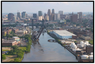
Showing posts with label Passaic River. Show all posts

Monday, July 8, 2019

Protecting Category 1 Rivers and Streams in NJ


New Jersey uses a tiered system to classify waterways with the highest tier being streams designated as “Outstanding Natural Resource Waters.” This allows them to be set aside in their natural state for posterity. Now, the New Jersey Department of Environmental Protection plans to designate about 750 additional miles of NJ's rivers and streams as “Category 1.” This designation will afford them stronger protections.

We already have about 6,800 miles of our state's waterways designated as Category 1. That means they are protected for their exceptional values ecologically, as a water supply, for recreation, and/or as fisheries For newly designated waterways, it means that they will be protected from development by 300-foot buffers, and any wastewater and discharges would have to meet more stringent standards so that “no measurable change” in water quality occurs.

This upgrade of waterways will be the first major one in more than a decade. Protecting waterways is far better - and less expensive - than cleaning up polluted ones.

“Category One waterways provide drinking water and sustain important fish and aquatic resources,’’ said Department of Environmental Protection Commissioner Catherine McCabe, noting that the Category 1 designations also help protect important wildlife habitats.

Looking northwest from Ramapo Lake Dam on the Hoeferlin Trail, Ramapo Mountain State Forest, NJ - Wikimedia
New Jersey is a water-rich state being surrounded by water on three sides, and having thousands of waterways acting as veins and arteries across the state. Many smaller headwaters streams connect to our major rivers and that water eventually flows into the Atlantic Ocean, Delaware River, Delaware Bay, Hudson River or New York Bay.

A good example of the connected nature of our waterways is the Ramapo River which gets its start at Round Lake in the Village of Monroe, New York. It flows southeast through the village and was dammed there in 1741 for a sawmill and grist mill. It then goes on to Harriman where the Nepera Chemical Plant was built. Though it has been dismantled, a Superfund site has been designated at the plant's location where barrels of toxic chemicals were buried. From Harriman, the river turns south through Ramapo, New York and then enters northern Bergen County, NJ.

In NJ, it follows the east side of the ridge of the Ramapo Mountains and into Potash Lake in Oakland and then into Pompton Lake in Pompton Lakes. The water that flows out of Pompton Lake forms the border between Pompton Lakes and Wayne. At its confluence with the Pequannock River between Pequannock and Wayne, it forms the Pompton River. Some of that water is diverted to the Wanaque Reservoir and the rest flows into the Passaic River, which flows into Newark Bay and, from there, New York Bay and then into the Atlantic Ocean.

Map of the Passaic/Hackensack watershed - Wikimedia

The NJ Department of Environmental Protection also proposes to reclassify waterways based upon fish sampling data, recognizing 24 stream segments as Exceptional Fisheries Resources, or “trout production” waterways. These waterways, located mostly in the New Jersey Highlands region, were found to have naturally reproducing trout. Trout that reproduce naturally are an excellent natural indicator of clean and healthy water, and that is important as the Highlands region supplies over two-thirds of the state with drinking water.

To see an interactive map of waterways proposed for reclassification, go to nj.gov/dep/workgroups/docs/2019c1_proposal/2019c1upgrade.html. Here are a few newly designated waterways:

  • Cooper River in the city of Camden, which flows into the Delaware River
  • Upper sections of the Maurice River in Cumberland County and also
  • many of its tributaries (Menantico Creek, Blackwater Branch and Little Robin Branch)
  • Much of the South Branch of the Raritan River in Hunterdon and Somerset counties, including tributaries like the Neshanic River, the Rock Brook and Prescott Brook.
  • Much of the Lamington River and its tributaries, which flow into the North Branch of the Raritan River;
  • Many waterways flowing into the upper Delaware River, including the Pequest River, Paulins Kill River, and the Lubbers Run, a Musconetcong River tributary;
  • Sections of the Salem River and its tributaries, including Oldmans Creek and Raccoon Creek. (The Salem River flows into the lower Delaware River)
  • The Fishing Creek in Cape May County, which flows into the Delaware Bay.


Source: Press Release state.nj.us/dep/newsrel/2019/19_0013.htm

Tuesday, November 20, 2018

Passaic River Coalition

Passaic River Basin
The Passaic River Watershed is an interdependent system of water retention, transportation and use formed by nature and adapted to human needs. This water falls as rain in the wilderness headwaters regions of the the Highlands of New York and New Jersey. It then flows through aquifers and rivers into reservoirs and wells to be used by people and industry in the downstream communities of the Lower Valley. The Passaic River moves through vast tracts of wetlands in the central basin, into the heavily urbanized lower valley and out to Newark Bay and the Atlantic Ocean.

The Passaic River Coalition (PRC) is an organization that provides assistance and stewardship for the preservation and protection of over 1,000 miles of waterways. It was established in 1969 and incorporated in 1972.

They works towards positive results, improvements in land-water resource management, and public health issues by working as an advisor to citizens, other environmental organizations, governments, and businesses. They gather scientific data and convert it into informed policy.

An example is one of their objectives to dredge all 17 miles of the Lower Passaic River and Newark Bay in order to significantly improve water quality and ensure that the contaminants will not create problems for future generations. Aspart of this, they want to make sure that the dredged sediment will not be reburied in a Confined Disposal Facility (CDF) in Newark Bay. rather, a land based treatment facility should be built in the region that will decontaminate the dredged material and produce a safe and useful product.

They also want navigability to be taken into consideration when plans are developed to dredge the river. They envision a future where the river is used, particularly for recreational and commercial boating.

PRC has been involved in the creation of new surface supply systems such as the Monksville Reservoir and the development of three Water Supply Master Plans for New Jersey. PRC has assisted in plans to restore Greenwood Lake, a primary water source for northern New Jersey and is creating the overall restoration guide for the Lake. In 1980, PRC established the Ground Water Protection Committee, which obtained federal recognition for the Buried Valley Aquifer system of the central Passaic and published studies on its contamination and protection. They created a Well-Head Protection Program to keep groundwater hazards out of municipal wells.

In 1993, PRC created a Land Trust to acquire properties of ecological significance and unique landscape character for water resource protection. With a policy of offering fair market value, PRC has acquired nearly 1,000 acres of dedicated open space that will never be developed, but will become sites for passive recreation like hiking or birding, outdoor research areas for students and scientists, and places for threatened and endangered species to find sanctuary.

PRC relies on a dedicated Board of Trustees, professional staff, and volunteers. You can donate to them or become a member and help continue their efforts.

Friday, February 24, 2017

Expanding Newark’s Riverfront Park


Last year, the NJ Department of Environmental Protection, the city of Newark The Trust for Public Land announced the groundbreaking for a nearly $8 million expansion of the city’s Riverfront Park.

Riverfront Park is an urban greenway meant to connect city residents to the Passaic River waterfront.

This is actually the beginning of the third phase of the park’s development, which entails two stretches of riverfront land that will be developed with a boardwalk, walkway system, a fitness zone, an overlook with seating, a bikeway, space for open-air events and a gateway to the downtown area. A walkway will also be constructed under the Jackson Street Bridge, allowing safe pedestrian crossing between the Ironbound section of Newark and downtown.

The first phase of the park system – developed as the result of a partnership among the city, Trust for Public Land and Essex County Parks Department – opened in 2012 and provides playing fields for baseball, soccer and football, as well as basketball and tennis courts.

A second phase of the park opened in 2013. This phase connected the recreational complex to the park through a gateway linked to riverfront green space, which was developed with a boardwalk noted for its burnished orange planking made from recycled plastic, walkways and a floating dock.

The DEP is providing approximately $6.3 million toward the estimated $7.76 million cost of this phase of the project, including funding for park construction and remediation. The Trust for Public Land has provided the balance of the funding through private donations and other local sources. Horizon Blue Cross/Blue Shield of New Jersey, based nearby, is funding the Horizon Wellness Trail through the Horizon Foundation and the Healthcare Foundation of New Jersey is providing funding for the Fitness Zone.

NJDEP Commissioner Bob Martin said. “Rivers have long been an integral part of urban communities. Connecting people to them again is an important aspect of redeveloping urban areas. The Administration has a proven track record of working with government leaders, community groups and nonprofit organizations to improve the quality of life in New Jersey’s cities through revitalization."

"Our continued work on Riverfront Park allows the Passaic River to serve as a front door to the city,” said Newark Mayor Baraka.

“In addition to providing a great outdoor space for city residents and downtown workers to enjoy Newark’s riverfront, our partnership is helping to create a healthier community,” said Trust for Public Land New Jersey Director Anthony Cucchi. “For example, the park’s expansion will soon provide a Fitness Zone to exercise in, a new dedicated lane for cyclists, and the Horizon Wellness Trail to connect Newark’s Ironbound neighborhood with downtown Newark.”

The DEP added the park development sites to its Brownfield Development Area Program in 2009. Under this initiative, the DEP works closely with communities to design and implement plans that transform contaminated and/or underutilized properties into productive places again. The last use of the park development area was the Balbach Smelting and Refining Works.

The project is expected to be completed in 2017. The first phase of work will include and remediation of contaminants from historic fill – slightly contaminated dirt moved from other parts of the city many decades ago to reclaim waterfront land – as well as a small area of contamination from polycyclic aromatic hydrocarbons and total petroleum hydrocarbons. These areas will be capped with clean fill, grass, trees and shrubs.

The Christie Administration has played a pivotal role in another key component of revitalization – making sure the river is remediated from decades of industrial pollution that has contaminated sediments with pesticides, metals, PCBs and dioxins from the production of the Vietnam War-era defoliant Agent Orange.

In partnership with the DEP, the federal Environmental Protection Agency has launched a $1.4 billion remediation of the most heavily polluted stretch of river sediments, an 8.3-mile stretch of the lower river downstream of the park site. This project includes removing 3.5-million cubic yards of contaminated sediments to out-of-state facilities as well as bank-to-bank capping.

The EPA has removed the most heavily contaminated sediments from portions of the river near the Diamond Alkali Superfund site. The company polluted the river with toxic dioxins resulting from the manufacturing of Agent Orange.

The Passaic River was vital to the region’s economy for more than 100 years, attracting thousands of jobs and bringing prosperity, but pollution ultimately led to bans on any harvesting of crabs and limitations on eating fish from the river.

Today, due to many years of efforts – including cleaning up past contamination and park development such as the Riverfront Park project – Newark is realizing its potential as an important recreational and natural resource.

Though they live along the Passaic River, many Newark residents hardly know it's there.
For decades, pollution and development have kept the people and the Passaic apart.
But with the opening of Newark Riverfront Park, that's starting to change.


For more on the project from the Trust for Public Land, visit: www.tpl.org/our-work/parks-for-people/newark-riverfront-park

SOURCE: http://www.nj.gov/dep/newsrel/2016/16_0094.htm
PHOTO: Micro Documentaries for the Trust for Public Land

Monday, September 26, 2016

Passaic River Symposium October 13-14 2016


The seventh Passaic River Symposium on October 13-14, 2016 will be an event featuring and integrating environmental management, watershed science, flood prevention, urban environments, sustainable development, and the Lower Passaic River Restoration Project. 

Registration Deadline: Friday, September 30  

The symposium will include invited keynote speakers and plenary sessions/presentations on all aspects of environmental management challenges relevant to the Passaic River Basin and other regional watersheds. 

The event will be held at Montclair State University.

This conference year will focus on the Record of Decision for the Lower 8.3 Miles of the Lower Passaic River, environmental monitoring results, flooding, storm water management, water quality and water supply, ecosystem restoration, and environmental advocacy and public outreach efforts. Projects in the upper River and tributary watersheds will also play a prominent role in this conference. Together, the Symposium will discuss in the context of how to achieve a vision for a sustainable Passaic River.

MORE INFORMATION   www.csam.montclair.edu/pri/conferences 
 

Wednesday, April 13, 2016

Paterson's Great Falls History

Distant view of Passaic Falls.
Distant view of Passaic Falls. by New York Public Library, on Flickr
It was founding father Alexander Hamilton - the current subject of a hip-hop Broadway musical bearing his name - who first imagined how the Great Falls could power industrial development. Hamilton visited the falls in 1778, in the midst of the Revolutionary War, and shared his vision with George Washington and General Lafayette.

After the war, as U.S. treasury secretary, Hamilton selected Paterson to become the nation's first planned industrial city. The water-powered mills produced silk, locomotives and guns, including the first Colt .45 pistols.

Paterson enjoys a distinguished history as one of this nation's earliest industrial centers. It owes its existence to the far reaching vision of one of America's most important founders, and a shaper of our modern governmental and financial institutions, Alexander Hamilton. Hamilton envisioned Paterson, with its water power provided by the Great Falls of the Passaic River, as America's counterpart and response to the industrial revolution occurring in England during the same period.

The history of the City of Paterson includes its beginnings as the ambitious project of Hamilton and the Society for Establishing Useful Manufacturers (S.U.M.) in 1792 at the Great Falls, the early development of water power systems for industrial use, and the various types of manufacturing that occurred in the District's mills into the 20th Century. These included cotton fabrics, railroad locomotives, textile machinery, jute, and silk spinning, weaving, and dyeing, among many others.

The Great Falls also represents compelling stories of the lives of immigrants who labored in the mills, those who owned and operated manufacturing concerns and became wealthy, and the quest of laborers and the labor movement for better working conditions and pay. Immigrants still settle today in Paterson to pursue their versions of Hamilton's vision, creating a diverse and vibrant culture.


Samuel Colt was an early Paterson business owner? From 1836 until 1842, his gun mill produced about 5,000 guns. A lack of government contracts was a major factor in his failure in Paterson. He later achieved success in his hometown of Hartford, Conn., with the outbreak of the Mexican-American War.

Waterfalls and ancient geology, engineering landmarks and the economic birth of a new nation - these are just a few of the things you will discover on your visit to the City of Paterson and the Paterson Great Falls National Historical Park.


Interesting slideshow of vintage Paterson postcards and audio about preserving the city's heritage from The New York Times.

Thursday, January 22, 2015

Following the Lenape Through Irvington and Paterson

I grew up in Irvington, New Jersey and despite its current unsavory reputation, it was a great place to be a kid in the 1950s and early 60s.

It is hard for any of us to really imagine New Jersey 15,000 years ago, but what is now Irvington was then buried under hundreds of feet of glacial ice. As the ice receded present-day contours of the town emerged, such as the Elizabeth River. As a kid, we called that "The Brook" and it's a natural feature that bisects the town from north to south.

The river enters Irvington 140 feet above sea level and gradually descends as it exits the town at Hillside at an elevation of 70 feet. The land east of the Elizabeth River is a gently rolling plain and west of the river is part of the Orange Mountains. The town's little "mountaintop" reaches 220 feet above sea level at Franklin Terrace.

The Lenape (who were later named Delaware Indians by Europeans) were the natives who lived in what is now New Jersey and along the Delaware River in Pennsylvania, the northern shore of Delaware, and the lower Hudson Valley and New York Harbor in New York when Europeans arrived in the sixteenth and seventeenth centuries.

They were the major tribes that lived in our state

The first inhabitants of this Elizabeth River valley were the Awkinges or Hackensacks, who were a subtribe of the Lenni Lenape. I couldn't find any evidence that there was any significant village there, but before Europeans came to the area there was plentiful game and well-stocked streams.

Around 1676, Newark's first settlers spread out towards the "suburbs" and laid out highways. We know that one Lenape trail became Clinton Avenue which ran straight to the Elizabeth River.

The Lenape Trail of today doesn't pass through Irvington or follow a historical American Indian trail exclusively.  Look at a map of the Lenape Trail (which is a component of the Liberty Water Gap Trail). You can see it go through Becker Park with a side trail that goes to to the Walter Kidde Dinosaur Park. The dinosaur tracks there (including the smallest ones ever found) pre-date even the Lenape but it doesn't tell any of our New Jersey natives' story.

The Lenape Trail continues west across the Morristown and Erie Railway tracks and passes under I-280 and continues along Hatfield Swamp and the Essex County Environmental Center before ending at the Patriots’ Path.

The Lenni Lenape people of our area were divided into smaller groups, but all participated in both hunting and gathering as well as cultivation. Deer, elk, bear, fox, raccoon, opossum, muskrat, beaver, squirrel and rabbit were all hunted for food and furs were used for clothing, bone for fashioning tools, toys, and sewing needles. Sinew was used as sewing thread.

Fish leftovers were used as fertilizer. They made maple sugar and had an abundant supply of natural honey. Cultivated garden plots usually contained corn, beans, pumpkins or squash, and tobacco. 

The Minsi  (AKA Munsee) were the "people of the stony country" whose totem was the wolf. They lived in the rugged country along the upper Delaware and their principal village was Minisink, on the east bank at the Delaware Water Gap.

You might know Mount Minsi and Lake Lenape which are located within the Delaware Water Gap National Recreation Area.

They were the largest of the subtribes and most warlike of the Lenape because of their proximity to the fierce Mohawks of the Iroquois nation.

In the Central area of NJ lived the Unami, “the people down the river.”

The southern part of our state was home to the Unilachtigo, “the people who lived near the ocean.”

These were some of the Indians that I read about as a kid in The Last of the Mohicans and the other Leatherstocking Tales of James Fenimore Cooper. I don't think I had any sense that these people had walked over the same lands that I grew up walking over myself.  Many years later, I taught The Light in the Forest in which a European is adopted by a band of Lenape.

The Lenni Lenape people participated in both hunting/gathering as well as cultivation and fishing. In their lands were a great assortment of animals such as deer, elk, bear, fox, raccoon, opossum, muskrat, beaver, squirrel and rabbit. Nothing went to waste. Furs were used for clothing, bone was used for fashioning tools and toys for children as well as being used for sewing needles, and sinew was used as sewing thread.

They spoke what we call an Algonquian language, known as either Lenape or Delaware. Among other Algonquian peoples the Lenape were considered the “grandfathers” from whom all the other Algonquian peoples originated. Consequently, in inter-tribal councils, the Lenape were given the respect one would give to elders.

The Treaty of Easton, signed between the Lenape and the English in 1758, moved them west out of New York and New Jersey and into Pennsylvania. Then they were pushed to Ohio and beyond.

It didn't work to their advantage, but the Lenape were the first Indian tribe ever to enter into a treaty with the United States government. They signed the Treaty of Fort Pitt during the American Revolutionary War and supplied the Continental Army with warriors and scouts in exchange for food supplies.
When the white man arrived, the Lenape had developed an extensive system of trails through the wilderness. These trails were originally 18 inches wide and could only accommodate persons walking in single file. Warriors, messengers, hunters, diplomats and visiting families apparently used separate paths. These Indian paths became bridle trails, wagon roads and twentieth century highways.      via  newhopepa.com
The Lenni-Lenape of New Jersey were peaceful and they were sometimes intermediaries in resolving problems within the nation. The hostile Iroquois mockingly called them “The Old Women.”

North of my hometown of Irvington, the Lenape were also living in what is now the Passaic valley around where I worked for a number of years at Passaic County Community College.

At the Paterson Museum, I learned that the Lenni Lenape Indians knew the Great Falls as a prime camping and fishing site. They called it “Totowa” which meant "to be forced beneath the waters" which shows their respect for the power of the falls.

The Passaic Falls, more popularly known as the Great Falls. There is no record of who first "discovered" the Great Falls. History books record the white settlers who moved into the area following the settlement of Newark in 1666. Of course, the Lenape discovered the Falls long before any white hunters or land prospectors from that colony wandered up the river.

Acquackanonck was the land in lower Passaic County from Essex County line to Pompton. The name is said to be derived from several  Indian words meaning place of brush net + rapid stream. The V-shaped brush nets were set in the river in shallow places so that fish became entangled in the twigs during the seasons when spawning runs of shad and sturgeon were underway.

Over a long period of time, the area of the falls was a productive source of fish for the Indians and later for the white settlers. During the spawning season, shad and other anadromous species (fish that migrate up rivers from the sea to spawn) would come in great numbers to the waters below the falls, where their upstream progress would be stopped.

These large catches couldn't be consumed immediately and much of the catch was dried for later use. Sturgeon, as well as shad, made their way to the foot of the falls and, because of their size, were especially prized. One of the largest ever reported was taken on August 31, 1817, and was said to have weighed 130 pounds.

The Lenape were not the only Indian tribe in this area, but they were the dominant tribe. There is still a group of the Ramapough Lenape Indian Nation (AKA Ramapo Mountain Indians) numbering about 5,000 who live around the Ramapo Mountains of northern New Jersey and southern New York.


Sources

Wednesday, June 18, 2014

Passaic River Mudflat Cleanup First Phase Completed

Over 16,000 cubic yards of toxic sediment have been removed from a 6 acre mudflat along the Passaic River near Lyndhurst.

Director of the New Jersey Chapter of the Sierra Club, Jeff Tittel says that the cleanup“is an important step forward in finally getting the cleanup process going. It has taken far too long to start the cleanup, but at least it is beginning to happen. The Passaic River has been polluted for too many decades with this dioxin and other industrial discharges. It is good the cleanup is starting, however compared to what needs to be done it is like emptying a beach with a child’s pale and shovel. One day hopefully the whole river will be cleaned up, including the 17.5 miles which is not part of this first phase of the cleanup. For far too long polluters have robed the River that belongs to all of us and this is a start of one of those milestones to bring the River back to the community."

Monday, September 23, 2013

$3 Million Program for Passaic River to Reduce Flooding Risks


Wayne, N.J. neighborhood flooded in April 2007 - via NY Times
The Christie Administration today announced that local and county governments in the Passaic River Basin may now apply for state grants to help them keep streams and rivers clear of snags, debris and shoals under a new $3 million program that will reduce flooding risks in communities throughout the Passaic River region.

The Department of Environmental Protection (DEP), which is administering the program, is distributing applications and other information about the grants to 116 eligible municipalities in the basin.

“While the Passaic River Basin was not as affected by Superstorm Sandy as our coastal communities, it certainly bore the brunt of Tropical Storm Irene and Tropical Storm Lee just a year earlier, when the river basin suffered severe flooding,’’ said DEP Commissioner Bob Martin. “We know there is no way to stop flooding in the river basin, but steps like this, which are identified in Governor Christie’s Comprehensive 15-Point Passaic River Flood Plan, are critical to alleviating flooding impacts to this repetitively-flooded area.’’

“Funds are allocated to participating communities to be used to clear fallen trees and other debris that can cause the Passaic River Basin to clog and overflow,’’ added Commissioner Martin. “Dredging in shallow waterways also will help keep water flowing during heavy rain events.”

Stream cleaning or de-snagging, is defined as the removal of accumulated sediments, debris, garbage, or vegetation from a stream with a natural stream bed, or the removal of any accumulated material from a stream previously channelized with concrete or similar artificial material.

The Passaic River watershed is about 935 square miles, with 84 percent located in New Jersey and the remainder in New York State. The Passaic River has seven major tributaries: the Whippany, Rockaway, Pompton, Pequannock, Wanaque, Ramapo, and Saddle rivers, all of which have periodic flooding problems.

On August 7, Governor Christie signed legislation that re-appropriated $3 million from the “Dam, Lake, Stream, Flood Control, Water Resources and Wastewater Treatment Project Bond Act of 2003’’ to fund state flood control projects.

Municipalities and counties have until November 30 to submit letters of interest to the DEP. The letters should include a statement of need, a description of the requested de-snagging and/or shoal dredging project, with an estimated cost of the project, including engineering, permitting, bidding and construction.

The DEP will establish a priority list for funding based upon previous flood damage in each applicant community, the likelihood of success of proposed projects in alleviating flood impacts, and whether municipalities or counties are willing to contribute matching funds to the project, among other considerations.

Municipalities with related projects are also encouraged to submit their letters of interest as one project through their county. Such combined projects will be ranked in the priority list based upon the highest ranking municipality in the group.

Each individual grant is expected to be in the range of $100,000, although the DEP may award additional funds if a project is deemed to be especially critical in addressing local or regional flooding.


For a list of towns eligible for the grant, visit: http://www.nj.gov/dep/docs/prfb-towns.pdf

For a copy of legislation signed by Governor Christie, visit: http://www.njleg.state.nj.us/2012/Bills/PL13/100_.HTM

Monday, June 17, 2013

Partial Settlement in Passaic River Contamination Litigation

Excerpted from NJDEP Press Release http://www.nj.gov/dep/newsrel/2013/13_0062.htm

Acting Attorney General John Hoffman and Department of Environmental Protection (DEP) Commissioner Bob Martin announced today that several principal defendants in the Passaic River litigation have agreed to pay the state $130 million to resolve a portion of the state’s claims related to contamination of the Passaic River.

The settling defendants are Spain-based oil and gas conglomerate Repsol, S.A, Argentina-based energy conglomerate YPF, S.A., YPF Holdings, Inc. and YPF International, as well as CLH Holdings, Inc., Maxus Energy Corporation, Maxus International Energy Company and Tierra Solutions, Inc. The agreement follows a recently-announced $35.4 million proposed settlement with 258 third-party defendants and, if approved by the court, will allow the state to immediately proceed with its claims against the principal defendant, Occidental Chemical Corporation (OCC), for the bulk of the state’s damages and future costs.

Going forward, the state intends to pursue its liability claims against the one remaining non-settling principal defendant, Occidental Chemical Corporation, for all future clean-up and removal costs related to contamination of the Passaic River. It also will pursue OCC for damages resulting from the intentional discharge of Agent Orange, dioxins and other hazardous substances by the former Diamond Shamrock plant. These costs and damages are separate from, and in addition to, the $130 Million received from the settling defendants.

Last summer Judge Lombardi entered a judgment against Occidental Chemical Corporation, holding it liable for all of the state’s clean-up and removal costs because Occidental is the legal successor to Diamond Shamrock. In previous litigation, New Jersey’s Appellate Division determined that Diamond Shamrock intentionally dumped hazardous pollutants into the Passaic River for decades.

Under terms of the agreement announced today, the settling defendants’ total exposure to all claims for Passaic River cleanup and removal costs and damages could go as high as $530 million, subject to certain conditions and exceptions.

The Passaic River Litigation was launched by the state more than seven years ago against Occidental Chemical Corporation and other companies associated with the former Diamond Shamrock Chemicals Company plant in Newark.

Diamond Shamrock manufactured pesticides and herbicides from the 1940s through the 1960s, including the infamous defoliating chemical Agent Orange during the Vietnam War. Over a period of many years, the Diamond Shamrock plant discharged the known carcinogen dioxin, as well as other hazardous substances, into the Passaic River.

The EPA is currently finalizing a detailed plan for the cleanup of the lower eight miles of the Passaic River.

The DEP reminds residents that harvesting blue claw crabs from the waters of the lower river and Newark Bay is prohibited because of the contamination. The DEP continues to engage in coordinated multi-language education efforts reinforcing the ban with the help of community groups and municipalities in the lower Passaic River and Newark Bay region.

Tuesday, April 16, 2013

Politics and Pollution on the Passaic River

a Passaic River cleanup, Lyndhurst

An article this past weekend by Tom Moran in The Star-Ledger gives a good summary of the complicated history of the pollution and cleanup attempts on the Passaic River.

It is a tale of corporations, environmentalists and politicians. The article opens by saying:

A half-century has passed since workers at Diamond Shamrock were ordered to dump dioxin into the Passaic River in Newark, and then to march out at low tide and knock down the toxic mud piles with rakes so that no one would know.

So began the long history of polluters evading responsibility for the murder of this river, an effort that continues to this day. Workers with rakes have been replaced by consultants and lawyers.

continue reading

Thursday, January 12, 2012

New Jersey's Newest National Park

Not far from downtown Paterson is is the Great Falls on the Passaic River which recently become America's 397th national park. The National Park designation makes the 35-acre site eligible for federal funds.

The 77-foot waterfall in downtown Paterson is second only to Niagara Falls in terms of water volume east of the Mississippi River.


Alexander Hamilton (lieutenant colonel in the American Revolution, confidant to George Washington, delegate to the Constitutional Convention, and first Secretary of the Treasury) formed in 1792 an investment group called the Society of Useful Manufactures (the “SUM”) whose funds would be used to develop a planned industrial city that was later to be known as Paterson.

Hamilton believed that the United States needed to reduce its dependence on foreign goods and should instead develop its own industries. The industries developed in Paterson were powered by the 77-foot high Great Falls of the Passaic, and a system of water raceways that harnessed the power of the falls. The district originally included dozens of mill buildings and other manufacturing structures associated with the textile industry and later, the firearms, silk, and railroad locomotive manufacturing industries. In the latter half of the 1800’s, silk production became the dominant industry and formed the basis of Paterson’s most prosperous period, earning it the nickname “Silk City.”

 Take a look at the Great Falls from a webcam view via EarthCam and the City of Paterson.

Friday, July 9, 2010

Passaic River Restoration

Cleaning the riverside of the Passaic River at Lyndhurst. Photo via http://www.pvsc.com

In order to protect and preserve local streams and rivers from water pollution, the Passaic Valley Sewerage Commissioners (PVSC) operate one of the country's largest treatment plants for the wastewaters of northern New Jersey.

In 1998, they created the Passaic River/Newark Bay Restoration Program to promote the recreational and economic uses of Newark Bay, the Passaic River and its tributaries. The Program is comprised of three elements: shoreline clean-ups, floatables removal, and "in-house" clean-ups.

The shoreline clean-up element has been among the most successful programs of its kind in the nation. Beginning in 1998, PVSC began assisting volunteer groups in conducting shoreline clean-ups to remove litter and other debris from along waterways within its service area.

In 2000, PVSC created a department of 15 full-time personnel to conduct larger shoreline clean-ups in addition to those organized by volunteer groups and community agencies. To date, PVSC's Restoration Program has conducted or assisted volunteers in more than 250 shoreline clean-ups that have removed over 1,000 tons of litter and debris from area shorelines.

In 1999, PVSC added floatables removal to the Program, after using state grant monies to purchase an innovative 50-foot surface skimmer vessel. Christened the S.V. Newark Bay, this vessel embarks on daily patrols on the Newark Bay and Passaic River, removing floating debris and litter. In 2001, PVSC added a second, smaller skimmer vessel to its clean-up arsenal, this one to conduct daily patrols in shallow water that had been inaccessible to the larger vessels.

Finally, PVSC conducts "in-house" riverbank clean-ups using the services of its employees. These projects are in response to requests for assistance from local municipal leaders. The crew is deployed to clean and restore specific problem areas within the PVSC service area. The success of the program can be demonstrated in its numbers. Since 1998, PVSC has removed 650 tons of floating matter and over 2,000 tons of shoreline debris.


Want to organize a shoreline clean-up? Contact Bob DeVita, River Restoration Program Manager, at (973) 466-2714.

for more information   http://www.pvsc.com/rr/

Sunday, May 9, 2010

Canoe Lessons on the Passaic River

If you missed the Passaic River Paddle Relay yesterday, here's a chance to get ready for next year - or just have some fun.

You can take a canoeing lesson at the Essex County Environmental Center next Saturday, May 15 at 9:30 a.m.

The class in paddling safety and techniques is for beginners and children (ages 10 and up accompanied by a parent or guardian).

The cost is $15 per person or $30 per canoe. You need to register in advance - call 973-228-8776.

Friday, May 7, 2010

Passaic River Paddle Relay

Interestingly, the Passaic River Paddle Relay is co-sponsored by the Passaic Valley Sewerage Commissioners. That may sound like an odd sponsor, but it makes good sense as a way to support this important and much-abused NJ river.

It is a highly competitive canoe and kayak race and will be run tomorrow May 8, from 8 a.m. to noon.

You can watch from the riverside between the Nereid Boat Club in Rutherford and the Essex County Riverbank Park in Newark.

Essex County Executive Joseph N. DiVincenzo, Jr. is going to be paddling with the  Essex County team.

Probably too late to register for this year (check out the PVSC site), but it's another good way to draw attention to the cleanup that has occurred on the Passaic.

Monday, November 23, 2009

Habitats and Partnerships

The NJFO’s Partners for Fish and Wildlife program recently wrote an article for the New Jersey League of Municipalities Magazine that highlights how the U.S. Fish and Wildlife Service can interact with municipalities across the State that want to create wildlife habitat.

Many of the 6,500 acres of wetlands, 3,000 miles of grasslands and other uplands, and 50 miles of riparian and in-stream habitat the Partners for Fish and Wildlife program has restored since it’s New Jersey inception in 1991 have come from partnerships with municipalities.


A good example of a successful partnership is Partners for Fish and Wildlife's "Partnership Project with NJ Audubon and Verizon" which won the Governor’s Environmental Excellence Award in 2007. That was a partnership of the USFWS's NJ Field Office’s Partners for Fish and Wildlife program, Verizon and the New Jersey Audubon Society.

The Verizon Center, located a mile upstream of the Great Swamp National Wildlife Refuge, is restoring 18 acres of uplands and 7 acres of riparian habitat. Verizon has also publicized the merits of voluntary corporate land stewardship.

Specific enhancements at the site include the removal and control of invasive vegetation; native grass and wildflower plantings; and the installation of a vernal pool, nest boxes and turtle nesting areas. These enhancements are currently providing suitable habitats for a variety of wildlife, including numerous bird and herptile species.

Verizon restored 25 acres on its property that are home to various grassland, riparian and wetland habitats. They planted over 500 native trees and shrubs on the site and plan to plant another 500 in 2008. They installed more than 10 acres of native grasses and wildflowers and removed invasive non-native vegetation on the land. They have implemented a delayed mowing schedule to promote wildlife breeding and have instituted a policy of zero chemical application on the restoration areas.

In addition they installed sand pits for turtle nesting areas, a vernal pool for amphibian breeding, installed numerous bird nesting boxes and outlined a monitoring and Stewardship Plan to track future progress on the site. A Stewardship Plan considers all aspects of resource management and documents management decisions and practices designed to maintain the land in a productive and healthy condition for present and future owners. It specifies actions that will increase the environmental and economic values of the land and the region.

The benefits extend beyond habitat restoration. The site extends along more than 3,700 feet of the Passaic River. In addition to improving water quality in the river the restored area in less than a mile upstream from a New Jersey Natural Heritage Priority Site known as the "Great Swamp Macrosite", an important area for the breeding of several threatened and endangered wetland species.

Restoring this habitat is part of Verizon's national commitment to green energy practices that include pursuing aggressive network equipment and building energy-reduction initiatives; utilizing alternative energy sources in the network, buildings and vehicle fleet; and promoting the company's technology as an alternative to travel, among other efforts.