Showing posts with label Wildlife Management Areas. Show all posts

Monday, January 3, 2011

Snake Hill

Snake Hill seen from the Laurel Hill Park
Snake Hill (known officially as Laurel Hill) is a 150 foot tall (46 m) rock sticking up in the middle of the Meadowlands. This igneous rock intrusion jutting up from the floor of the Meadowlands in Secaucus, New Jersey is the site of a glacial lake, Lake Hackensack, that only started receding in 8000 B.C. The rock along the Hackensack River bank is the highest point on Laurel Hill which was formed by volcanic action over 150 million years ago.

In Colonial times, people kept away from the peculiar sloped hill because of the many large black snakes found there and the area was nicknamed “Snake Hill.”

From 1855 to 1962 there were Hudson County penal and charitable institutions on Snake Hill. The Almshouse, Penitentiary, Quarry and Hospital for the Insane, Contagious Diseases Hospital, and Tuberculosis Sanatorium, were all grouped on the north side of Snake Hill. Hundreds of people lived at Snake Hill at any given time. The Hudson County Burial Grounds is a Potter's Field associated with the numerous institutions, which had long been forgotten. They were unearthed during the addition to the New Jersey Turnpike for access to Secaucus Junction at exit 15X.

In 1962 Hudson County finished closing their facilities on the site. The County entered into a 20 year contract with Callanan Industries to level much of the hill and the rock formation was largely obliterated by quarrying in the 1960s that reduced its height by one-quarter and its base area by four fifths. The diabase rock was used as building material in growing areas like Jersey City. In the 1960s and 70's, Gallo Asphalt had 4 asphalt plants, side by side, adjacent to the quarry and supplied paving materials throughout the surrounding urban region. Production ended in 1982.

The graffiti-covered remains of Snake Hill are a familiar landmark to travelers on the New Jersey Turnpike's Eastern Spur, which skirts its southern edge.

The rock is most often referred to as Laurel or Snake Hill (Slangenbergh in Dutch) but has also been called Fraternity Rock (because of the Greek letters painted on it presumably by local college fraternities), Long Neck (because it is a volcanic neck), Graffiti Rock and Mt. Pinhorne (after 17th century plantation owner William Pinhorne). The name changed from Snake Hill to Laurel Hill in 1926, when Hudson County freeholder Katherine Whelan Brown said that it was the "crowning Laurel of Hudson County" because of its unusual height prominence in the low lying meadowlands.

Most of the original 184-acre (0.74 km2) parcel is currently being utilized as Laurel Hill County Park, which includes a portion of Hackensack RiverWalk.

Laurel Hill Park is home to the Hackensack Riverkeeper's Field Office and Paddling Center. The Hackensack Riverkeeper also conducts many of its Eco-Cruises from this park.

There is a narrow Ridge Trail along the top of the hill.

View from Ridge Trail atop Snake Hill

The rock is a 61 meter (203 ft) high pipe-like diabase intrusive, which is believed to be an offshoot of the nearby Palisades Sill. It may have been what is known as a volcano plug. Mineralized shales and sandstones, intruded by the diabase, are visible in the north and southwest sections of the property.

Legend has it that a NY advertising executive, passing the hill on a train, is said to have drawn from it the inspiration for the Prudential "Rock of Gibraltar" logo in the 1890s.

The mineral Petersite was discovered at Snake Hill in June 1981 by Nicholas Facciolla, who took it to the Paterson Museum. In 1982 the mineral was recognized as a new discovery and named for Thomas Peters and Joseph Peters curators of minerals at the Paterson, New Jersey, museum and the American Museum of Natural History in New York City, respectively.


Birding, paddling and wildlife trail walking is available at Laurel Hill County Park & Saw Mill Creek Wildlife Management Area. The Saw Mill Creek Trail takes you near the vast mudflat and wide-open space of the Saw Mill Creek Wildlife Management Area (WMA). The base of the trail was initially built in the 1920’s and 1930’s as an access road for what are now high tension electric lines. It was reconstructed as a walking trail in 2001. Stone and soil were added, and six seating areas were incorporated. Native plants were used
and there are beautifully-designed entrance gates at the trailheads.

Laurel Hill Park is home to the Hackensack Riverkeeper's Field Office and Paddling Center, which is open weekends from April thru October and weekdays by appointment. Hackensack Riverkeeper also conducts many of its Eco-Cruises from this park.

During this winter season, hiding along the channels and main creek, using the reeds as windbreaks on cold winter days, you will find Common and Hooded Mergansers, Common Pintail, Gadwall, Northern Shoveler, Bufflehead, Blue-winged and Green-winged Teals, Canada Goose and Mute Swan, some of which also breed in the Meadowlands. A glance at the electrical towers near the Turnpike may turn up a Peregrine Falcon or Red-tailed Hawk. Look across the marsh where the vegetation has died back and see the 3-foot tall dome-shaped lodges made by the common muskrat. Great Cormorants and Bald Eagles may also be seen.

Directions: Follow County Avenue south from Secaucus. Bear right on New County Road just before the New Jersey Turnpike overpass. Follow for about one mile past the county jail complex (on the left) into Laurel Hill Park. Get driving directions via Google Maps

Sources:


Tuesday, December 7, 2010

Non-Hunting Areas in NJ For Outdoor Recreation

In addition to the information posted here yesterday, here are some other sources of information on places in NJ to use for hiking, birding and other recreational outdoor pursuits during the various hunting seasons.

A list of "Public Deer Hunting Land in New Jersey" is available online from NJ Fish & Wildlife at http://www.state.nj.us/dep/fgw/huntland.htm

There's also information on "Lands Open or Closed to Sunday Bow Hunting" which includes Wildlife management Areas and public lands that are still closed to hunting on Sundays. The latest list I could find is from 2009 so I'm assuming there haven't been changes - see http://www.njfishandwildlife.com/news/2009/sundayhunt.htm


Of course, some of the smaller parks have no hunting allowed and those are good locations during this time too.

You can try Cheesequake State Park, Wells Mills County Park (Ocean County), the Watchung Reservation (Union County), South Mountain (Essex County), Apshawa Preserve(Passaic County) and the Ramapo Valley County Reservation (Note that the surrounding areas of Ramapo Mountain State Forest and Ringwood State Forest do allow hunting.)

For hikers, two good resources are: 

Monday, November 22, 2010

Rockport Pheasant Farm

Pheasant Male1
Pheasant in Hopatcong by HVargas, on Flickr

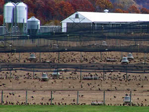
The state-owned Rockport Pheasant Farm in Mansfield has raised pheasants since 1923. Now the facility has been improved and expanded.

The $1.3 million project was financed by sportsmen's fees and stamps. The complex replaces an outdated facility that was long overdue for an overhaul. It is expected that they will release 55,000 of the birds annually.

The pheasant farm includes a new brooder house, egg incubators and hatching room. The upgrades create a modern operation that includes automatic egg turning in forced-air circulating incubators, and automated feeding.

State Division of Fish and Wildlife Director David Chanda said the upgrades will ensure reliable annual production of superior pheasants for the same or lower cost than if birds were purchased from suppliers.

The farm is a 492-acre facility located within the 1,200 acre Rockport Wildlife Management Area. The pheasants are stocked in 25 Wildlife Management Areas statewide.

Based on the 2007-08 state Firearm Hunter Harvest Survey, nearly 12,000 hunters spent more than $4,300,000 (excluding license and permit fees but including income to local businesses, such as gas stations, diners and restaurants, convenience stores, sporting goods stores and taxidermists. The pheasants are called "Rockport Rockets" because these state-raised pheasants have a reputation for being extremely fast in flight.

The Rockport Pheasant Farm is open daily from 7:30 a.m. to dusk. It is located on Rockport Rd. (Rt. 629) roughly 3.5 miles south of Main St. (Rt. 46), Hackettstown, in scenic Warren County. At Rockport there are pens holding exotic pheasants, turkeys and other birds.

The historic Morris Canal, its towpath intact, passes through the farm. The canal basin (explaining the "port" in Rockport’s name), where boats would dock for the night, was recently drained as a precaution against the introduction of avian flu but remains visible. Picnicking is allowed but there are no food or toilet facilities available. For more information call 908-852-3461.

Friday, August 13, 2010

Maps of the NJ Wildlife Management Areas

New Jersey's Wildlife Management Area System, administered by the Division of Fish and Wildlife's Bureau of Land Management, preserves a diversity of fish and wildlife habitats from Delaware Bay coastal marshes to Kittatinny Ridge mountain tops.

Ranging in size from the 0.68 acre Delaware River Fishing Access Site at the Pennsauken WMA to the 30,000-acre Greenwood Forest Tract in Burlington and Ocean counties, Wildlife Management Areas provide countless outdoor recreational opportunities for New Jersey residents and visitors from out of state.

The system had its beginning with the purchase of the 387-acre Walpack Tract in Sussex County in 1932. This land was purchased as a "Public Shooting and Fishing Ground" by the Board of Fish and Game Commissioners, the forerunner of today's Fish and Game Council. Presently there more than 327,000 acres in 120 areas, and new properties and additions to existing properties are continually being added. This acreage represents more than 44% of New Jersey's state-owned public open space.

You can download maps and information on all the WMAs at
http://www.state.nj.us/dep/fgw/wmaland.htm

Wednesday, November 25, 2009

Wild Turkeys in New Jersey


Though you won't find them on the NJ endangered or threatened species list, this is a good time to write a bit about wild turkeys in NJ.

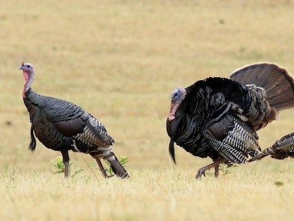
The Division of Fish and Wildlife started a Turkey Restoration Project in 1977 that is a great wildlife management success story for New Jersey. That was needed because by the mid-1800s, turkeys had disappeared in New Jersey due to habitat changes and killing for food.

Division biologists, in cooperation with the NJ Chapter of the National Wild Turkey Federation, reintroduced wild turkeys in 1977 with the release of 22 birds.

In 1979 biologists and technicians began to live-trap and re-locate birds to establish populations throughout the state. By 1981 the population was able to support a spring hunting season, and in December, 1997, a limited fall season was initiated.

There is now an abundance of wild turkeys throughout the state with turkeys found wherever there is suitable habitat. People from outside NJ are always amazed when I tell them that wild turkeys are present even in suburban areas. I pass them every week on my daily commute through suburban Essex County and into Passaic County.

Even in South Jersey, where wild turkeys had been struggling just a few years ago, intensive restoration efforts have improved population numbers significantly.

The population is estimated at 20,000 - 23,000 with an annual harvest of more than 3,000.

The kind of food, cover and water present in an area determines the suitability of that habitat for turkeys. Different foods are preferred during the four seasons. Turkeys may use different areas in the winter than they do during the spring and summer.

Because food plants are distributed variably throughout turkey range, principal foods are given here as generalities.

      Principal Foods During the Four Seasons
Winter Spring Summer Fall
Acorns Acorns Grass, leaves Sedges
Grass, sedge Grass, sedge Blackberries Acorns
Corn Corn Acorns Insects
Wild grapes Beechnuts Wild cherries Beechnuts
Dogwoods Burdock Huckleberries Wild grapes
Sumacs Ferns Bristle grasses Wheat
Beechnuts Non-woody legumes Blueberries Corn
Honeysuckle Wild grapes Wild grapes Insects
Wild cherries Insects Black gum Hawthorn
Insects
Buckwheat Buttercup
Hawthorns
Sedges Wild rye
Persimmons

Hornbeam


Violets


2009 Wild Turkey Hunting Season Information Booklet
 
2009 Turkey Hunting Area Map and Lottery Quota Information

Friday, October 23, 2009

Greenwood Forest and Pasadena Wildlife Management Area

In our continuing series on Wildlife Management Areas and Wildlife Viewing Areas in NJ, today we look at The Greenwood Forest/Pasadena Wildlife Management Area.

This WMA is in Burlington and Ocean Counties in Lacey, Barnegat, Manchester, Berkeley & Woodland Townships. At 95,923 acres it is the largest tract of land preserved by the New Jersey Division of Fish and Wildlife's Bureau of Land Management.

Together with Brendan T. Byrne State Forest, this area constitutes most of the Western Pinelands, the smallest of four conservation zones identified in the Pinelands by NJ Wildlife Action Plan.

This habitat is made up of mixed pine and riparian forests with patches of fields and shrub-scrub. Most of the area is upland pine-oak and scrub-shrub forests with the remaining area being upland habitats including fields.

The lowlands contain pitch-pine forest and Atlantic white cedar bogs.

The headwaters of Cedar Creek are also found here and it connects Greenwood Forest / Pasadena WMA to Lebanon State Forest.

This forest habitat supports breeding species including an estimated 100 Eastern Towhees, 100 Pine Warblers and 60 Prairie Warblers. Barred Owls, favoring swamps and deep forests, particularly those bordering lakes, streams or marshes, are permanent residents in this IBA. Sporadic populations of Red-headed Woodpeckers also inhabit the site’s low-density forest stands.

Some species found here include: the state-threatened Barred Owl, Blue-winged Warbler, Brown Thrasher, Eastern Towhee, Eastern Wood-Pewee, Field Sparrow, Northern Bobwhite, Pine Warbler, Prairie Warbler, Whip-poor-will, Baltimore Oriole, Black-and-white Warbler, Black-billed Cuckoo, Blue Jay, Common Grackle, Eastern Wood-Pewee, Gray Catbird, Tufted Titmouse, and Yellow-billed Cuckoo. See http://www.njaudubon.org for more information.

Northern Pine Snake - NJDEP photo

Currently, the Endangered and Nongame Species Program is working with the Division's Bureau of Land Management to enhance pine snake habitat in a portion of Greenwood Forest Wildlife Management Area.

The primary threats to this site include over-abundant deer and loss of natural ecological forces such as fire and disturbance.

Approximately 1000 acres of the Greenwood Forest/Pasadena WMA are managed as quail habitat and offers hunting and wildlife viewing opportunities.

There are also several hiking and wildlife-watching opportunities throughout the site.

More information: (PDF documents)

Wednesday, June 17, 2009

NJ Wildlife Management Areas


New Jersey's Wildlife Management Area System, administered by the Division of Fish and Wildlife's Bureau of Land Management, preserves a diversity of fish and wildlife habitats from Delaware Bay coastal marshes to Kittatinny Ridge mountain tops.

The WMAs range in size from the 0.68 acre Delaware River Fishing Access Site at the Pennsauken WMA to the 30,000-acre Greenwood Forest Tract in Burlington and Ocean counties.

The areas provide outdoor recreational opportunities for New Jersey residents and visitors from out of state.

The purchase of the 387-acre Walpack Tract in Sussex County in 1932 marks the start of the system. The tract was purchased as a "Public Shooting and Fishing Ground" by the Board of Fish and Game Commissioners who were the forerunner of today's Fish and Game Council.
Part of the South Branch of the Raritan Wildlife Management Area

Today there are more than 324,000 acres in 120 areas which represents more than 44% of New Jersey's state-owned public open space.

The purchase of lands for the Wildlife Management Area System was initially funded entirely from the sale of hunting and fishing licenses, but, beginning in 1961, Green Acres bond issues have paid for about half of the present holdings.

The infusion of Green Acres monies has also broadened the mission of the Wildlife Management Area System from areas where fish and wildlife habitat is protected and enhanced, to providing a variety of compatible recreational and educational opportunities.

Thursday, June 11, 2009

Bats in New Jersey

Nine species of bats are considered regular residents of New Jersey. These include the little brown bat, big brown bat, northern long-eared bat, small-footed myotis, Eastern pipistrel, Indiana bat (state and federally endangered), hoary bat, red bat and silver-haired bat.


Endangered Indiana bat

The hoary, red and silver-haired bats are part-time residents that are found here from spring through fall when they migrate to southern states for the winter. The other six species remain here throughout the entire year and require special habitats for winter hibernation.

Natural caves once provided hibernating habitat for bats, but today most caves are subject to disturbance by people and thus are not suitable for use by bats. Abandoned mines and tunnels have replaced natural caves as the primary winter habitat for bats in many parts of the country because they are often unsafe to enter or inaccessible to people.

New Jersey's largest known bat hibernaculum is the Hibernia Mine in Rockaway Township, Morris County. The mine was abandoned in the early 1900s and the first record of bats using the mine is from the 1930s. In the decades that followed, the mine continued to provide winter habitat for bats but frequent and constant human disturbance limited the mine's potential.

Unsuccessful attempts were made by landowners to keep people out of the mine, but these efforts also made it unavailable to the bats. During the summer of 1994, the Endangered and Nongame Species Program negotiated an agreement with landowners to install a special bat conservation gate to keep people out but allow free access by the bats.

The state has also acquired the property through the Green Acres Program and it is currently part of the Wildcat Ridge Wildlife Management Area and is listed as a Watchable Wildlife Site.

The ENSP conducts a biennial winter survey to assess the bat population in the Hibernia Mine. A 1999 survey found a peak of more than 30,000 bats.

Starting in 2003, a Summer Bat Count has been done to map summer roosting locations throughout New Jersey.

New hibernacula have been located and protected including a tunnel in Worthington State Forest in Warren County.

Cooperating with the ENSP on these efforts are the Division of Parks and Forestry, the US Army Corps of Engineers, the US Fish and Wildlife Service and Bat Conservation International.