Monday, January 31, 2011

Removal of Dams Will Open Up Fish Spawning

The Department of Environmental Protection has secured a landmark agreement that will open up a large stretch of the Raritan River for fish spawning as compensation to the public for harm to natural resources caused by past pollution at a refinery and three polymer plants that were operated by or affiliated with the El Paso Corp.

The removal of the dams, financed and carried out by El Paso, will open up a nearly 10-mile stretch of the middle and upper Raritan to fish migrations for the first time in more than a century, at the same time expanding recreational opportunities along the river.

"This unique and unprecedented settlement will make valuable habitat in the Raritan River available for fish spawning while improving overall environmental conditions in the river system," Commissioner Martin said. "In addition, dam removal will make it easier for kayakers, canoeists, and other lovers of the outdoors to enjoy a river system that has been undergoing a steady and impressive ecological comeback over the years."

The settlement resolves Natural Resource Damage claims by the DEP against the Houston-based company that stem from contamination at EPEC Polymers Inc in Flemington, Hunterdon County; Nuodex Inc. in Woodbridge, Middlesex County; EPEC Polymers Inc. in Burlington City, Burlington County; and the Eagle Point Refinery in West Deptford, Gloucester County. Investigations and/or cleanups are under way at those sites.

The settlement marks an important first step in what the DEP hopes will become an even broader effort to enhance fish passage or remove additional dams in the Raritan and its tributaries, including the Millstone River.

"This portion of the river was once an important spawning area for fish migrating from Raritan Bay," said Amy Cradic, Assistant Commissioner for Natural and Historic Resources. "This agreement is a major win for the environment by reopening these spawning areas and helping to restore balance to the estuary."

Natural Resource Restoration is the remedial action that returns the natural resources to pre-discharge conditions. It includes the rehabilitation of injured resources, replacement, or acquisition of natural resources and their services, which were lost or impaired. Restoration also includes compensation for the natural resource services lost from the beginning of the injury through to the full recovery of the resource.

Examples are:
  • GROUND WATER: non-point source pollution abatement projects, acquisition of land for aquifer recharge
  • WETLANDS and HABITAT: rehabilitation or creation of wetlands / habitat in the appropriate ratios to compensate for the functions and services lost
  • INJURED SPECIES: restoration of appropriate habitat and monitoring of success / research projects
  • LOST PUBLIC USE: enhanced public access, information and interpretive centers


Dam removal will open up 10 miles of migratory fish habitat along a stretch of the Raritan that twists through a highly diverse residential, commercial and agricultural portion of Somerset County that includes Bridgewater, Bound Brook, Somerville and Manville. It will also open up some 17 miles of tributaries to spawning. None of the dams were built for flood control.

The fish to benefit most from the removal of the dams are American shad, American eel, herring, and striped bass. These species once migrated in prodigious numbers through the gravelly shallows of the upper Raritan, most to spawn.

Striped bass and shad are important recreational species. Herring and eel are important food sources for other species in the ocean and estuaries, including game species such as striped bass, weakfish and bluefish.

Better water flow in the river will also improve flushing of sediments, reduce nutrient loadings and improve conditions for tiny aquatic organisms that are critical to the food web in any river system, Assistant Commissioner Cradic said.

The dams to be removed are:

Calco Dam, located at river mile 20.9 and built by the Calco Chemical Co. in 1938 to disperse chemicals from its facility. The dam is essentially a large concrete pipe spanning the river that today carries and disperses wastewater into the river for Somerset Raritan Valley Sewerage Authority. The authority has constructed a new outfall that will be operational shortly.

The Nevius Street Dam, located at river mile 27 and constructed of rocks and mortar in 1901 for aesthetic purposes and later retrofitted to provide water to ponds on the Duke estate. The DEP and El Paso are working on a plan to ensure the river continues to feed water to these ponds after the dam is removed.

The Robert Street Dam, a 6 ½-foot-high sheet piling and concrete dam located at river mile 27.9 and constructed prior to 1930 for purposes that are not known today.

The Island Farm wier, a dam located between the Calco and Nevius dams and constructed in the 1990s for the Elizabethtown Water Co. and the New Jersey Water Supply Authority, is not affected by the agreement with El Paso. A large fish ladder in operation at this dam is routinely monitored by the DEP's Division of Fish and Wildlife.

El Paso approached the DEP several years ago to cooperatively resolve its Natural Resource Damage liability. Natural Resource Damage claims seek to restore natural resources such as wetlands or groundwater and compensate the public for the amount of time the resources were harmed by pollution.

The DEP uses funds secured from Natural Resource Damage settlements toward ecological restoration projects, typically in the same watershed or general area where resource damages occur.

The Flemington and Woodbridge polymer facilities are located in the Raritan's watershed. The Eagle Point refinery, which El Paso once owned, and the Burlington County polymer facility are located in the Delaware River watershed. El Paso has agreed to provide the DEP $156,655 for a migratory fish study for the Delaware watershed.

The DEP has been working closely with stakeholders, including dam owners, environmental groups, property owners, local utilities, the U.S. Fish and Wildlife Service and the National Oceanic and Atmospheric Administration to make the Raritan River project a reality.

The DEP will continue working with El Paso as the company designs and implements the project. The company has already completed significant engineering studies and is expected to soon file for dam safety, land use and other DEP permits. The company is expected to launch the project this summer with the removal of the Calco Dam.

For a copy of the settlement agreement, visit: http://www.nj.gov/dep/docs/elpaso-nrd-settlement.pdf

For more information on the DEP's Office of Natural Resource Restoration, visit: http://www.nj.gov/dep/nrr

Friday, January 28, 2011

NJ Residents Must Recycle Electronic Waste

The NJ Department of Environmental Protection reminds New Jersey residents that old TVs, computers and computer monitors - items known collectively as electronic waste, or e-waste - must be recycled as of the beginning of 2011, as required by the Electronic Waste Management Act.

“We expect a smooth transition thanks to the work of municipalities, counties and manufacturers who have been cooperating closely with the DEP to coordinate their efforts,” Commissioner Bob Martin said. “Everyone has been working hard to make sure residents will have ample opportunities for recycling their electronic waste.”

The Electronic Waste Management Act bans the disposal of televisions and all personal or portable computers - including desktop, notebook and laptop computers, as well as computer monitors - in the regular waste stream beginning Jan. 1, 2011. Manufacturers of these devices will now be funding the collection of e-waste so that it is free for consumers.

The new law means residents can no longer put TVs, computers and monitors out on the curb for pickup under regular solid waste collection programs. Many residents will have to take these items to a drop-off point, such as a county or municipal solid waste collection center or a participating electronics retail store. Some municipalities already conduct special curbside pickup programs for recycling of e-waste and are expected to continue doing this.

All 21 counties and many municipalities already have e-waste recycling programs in place. These include special collection events and drop-off points. Best Buy stores and community-based service programs, most notably Goodwill Industries and the Salvation Army, also accept these materials. In many cases, manufacturers will simply pick up the cost of operating these existing programs.

Residents should contact their county solid waste agency or municipal recycling coordinator for e-waste recycling options currently available in their communities. These options will continue to grow in the coming year. The DEP also is compiling a resource list to assist residents in finding collection points. A working draft of the list is available at www.recyclenj.org

“We still have some work to do,” Commissioner Martin said. “Over the next several months, the Electronic Waste Management Act will help us fill in gaps to ensure that all covered waste is recycled and that everyone has convenient options. Equally important, this law raises public awareness about the importance of recycling these materials.”

Electronic waste makes up about two percent of the solid waste disposed in New Jersey. Because of the high consumer demand for new technologies, electronic waste is also growing two to three times faster than any other component of the solid waste stream, according to the federal Environmental Protection Agency. TVs, computers and computer monitors contain lead, mercury, cadmium and other toxins. Cathode Ray Tubes, or CRTs, in particular contain large amounts of lead that is used to shield consumers from radiation.

The DEP estimates that the program will prevent 50 million pounds of electronic waste from being sent to solid waste facilities during its first year. The law also contains strict provisions to ensure that, once collected, the materials are recycled properly and in accordance with state and federal laws. Manufacturers must ensure that these devices are not exported for disposal in a manner that poses a risk to public health or the environment.

Manufacturers must be properly registered with the DEP and participating in the program in order to sell covered devices in New Jersey. Most manufacturers have already registered and full compliance is expected.

The DEP is currently developing rules establishing methodologies for determining market shares for television manufacturers and return shares based on weight for other covered electronic devices for the purposes of apportioning responsibility for program costs among manufacturers. The development of these rules does not affect the ongoing establishment of collection programs.

The Electronic Waste Management Act does not cover cell phones, DVD players, VCRs, game consoles, or other electronic devices, although some retailers and service organizations provide opportunities for recycling these items.

Thursday, January 27, 2011

Deer Management Program Hunts Continue in February


Deer management controlled hunts continue in NJ January and February.

Postcards went out in Essex County that deer-culling efforts would begin again this month and continue until February 24th. The county sees this as a cornerstone of a reforestation initiative at the South Mountain, Eagle Rock and Hilltop reservations. Oak, beech, hickory and maple stands have been damaged or destroyed by the abundance of white-tailed deer in those areas where hunting is not allowed.

In Essex, 19 licensed hunters will be in the reservations on Tuesdays and Thursdays and the reservations will be closed during those times.

The hunts have always been controversial with protests and signage appearing in many neighborhoods.

These hunts began at South Mountain in 2008 and at Eagle Rock and Hilltop last year. The hunters have taken about 750 deer. The goal is to have five deer per square mile in order for the forest to regenerate. In South Mountain, there are about 27 per square mile.

The shooters, who have passed a marksmanship test and will be paid in venison, will fire single shots from assigned perches at least 20 feet of the ground. They will be at least 450 feet from any residences.

In Union County, the hunt is in the Ash Brook Reservation and Golf Course in Scotch Plains and is to prevent destruction of forest vegetation and also to reduce the number of motor vehicle accidents caused by deer.

Eight volunteer marksmen licensed by the state will conduct the hunt, which will continue through February 12 during daylight hours and without hunting on Sundays.

A last-minute approval of an amendment to this year’s deer management plan, allows hunting in Watchung. This is the first year that Warren Blue Ridge Sportsmen’s Club is conducting the hunt, but the process remains the same as in past years.

The hunt will take place on three tracts of public land and six tracts of private property. The public land includes a 19.81 tract of land on the west end of Mountain Boulevard, 9.56 acres on Sequoia Drive and 6.4 acres between Route 22 and Johnston Drive.

The private properties are located on Mountain Boulevard, Bonnie Burn Road, a parcel of land between Route 22 and Bonnie Burn Road, the west side of Bonnie Burn Road, Sequoia Drive, Ellisen Road, High Tor Drive, Old Somerset Road, Dugway and Timberline Way.

Meat butchered from the kill, which is distributed by the Community Food Bank of New Jersey, provided about 23,000 meals to the needy and homeless last year. In Essex, volunteers who participate for a majority of days also receive venison as payment.

ALSO
Community-Based Deer Management http://www.state.nj.us/dep/fgw/cbdmp.htm

Monday, January 24, 2011

Going Local - Garret Mountain and Mills Reservation

I live in the very urban Essex County and work in the only slightly less urban Passaic County. But I pass natural areas every day on my short drive to work and they are places I visit frequently.

Garret Mountain Reservation is Passaic county's major recreational area. It offers visitors grass fields, several miles of walking/running trails, basketball courts, and picnic areas.

Barbour's Pond is state stocked with fish for anglers. This manmade pond is on the Slippery Rock Brook and was created in 1888. Its normal surface area is 11 acres.

There is an Equestrian Center with horseback riding lessons.

This woodland oasis is a good place to see migrating song birds, including 35 species of Warblers, numerous Vireos, Orioles, Sparrows and Thrushes. Birdwatchers from the Tri-state areas flock to this hotspot for great views of 150+ species per year along the easily accessible trails.

Lambert Castle
Lambert Castle, located on the eastern slope of the mountain, just off Route 19, is a 19th century castle which has been recently renovated and now hosts the Passaic County Museum (open to the public).

The "Castle" was built in 1893 by a wealthy silk manufacturer. (Paterson was known as "Silk City".) Many workers believed Catholina Lambert built it high up on the mountain to watch over his mills below.The Morris Canal once ran at the site of Lambert Castle.

This area is especially rich in labor and industrial history.  You can spend several days with visits to Lambert Castle as well as the nearby Paterson Museum-Thomas Rodgers Building [manufactured steam engines] at 2 Market Street, and the Great Falls and related raceway system which was a source of water power (start at the Visitors' Center at 65 McBride Avenue Extension). The American Labor Museum/Botto House was the 1913 silk strike headquarters and is at 83 Norwood Street in Haledon.

http://friendsofgarretmountain.blogspot.com

Trail Information http://www.nynjtc.org/park/garret-mountain-reservation 


Mills Reservation is a county park located on the First Watchung Mountain, consisting of a 157.15-acre (0.6360 km2) protected wooded area located in Cedar Grove and Montclair, New Jersey, United States. The reservation is maintained by the Essex County Park Commission.

In 1954 the Park Commission received a gift of 118.9 acres from the Davella Mills Foundation. The stipulation for the original gift was that the land be preserved in its natural state. Therefore, the only development undertaken on this land was a small parking area and a system of walking trails that gives the public access to the interior—a minimal design by the Olmsteds in their last association with Essex County. There are no buildings in Mills Reservation.

The reservation has several walking/jogging trails, including four major trails and numerous smaller trails. One of the four main trails leads to a cliff that overlooks the New York City skyline. See http://www.nynjtc.org/hike/mills-reservation-new-york-city-view

Activities in Mills Reservation include walking, jogging, hiking, and birding. Bike riding is prohibited by the county - but I have passed a number of cyclists and there is ample evidence of bikes on the trails.

During World War Two, an anti-aircraft gun emplacement was made in Mills Reservation at the southern lookout point (called Quarry Point) on the cliffs overlooking New York City. All that remains of this today is a circular cement platform.

The area has attracted bird watchers who observe migratory birds, such as warblers in the spring and hawks in the fall. The Montclair Hawk Lookout is atop a 500-foot basalt ledge on a ridge across from Quarry Point on the First Watchung Mountain in Montclair, New Jersey. It is a well constructed, stone-filled platform that is the site of the Montclair Hawk Lookout, a sanctuary of the New Jersey Audubon Society.

This is the first ridge west of the lower Hudson River Valley, and runs from northeast to southwest. The view from the platform is south and east with a view of the Verrazano Narrows Bridge, the entire New York City skyline including the Statue of Liberty, all the way northeast to the Palisades. To the north and west, peaks from the Ramapo Mountains can be discerned, and the beginning of the Second Watchung Mountain.

Quarry Point in Mills Reservation is where the Spring Hawk Count is conducted, as the visibility to the south is better from there.

The Montclair Hawk Watch has been conducted there since 1957. It is the second oldest continuous hawk watch in the nation.

Friday, January 21, 2011

Proposed Changes to NJ Endangered Species List

Proposed amendments to the list of endangered wildlife species, and the list of nongame wildlife native to the state, were scheduled to be published in the New Jersey Register on January 18, 2011.

The list changes are being proposed to reflect recent status assessments of many birds and insects, and makes corrections to many species taxonomic names. The proposal also changes some of the status terms and definitions that apply to nongame wildlife to better reflect current species status in the state.

The Endangered, Nongame and Exotic Wildlife rules include the list of endangered species which was last amended in April 2003. The Department is proposing to amend the list of endangered species to add five species and reclassify eight species to differentiate the level of conservation concern applicable to the species during the breeding season from that applicable during the nonbreeding season.

The proposed amendments add four species to the list of endangered species based upon this analysis: black rail (breeding population), golden-winged warbler (breeding population), red knot (non-breeding population), and gray petaltail (a dragonfly). In addition to the four species proposed for change to endangered status, it is proposed that the Indiana bat be included in the list of New Jersey endangered species because it is listed as endangered pursuant to the Federal Endangered Species Act.

The Department is proposing to modify the endangered status of eight species of birds for either the breeding or non-breeding populations.

The bald eagle is currently classified as endangered for both breeding and non-breeding populations. The classification of the bald eagle will continue to be endangered for the breeding population, which includes all bald eagles present in the State during the breeding season. However, the non-breeding population, which includes all bald eagles present in the State outside of the breeding season, is proposed to be reclassified as threatened.

Six bird species currently listed as endangered for both breeding and non-breeding populations are proposed to continue to be classified as endangered for their breeding populations but are proposed to be listed as special concern for their non-breeding populations. These species are the pied-billed grebe, northern harrier, northern goshawk, peregrine falcon, short-eared owl, and vesper sparrow.

Loggerhead shrike
Image: http://www.conservewildlifenj.org/images/artmax_206.jpg

For the loggerhead shrike, another bird species currently listed as endangered for both breeding and non-breeding populations, the non-breeding population will continue to be classified as endangered at, but the breeding population is proposed to be classified as extirpated, as this species no longer breeds in New Jersey.

The proposed rule amendments are open for public comment until March 19, 2011. The official notice of the rule proposal, as well as a link to the rule amendments, can be viewed on the NJ DEP website at nj.gov/dep/rules/notices.html

Monday, January 17, 2011

Apshawa Preserve


This 576-acre preserve offers a diversity of habitats and beautiful vistas in the heart of the Highlands of northern New Jersey. The 40-acre Butler Reservoir is a scenic attraction for hikers and birdwatchers, and the Apshawa Brook flows through the preserve to the Pequannock River. Apshawa's mixed hardwood forest is dominated by oak and sugar maple.

There are almost seven miles of blazed trails in the Apshawa Preserve open for hiking, bicycling, horseback riding, nature study and fishing.

The Apshawa Preserve is open year round from dawn to dusk for recreation, and can be accessed from Macopin Road in West Milford.


Friday, January 14, 2011

N.J. DEP tentatively agrees to allow Walmart store in Pine snake neighborhood

Science update from NewJerseyNewsroom.com

The state has reached a tentative agreement with a developer that would allow the construction of a Walmart store on 21 acres of Pinelands off Route 37 on the Toms River and Manchester border.

The Department of Environmental Protection Thursday said the agreement calls for the permanent preservation of 212 acres of forest near the store site an attempt to enhance pine snake habitat that would be adjacent to the property.

Large-scale development of the 212 acres is already constrained by Pinelands and endangered species regulations and the proposed agreement would preserve the land as undeveloped forest.

Under the agreement, Jaylin Holdings would construct five hibernacula, or den areas, thin sections of forest canopy to create sunny areas snakes need for basking, create upland forest clearings for nesting, and block access to limit human activity that may stress snakes.

N.J. DEP tentatively agrees to allow Walmart store in Pine snake neighborhood

Thursday, January 13, 2011

American Kestrels in NJ

American Kestrel eating a cricket "on the wing" 
photo via http://birdcapemay.org

The American Kestrel was a once-common inhabitant of fallow fields and pastures has declined in recent years, and the reasons are largely unknown. The Endangered and Nongame Species Program embarked on a survey campaign in 2004, and the findings were alarming. More detailed surveys and habitat evaluations were conducted in 2005, along with building a predictive habitat model.

Experiments with nest boxes are planned for 2006 to see if breeding success can be improved for this now scarce bird. 200 nest boxes will be constructed and installed throughout New Jersey. These boxes will be monitored during the breeding season by ENSP staff and/or volunteers.

Please report your sightings of this bird, especially in the breeding season (April – July) using the Sighting Report Form http://www.njfishandwildlife.com/ensp/rprtform.htm

Wednesday, January 12, 2011

Winter Birding

Advice from Paul Kerlinger on birding this month: "Just because it is cold, dreary, and January, don’t miss some wonderful birding. Dress warmly, go to the right spots, and you are likely to get great views of species you normally wouldn’t see."

January: Blizzards of birds in Cape May

It was a blizzard, but the “snowflakes” weren’t falling from the sky. Instead, they were rising up from the marsh, swirling and milling in a rough semi-circle before moving off. More than 10,000 Snow Geese had just blasted off from the salt marshes of Forsythe (formerly Brigantine) National Wildlife Refuge (near Absecon in Atlantic County). The reason for this spectacle was a single, adult Bald Eagle that had taken off from the trees a half-mile away and flew slowly toward the geese. That eagle was looking for a meal; perhaps a sick or injured goosed or even a dead one. With more than a half-million Snow Geese in South Jersey during the winter, the pickings are generally easy.

2010 Osprey Information for NJ

Ospreys are well-loved birds of our coastal bays and marshes. Formerly known as the fish hawk, ospreys rely almost exclusively on fish for their diet. They have taken well to human structures, such as duck blinds and channel markers, for nest structures. They, like eagles and falcons, succumbed to the effects of DDT and their population dropped to about 60 pairs by the early 1970s.

With the help of biologists and, more recently, volunteers who put up nest structures, they have recovered to more than 360 nesting pairs. The Endangered and Nongame Species Program monitors their health as an indicator of many coastal species, as they are sensitive to contaminants and the viability of the aquatic food chain.

2010 Osprey Report (pdf, 179kb)

Tuesday, January 11, 2011

NJ Peregrine Falcon Information for 2010

Peregrine falcons, as the fastest bird in the skies, have fascinated people for centuries. Peregrine numbers fell due to the effects of DDT which caused their eggs to fail, and they became extinct east of the Mississippi by 1964. They were one of the first birds to be the focus of conservation, however, and through an intensive reintroduction program, returned to the skies in New Jersey and other eastern states in the 1980s.

The population in New Jersey has been about 15-20 pairs annually since 1998. In 2003, on the 30th anniversary of New Jersey’s Endangered and Nongame Species Conservation Act, peregrine falcons returned to their historic cliff nesting habitat on the Hudson River Palisades – a huge milestone in the peregrine's recovery in the state and the region.

2010 Peregrine Falcon Report (pdf, 255kb)

Monday, January 10, 2011

NJ Bald Eagle Report for 2010

The bald eagle is a shining example of recovery in New Jersey. In 1973, when the Endangered and Nongame Species Conservation Act was passed, there was just one nesting pair, in a remote forest in Cumberland County.

Today there are approximately 80 nesting pairs of eagles in the state. Most are in the Delaware Bay counties of Cumberland and Salem, but eagles can be found nearly statewide. Additionally, numbers of wintering eagles along the Delaware have increased dramatically. They remain on the endangered list (threatened federally), however, due to their sensitivity to environmental contaminants, habitat loss and human disturbance. The challenge to biologists and citizens now is protecting the lands and waterways used by eagles to maintain and enhance this species' recovery.


2010 Eagle Report (pdf, 535kb)

Friday, January 7, 2011

NJ Raptor Reports for 2010 Now Online

Peregrine on prey
Raptors, commonly referred to as "birds of prey," include hawks, owls, eagles, falcons and vultures. Raptors have fascinated people for thousands of years and inspire people even today. Fortunately, after some frightening declines in some of our largest species, raptors represent some of New Jersey's greatest success stories.

The bald eagle, osprey and peregrine falcon have made impressive comebacks from the brink of extinction, in large part thanks to the efforts of division biologists. Unfortunately, not all species of raptors are thriving - the American kestrel, for instance, has experienced a sharp decline in recent years, and the work of biologists in the Endangered and Nongame Species Program continues

The NJDEP Division of Fish and Wildlife has posted the 2010 annual reports for Bald Eagle, Osprey and Peregrine Falcon on its website.  The reports summarize management and research activities, nest productivity and related information on these state endangered species.  Thanks to the efforts of the division's Endangered and Nongame Species Program and others, all three species have staged remarkable comebacks in the state.

To view the reports, as well as other information about these species, visit http://www.njfishandwildlife.com/ensp/raptor_info.htm .

Monday, January 3, 2011

Snake Hill

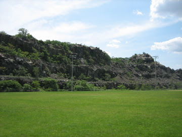
Snake Hill seen from the Laurel Hill Park
Snake Hill (known officially as Laurel Hill) is a 150 foot tall (46 m) rock sticking up in the middle of the Meadowlands. This igneous rock intrusion jutting up from the floor of the Meadowlands in Secaucus, New Jersey is the site of a glacial lake, Lake Hackensack, that only started receding in 8000 B.C. The rock along the Hackensack River bank is the highest point on Laurel Hill which was formed by volcanic action over 150 million years ago.

In Colonial times, people kept away from the peculiar sloped hill because of the many large black snakes found there and the area was nicknamed “Snake Hill.”

From 1855 to 1962 there were Hudson County penal and charitable institutions on Snake Hill. The Almshouse, Penitentiary, Quarry and Hospital for the Insane, Contagious Diseases Hospital, and Tuberculosis Sanatorium, were all grouped on the north side of Snake Hill. Hundreds of people lived at Snake Hill at any given time. The Hudson County Burial Grounds is a Potter's Field associated with the numerous institutions, which had long been forgotten. They were unearthed during the addition to the New Jersey Turnpike for access to Secaucus Junction at exit 15X.

In 1962 Hudson County finished closing their facilities on the site. The County entered into a 20 year contract with Callanan Industries to level much of the hill and the rock formation was largely obliterated by quarrying in the 1960s that reduced its height by one-quarter and its base area by four fifths. The diabase rock was used as building material in growing areas like Jersey City. In the 1960s and 70's, Gallo Asphalt had 4 asphalt plants, side by side, adjacent to the quarry and supplied paving materials throughout the surrounding urban region. Production ended in 1982.

The graffiti-covered remains of Snake Hill are a familiar landmark to travelers on the New Jersey Turnpike's Eastern Spur, which skirts its southern edge.

The rock is most often referred to as Laurel or Snake Hill (Slangenbergh in Dutch) but has also been called Fraternity Rock (because of the Greek letters painted on it presumably by local college fraternities), Long Neck (because it is a volcanic neck), Graffiti Rock and Mt. Pinhorne (after 17th century plantation owner William Pinhorne). The name changed from Snake Hill to Laurel Hill in 1926, when Hudson County freeholder Katherine Whelan Brown said that it was the "crowning Laurel of Hudson County" because of its unusual height prominence in the low lying meadowlands.

Most of the original 184-acre (0.74 km2) parcel is currently being utilized as Laurel Hill County Park, which includes a portion of Hackensack RiverWalk.

Laurel Hill Park is home to the Hackensack Riverkeeper's Field Office and Paddling Center. The Hackensack Riverkeeper also conducts many of its Eco-Cruises from this park.

There is a narrow Ridge Trail along the top of the hill.

View from Ridge Trail atop Snake Hill

The rock is a 61 meter (203 ft) high pipe-like diabase intrusive, which is believed to be an offshoot of the nearby Palisades Sill. It may have been what is known as a volcano plug. Mineralized shales and sandstones, intruded by the diabase, are visible in the north and southwest sections of the property.

Legend has it that a NY advertising executive, passing the hill on a train, is said to have drawn from it the inspiration for the Prudential "Rock of Gibraltar" logo in the 1890s.

The mineral Petersite was discovered at Snake Hill in June 1981 by Nicholas Facciolla, who took it to the Paterson Museum. In 1982 the mineral was recognized as a new discovery and named for Thomas Peters and Joseph Peters curators of minerals at the Paterson, New Jersey, museum and the American Museum of Natural History in New York City, respectively.


Birding, paddling and wildlife trail walking is available at Laurel Hill County Park & Saw Mill Creek Wildlife Management Area. The Saw Mill Creek Trail takes you near the vast mudflat and wide-open space of the Saw Mill Creek Wildlife Management Area (WMA). The base of the trail was initially built in the 1920’s and 1930’s as an access road for what are now high tension electric lines. It was reconstructed as a walking trail in 2001. Stone and soil were added, and six seating areas were incorporated. Native plants were used
and there are beautifully-designed entrance gates at the trailheads.

Laurel Hill Park is home to the Hackensack Riverkeeper's Field Office and Paddling Center, which is open weekends from April thru October and weekdays by appointment. Hackensack Riverkeeper also conducts many of its Eco-Cruises from this park.

During this winter season, hiding along the channels and main creek, using the reeds as windbreaks on cold winter days, you will find Common and Hooded Mergansers, Common Pintail, Gadwall, Northern Shoveler, Bufflehead, Blue-winged and Green-winged Teals, Canada Goose and Mute Swan, some of which also breed in the Meadowlands. A glance at the electrical towers near the Turnpike may turn up a Peregrine Falcon or Red-tailed Hawk. Look across the marsh where the vegetation has died back and see the 3-foot tall dome-shaped lodges made by the common muskrat. Great Cormorants and Bald Eagles may also be seen.

Directions: Follow County Avenue south from Secaucus. Bear right on New County Road just before the New Jersey Turnpike overpass. Follow for about one mile past the county jail complex (on the left) into Laurel Hill Park. Get driving directions via Google Maps

Sources: